Day totals: 12 hrs, 25.4 kms
Actual Date: April 16, 2015
From Roxbury it's just a quick couple of miles and I'm back in Chambersburg connecting the South and North segments of my Appalachia Superhike
.
But I've been thinking lately that my exploration of the Appalachian Mountains hasn't included a whole lot of mountains! Much of it has taken place in the very flat, wide Cumberland Valley--which really should be called the Cumberland Plains, as the mountains are quite far apart.
So I've decide to add an extra loop to my Superhike: I'm going to cross thes mountain into Huntingdon county, where you've got mountains nearby all the time. I'm sure the culture is quite different from the overdeveloped plains--so I really need to to have that as part of my experience of this region.
Oh yeah... and despite this being a comparatively sparsely inhabited area, there are actually more towns than in the Cumberland Valley where many historic villages have been unincorporated and turned into vast swaths of suburban sprawl.
So over the mountains I go.
Experiencing Path Valley
Today it doesn't look like I'll be discovering any new towns though
. I will be crossing two mountain ridges and experiencing two valleys--so it's still going to be a busy, tiring day.
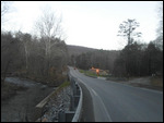
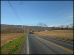
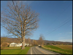
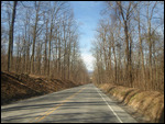
So I start my hike before sunrise, parking my car in Roxbury and setting off up the road at a brisk pace. It's not long and the road starts climbing up the steep slopes of my first ridge.
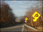
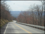
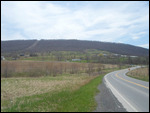
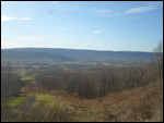
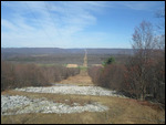
Unlike most mountain ranges, which consist of uneven ups and down throughout the range, the Appalachian mountains of this area consist of long, straight ridges separated by long, straight valleys. This means that if you're traveling northeast, you can pretty much walk on flat ground with no ups or downs, but if you travel northeast... well... you've got a to hike over a ridge every couple of miles. That's what's going to happen today. But I'm psyched up for it and sprint to the top of my first ridge, and soon Path Valley is visible between the trees, far below.
A mere 1-3 miles wide, Path Valley is just a skinny snake of civilization--quite a contrast with the vast, industrialized and overdeveloped Cumberland Valley
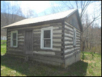
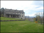
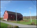
. In fact, it doesn't even have a town at the bottom--just a small, unincorporated community known as Spring Run. I'm only going to be in this valley a couple of hours, but I'm determined to discover something about it. Down the slope I'm welcomed by a charming, rustic little cabin that looks a lot like the homes in this area did 250 years ago.
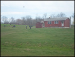
Suddenly movement interrupts the tranquil scenery. A bunch of figures in black are scurrying around a knoll next to a one room red building.
Of course! Amish schoolkids out on recess! I was hoping I would encounter this scene along my journey. The girls are wearing black dresses and blue blouses, the boys, black and blue as well. All ages and both genders are playing a game of baseball together. Despite their dresses the girls can really run! There are about 20 kids or so... considering Amish fecundity, that could be like... 2 families!
Then three facts pop into my mind at the same time: 1
. Amish rarely cross the mountains to leave the valley that they live in. 2. Path Valley is really, really small. 3. Amish only marry other Amish.
This means... um, how can I say this politely... the Amish gene pool here must be really, really small as well...
I think of what it must be for these kids to grow up, perhaps living their entire lives seeing nothing but this skinny valley. Like living on a 3 mile wide island--except for them it's by choice.
It's a painful thought--particularly for me. Because I also grew up in a cage of sorts, being told that the world outside was a very dangerous and evil place. It wasn't until I was in my 20s that I finally realized how beautiful, welcoming, and accessible the Big World really is. I guess I kind of wish everyone could have this realization.
Just a stones throw away is Interstate 76, the oldest limited access toll road in America which has been connecting the these isolated valleys to the rest of America for the last 75 years
. I wonder what this Amish kids think when that see those cars and trucks whizzing past...
Spring Run consists of a gas station, store, bank, 2 churches and a diner. I figure I could grab something to eat--and maybe learn a bit about life in this valley. Inside the "regulars" are chatting with the waitresses and with each other. They talk about getting burned with a rotar tiller... wondering about the new occupants of a nearby house... swapping stories about relatives who have Alzheimers and got lost... work...
"They don't like me on the other side of the mountain" one bearded fellow jokes. I'm assuming the "other side of the mountain" is Cumberland Valley.
The busboy, an older fellow is wearing a t-shirt that reads "All God's Creatures have Special Place..." (picture of some wild animals) ..."Right next to mashed potatoes and gravy!"
Religion and hunting
... two of the pillars of Appalachian culture--put together on one t-shirt!
And with that... my "cultural immersion" in Path Valley is over, begin my ascent up my next ridge and on into another valley
Huntingdon County
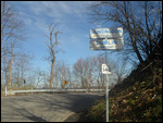
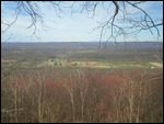
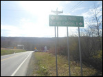
At the top of the ridge, a sign welcomes me to Huntingdon County, the mountainous county that I'll be exploring for the next couple of days. One thing I immediately notice is that, unlike previous valleys which are wooded on the slopes and heavily farmed at the bottom, this valley is actually more forested at the bottom as well. I kind of had the impression that all flat land in Pennsylvania is either used for farming or urbanized...
I'm not sure the name of this valley, I'm going to call it Shade Gap Valley after it's only town.
At the bottom, there's a side road with a sign that reads "Burnt Cabins, 8 miles"
. I was curious as to the story behind Burnt Cabins... some Indians burned the cabins of white settlers, perhaps?
No, the opposite.
White people burned the homes of the Indians?
No--not that either!
What really happened was a refreshing anomaly in the cruel and tragic relationship between the White Man and the Natives. See, back in the mid-1700s, there was an agreement that this land was to belong to the Indians. Then, a couple of white families decided to test that agreement and built homes on Indian land.
So what happened next? Well, the provincial government (yes, the white man's government) did something unusual: they decided to enforce that agreement--and burn down the houses of the white settlers! Thus the name, Burnt Cabins.
Sadly, this stroke of true justice and of treating Indians as equals with equal rights was shortlived
. Not long after, white folks went back to their usual habit of forcing the indians off their land as soon as they had the ability to do so...
It's a bittersweet moment of history. It makes you realize that, you know... things could have been different. If only this idea had caught on and governments around the country had realized that, hey, it really is better to treat all humans equally and justly....
It wouldn't be for another 200 + years that that would start happening again...
It's time to call it a day. It's a long bike ride back to Roxbury, so I'm going to stop here.
Post-visit: The "Real" Appalachia
Saturday, August 23, 2014
 Roxbury, Pennsylvania, United States
Other Entries
-
54Post-visit: Yard Sale day
Jul 0549 days prior Middletown, United Statesphoto_camera9videocam 0comment 0
 -
55Post-visit: Fishing Day
Jul 0549 days prior Hershey, United Statesphoto_camera12videocam 0comment 0
 -
561844. A More Typical Town
Jul 1539 days prior Hummelstown, United Statesphoto_camera7videocam 0comment 0
 -
571845. Not Much History Left
Jul 1539 days prior Paxtang, United Statesphoto_camera3videocam 0comment 0
 -
581846. Sandwich Suburb
Jul 1539 days prior Lemoyne, United Statesphoto_camera2videocam 0comment 0
 -
59Post-visit: Back to the Park
Jul 1539 days prior Camp Hill, United Statesphoto_camera2videocam 0comment 0
 -
60Post-visit: Suburb with a Soul
Jul 1539 days prior New Cumberland, United Statesphoto_camera3videocam 0comment 0
 -
61Post-visit: A Suburb Utopia?
Jul 2034 days prior Shiremanstown, United Statesphoto_camera4videocam 0comment 0
 -
62Post-visit : Back to my old home
Jul 2034 days prior Mechanicsburg, United Statesphoto_camera10videocam 0comment 0
 -
631847. The Powers of Nature
Jul 2529 days prior Mount Holly Springs, United Statesphoto_camera50videocam 0comment 0
 -
64Post-visit: The Indian School Cemetery
Jul 3024 days prior Carlisle, United Statesphoto_camera43videocam 0comment 0
 -
65Post-visit: Disappearing Farmland
Jul 3123 days prior Carlisle, United Statesphoto_camera0videocam 0comment 0
 -
66Postvisit: Hiking in the Rain
Aug 0122 days prior Newville, United Statesphoto_camera9videocam 0comment 0
 -
67Post visit: Clean up Day
Aug 0122 days prior Shippensburg, United Statesphoto_camera14videocam 0comment 0
 -
681848. The Amish Schoolhouse
Aug 0716 days prior Newburg, United Statesphoto_camera23videocam 0comment 0
 -
691849. Changes in the Village
Aug 158 days prior Orrstown, United Statesphoto_camera6videocam 0comment 0
 -
70Postvisit: The Edge of the Mountain
Aug 158 days prior Pleasant Hall, United Statesphoto_camera9videocam 0comment 0
 -
71Post-visit: The "Real" Appalachia
Aug 23 Roxbury, United Statesphoto_camera21videocam 0comment 0
 -
721850. A Covered Bridge
Sep 019 days later Shade Gap, United Statesphoto_camera9videocam 0comment 0
 -
731851. Following the Trolley Line
Sep 019 days later Rockhill Furnace, United Statesphoto_camera5videocam 0comment 0
 -
741852. Escaping the Rain
Sep 019 days later Orbisonia, United Statesphoto_camera4videocam 0comment 0
 -
751853. Across the Bridge
Sep 019 days later Shirleysburg, United Statesphoto_camera7videocam 0comment 0
 -
761854. American Cemeteries
Sep 0715 days later Mount Union, United Statesphoto_camera10videocam 0comment 0
 -
771855 My One Hour Hike in Mifflin County
Sep 0715 days later Kistler, United Statesphoto_camera5videocam 0comment 0
 -
781856 Climbing 1,000 Steps
Sep 0715 days later Mapleton, United Statesphoto_camera28videocam 0comment 0
 -
791857 Gun Country
Sep 0715 days later Mill Creek, United Statesphoto_camera6videocam 0comment 0
 -
801858 Pre-dawn Tour
Sep 0816 days later Huntingdon, United Statesphoto_camera11videocam 0comment 0
 -
811859 Forest full of Deer
Sep 0816 days later Petersburg, United Statesphoto_camera19videocam 0comment 0
 -
821860 Why Huntingdon is in Decline
Sep 0816 days later Alexandria, United Statesphoto_camera15videocam 0comment 0
 -
831861 Reaching Blair County
Sep 0917 days later Birmingham, United Statesphoto_camera19videocam 0comment 0
 -
841862 The Mansions of Tyrone
Sep 0917 days later Tyrone, United Statesphoto_camera15videocam 0comment 0
 -
851863 A Chat with a Stump Carver
Sep 0917 days later Bellwood, United Statesphoto_camera11videocam 0comment 0
 -
861864 The Oldest Gas Station in the World
Sep 1018 days later Altoona, United Statesphoto_camera45videocam 0comment 0
 -
871865 A Much Nicer Town Center
Sep 1018 days later Hollidaysburg, United Statesphoto_camera15videocam 0comment 0
 -
881866 The Shabbiest Town Hall
Sep 1018 days later Newry, United Statesphoto_camera8videocam 0comment 0
 -
891867 Reboot Hike
Sep 1624 days later Duncansville, United Statesphoto_camera4videocam 0comment 0

 Roxbury, Pennsylvania, United States

2025-05-22