12 hrs, 21.4 kms
Actual date: December 2, 2015
Today marks the start of a new "Section" of my hike through the USA
. Unlike a last year, when a "Superhike" had a clear starting and ending point, my hiking now just continues on and on indefinitely, so I have the freedom to cut it up into whatever sections I choose.
I'm starting a new Section in Duncannon, because I'm entering an area with a distinct culture, economy and geography: The Cumberland Valley.
The Cumberland Valley is really just a section of the Great Appalachian Valley which stretches all the way from the Canadian border down to Alabama. This fertile, productive corridor is an important slice of America's culture and history--and I'll be hiking in and out of it several times during my USA Hike.
THe Cumberland Valley includes the western suburbs of the state capitol, Harrisburg and then a series of towns neatly spaced at about 15 miles apart (which would've been a full day trip back in the wagon days). Carlisle... Newville... Shippensburg
... Chambersburg... Hagerstown--across the Civil War border and into The South.
It's a valley I have already explored quite a bit--I parkbenched all of these towns back in the early days of my journey. But now it's time to go back and connect them all with a single hike. I'm looking forward to re-experiencing this part of the country which has been my place up residence off and on for some 8 years ("home" is a bit too strong of a word...)
So here we go.
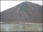
I follow the road along the Susquehanna that is packed with cars--commuters heading to and from their jobs around Harrisburg. Then suddenly.. a sign pointing at a trail that zigzags up the steep mountain to my left: The Appalachian Trail. The Trail I could've taken--but chose not too. I chose to walk the busy roads so I could experience as many towns along the way.
I do feel a brief moment of sadness for the path not taken
...
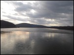
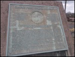
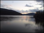
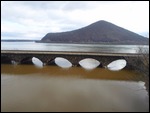
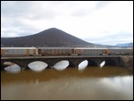
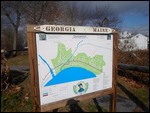
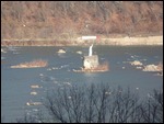
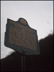
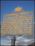
I will join the trail for a short stretch: the bridge across the massive, majestic Susquehanna. Here the is a historical marker that states that this is where the Eastern Division of the the Pennsylvania Canal System was buit. This system connected various rivers and valleys all around Pennsylvania, allowing the movement of Iron, timber and other mineral wealth.
It was not without challenges: despite its massive width, the Susquehanna is shallow with rocky, rapid currents, making it a difficult river for river traffic. Although it didn't have a massive project like the C and O canal running parallel to the Potomac, it did have several canals that bypassed the rapids. Also, there were specially built boats called "ark boats" that could handle the rocks and rapids.
Once again, I must admit that I'm pretty impressed by the ingenuity and determination of early Americans in overcoming challenges to their economic and industrial development
...
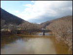
I cross the river... and immediately another: the Juniata... another important waterway connecting another series of towns... but that will be for exploring another day.
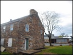
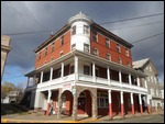
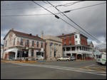
On the other side is the quiet town of Duncannon. Here is one of the rare times when the Appalachian Trail runs through the middle of a town--which I'm sure is a welcome relief to many through hikers who in other places have to hike/hitchhike many miles out of their way in search of supplies.
This means that Duncannon is a town where smelly, unshaven folks trudge through carrying dusty backpacks... and they are not treated as unwelcome vagrants--but rather as business opportunities... with several stores sporting signs saying "welcome hikers!"...
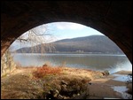
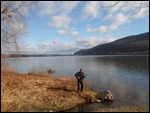
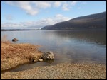
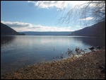
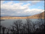
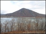
One thing that does seem to be squandered in these parts is the riverview. Elsewhere in the world this majestic view of the Susquehanna and surrounding slopes would unquestionably be turned into a walking/biking path
. Here, there's a railroad running on both sides of the river. There are a couple places in town where you can go under the railway and get a glimpse of the river... but that's about it. I even try to blaze my own trail on the space between the river and the railway... with limited success...
Finally I continue on my way, bidding a reluctant farewell to the Appalachian Trail once again, as the trail climbs up the mountain, and I follow the busy highway to my next town.
I do find a quiet road that follows the river for a stretch. There are houses along the river, each sporting a clear "No Tresspassing" sign. Finally the road itself says "No Tresspassing" and I'm forced to go back to the highway again.
Kind of sad... this riverway is one of Pennsylvania's treasures and should be enjoyed by everyone...
1839. Respected Hobos
Tuesday, July 01, 2014
 Duncannon, Pennsylvania, United States
Other Entries
-
311831. Back on the C & O Canal
Apr 0191 days prior Brunswick, United Statesphoto_camera15videocam 0comment 0
 -
321829. The Original Housing Crisis
Apr 0488 days prior Boonsboro, United Statesphoto_camera14videocam 0comment 0
 -
331830. Middletown Historical Society
Apr 0488 days prior Middletown, United Statesphoto_camera24videocam 0comment 0
 -
34Post-visit: Approaching the Megalopolis
Apr 1181 days prior Frederick, United Statesphoto_camera48videocam 0comment 0
 -
35Post-visit: The Overlook
Apr 1181 days prior Harpers Ferry, United Statesphoto_camera47videocam 0comment 0
 -
361832. A Swim in the Shenadoah
Apr 1181 days prior Bolivar, United Statesphoto_camera15videocam 0comment 0
 -
371833. Meeting a Stereotypical West Virginian
Apr 2468 days prior Ranson, United Statesphoto_camera15videocam 0comment 0
 -
38Post-visit : Goodbye West Virginia
Apr 2567 days prior Charles Town, United Statesphoto_camera9videocam 0comment 0
 -
391834. Entering The South
Apr 2567 days prior Berryville, United Statesphoto_camera14videocam 0comment 0
 -
40Post-visit: A True Virginian Town
May 0359 days prior Winchester, United Statesphoto_camera21videocam 0comment 0
 -
411836. Living in a Log House in the 21st Century
May 0359 days prior Stephens City, United Statesphoto_camera10videocam 0comment 0
 -
421837. The Unitarian Universalist Church
May 0359 days prior Middletown, United Statesphoto_camera11videocam 0comment 2
 -
431838. The Great Train Raid
May 0458 days prior Strasburg, United Statesphoto_camera16videocam 0comment 0
 -
441839. A Good Stopping Point
May 0458 days prior Toms Brook, United Statesphoto_camera7videocam 0comment 0
 -
451840. Strumming by the river
Jul 01earlier that day Marysville, United Statesphoto_camera4videocam 0comment 0
 -
46Post-visit: Remembering Nathan's Bar
Jul 01earlier that day Enola, United Statesphoto_camera6videocam 0comment 0
 -
471841. Riverfront Town
Jul 01earlier that day Wormleysburg, United Statesphoto_camera9videocam 0comment 0
 -
481839. Respected Hobos
Jul 01 Duncannon, United Statesphoto_camera22videocam 0comment 0
 -
49Postvisit: A sunrise or a sunset?
Jul 043 days later Harrisburg, United Statesphoto_camera148videocam 0comment 0
 -
501846. Another disappointing Suburb
Jul 043 days later Penbrook, United Statesphoto_camera1videocam 0comment 0
 -
51Post-visit: The Street Worshipper
Jul 054 days later Steelton, United Statesphoto_camera11videocam 0comment 0
 -
52Post-visit: Past the Airport
Jul 054 days later Highspire, United Statesphoto_camera2videocam 0comment 0
 -
531843. Across from 3 Mile Island
Jul 054 days later Royalton, United Statesphoto_camera4videocam 0comment 0
 -
54Post-visit: Yard Sale day
Jul 054 days later Middletown, United Statesphoto_camera9videocam 0comment 0
 -
55Post-visit: Fishing Day
Jul 054 days later Hershey, United Statesphoto_camera12videocam 0comment 0
 -
561844. A More Typical Town
Jul 1514 days later Hummelstown, United Statesphoto_camera7videocam 0comment 0
 -
571845. Not Much History Left
Jul 1514 days later Paxtang, United Statesphoto_camera3videocam 0comment 0
 -
581846. Sandwich Suburb
Jul 1514 days later Lemoyne, United Statesphoto_camera2videocam 0comment 0
 -
59Post-visit: Back to the Park
Jul 1514 days later Camp Hill, United Statesphoto_camera2videocam 0comment 0
 -
60Post-visit: Suburb with a Soul
Jul 1514 days later New Cumberland, United Statesphoto_camera3videocam 0comment 0
 -
61Post-visit: A Suburb Utopia?
Jul 2019 days later Shiremanstown, United Statesphoto_camera4videocam 0comment 0
 -
62Post-visit : Back to my old home
Jul 2019 days later Mechanicsburg, United Statesphoto_camera10videocam 0comment 0
 -
631847. The Powers of Nature
Jul 2524 days later Mount Holly Springs, United Statesphoto_camera50videocam 0comment 0
 -
64Post-visit: The Indian School Cemetery
Jul 3029 days later Carlisle, United Statesphoto_camera43videocam 0comment 0
 -
65Post-visit: Disappearing Farmland
Jul 3130 days later Carlisle, United Statesphoto_camera0videocam 0comment 0
 -
66Postvisit: Hiking in the Rain
Aug 0131 days later Newville, United Statesphoto_camera9videocam 0comment 0

 Duncannon, Pennsylvania, United States


2025-05-22