At departure from Norfolk, existing conditions were 15-20 knot NE winds and, due to the close apparent wind angle required to pass through the South Chesapeake Bay Bridge Tunnel, we began motor sailing upwind. Winds were diminishing and, as forecast, had lessened to below 10 knots by the time we rounded Cape Henry, VA, so we were motoring on one engine with the jib. We were bundled up in winter clothing for air temperatures in the upper 40's to 50’s. Our intended route would take us across the Gulf Stream (a swiftly flowing ocean current that would work against us) in the vicinity of Cape Hatteras, after which we would head S SW to our intended landfall at Marsh Harbour, Great Abaco, Bahamas. We anticipated the non-stop journey to last approximately four days over a course of approximately 650 nautical miles.
We had established a watch schedule for round-the-clock sailing, which divided the navigation, helm and lookout responsibilities amongst the crew
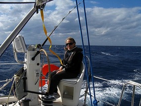
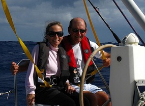
. Each of four crew members would stand a 3-hour watch with 9 hours off. As Captain, Dave would act as a "floater" and was a stand-by on every watch, particularly those maintained by Donna and Paul, who were new to passage-making. Donna had “first pick” of the watches and quickly took the 5AM-8AM and 5PM-8PM watches for sunrises and sunsets. She figured that would work best for her since she always was awake by 5 AM anyway and could easily fall asleep by 8:30 PM. For her, that was routine. Paul followed Donna’s shift from 8AM-11AM and 8PM-11PM. John took over at 11AM and 11PM and Carter took over at 2AM and 2PM. Everyone on watch was in full safety garb and tethered to the cockpit with the ability if necessary to move about the vessel through the use of the jacklines stretching to forward points of the boat.
Pas de Deux is equipped with a full complement of electronic aids to navigation and communications, including multiple GPS receivers, two chart plotters, radar, AIS (automatic identification system), VHF and SSB communications, and satellite telephone--all supporting a safe ocean voyage
. Our first challenge, however, involved said navigation equipment! This occurred shortly after dusk on our first day after Dave set up a radar “guard zone” to alert us when an object crossed a perimeter set around the boat. Shortly after setting up that safety perimeter, the Furuno radar/chart plotter/ GPS/AIS malfunctioned, rendering it practically useless in all respects. Troubleshooting led to restoring some functionality but critical aspects remained absent (radar and AIS functionality) and we were forced to rely on backup GPS capabilities for navigating. At that point, Dave reminded us that Columbus had none of this equipment! This malfunction plagued us for the remainder of the passage and was never fully resolved until after our arrival in the Bahamas. Fortunately in the open ocean chart plotters are not critical and our backup GPS capabilities provided for safe passage.
Our “buddy boat” Our White Magic largely followed our same path and we remained in routine communication with each other sharing weather conditions and any other information of interest
. They were apprised of our compromised electronics and had occasion to alert us well in advance to a vessel nearing our path, which would normally be a function of our AIS and radar, as their systems were fully functional.
We planned our Gulf Stream crossing based on NOAA charting of the northern and southern "walls" of the Stream, choosing to cross at what we believed would be one of the narrowest positions, an entry point just northeast of Cape Hatteras, bearing a southeast course. We expected the crossing to take approximately 8-10 hours. Our weather router had advised us to exit the Stream by Thursday evening due to forecasted wind direction and intensity changes that would make the Gulf Stream rougher. By monitoring sea water temperature we believe we entered the Gulf Stream at 0343 on the morning of November 5 as evidenced by the sudden increase in water temperature displayed on our instruments. Water temperature rose from approximately 65 degrees F to 74 degrees F in a matter of minutes. Had it been daylight we might have seen the water color change characteristic of the Stream. We’re not quite as sure when we exited the Stream but in the early afternoon of November 5 we changed course to the south setting a waypoint on our backup GPS to Man O’ War Channel, Great Abaco – our intended landfall.
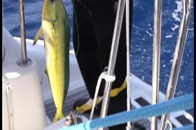
To this point, winds had remained light, causing us to motor sail with the jib and one engine until the following day, November 6 when stronger northwest winds built by mid-day, then clocked to the northeast 15-20 knots, permitting us to fly the symmetrical spinnaker and shut down the engine. These conditions improved our speed and comfort and we had a great sailing day that Friday. We hooked two dolphin but lost them both before the sail change. After the sail change, Dave alerted Paul that there would be no chance to slow the boat if we hooked another fish. Within minutes of raising the spinnaker we hooked two more dolphin and managed to get them both aboard despite boat speed in the 8-12 knot range. Paul cleaned and prepared the fish for a yummy dinner!
Prior to nightfall, we lowered the spinnaker (it’s not prudent to sail at night with it) and switched back to the jib and motor sailed that night as the winds had diminished once again. The following morning, we raised the main to the first reef point and turned off the engine due to increasing NE winds. We covered a great distance during daylight hours that day with the sail plan of main and jib and NE wind conditions building to 20-30 knots. At nightfall, we put a second reef in the main and reefed the jib. The building wind had resulted in a building sea state with waves 8-10 ft. These would be considered by many to be rough and, combined with the speed at which the boat was moving (despite double reefs), certainly noisy for those sleeping below as breaking waves perpendicular to our course struck the hulls, seeming even more amplified to those below deck and admittedly unexpected to Dave. We all slept with earplugs. Paul was gracious enough to share his Scopolomine patches for those who needed them by this time. The good news was that with our southern trajectory, the air temperature had increased by this time, allowing us to throw off our winter garb!
Sunrise on Sunday, November 8 saw NE winds still 20-30 knots with heavy seas, so we maintained our sail plan of two reefs in the main and the jib into the daylight hours. From 0645 on November 7 to 0645 on November 8 we covered 200.2 nautical miles. From noon on November 7 to noon on November 8 we covered 207 nautical miles. For a cruising boat, that translates to very good passage-making speed. Given the conditions of the day prior and the forecasted conditions at the time of our expected arrival at Great Abaco, the decision was made on Saturday to alter our landfall destination to Spanish Wells, Eleuthera to avoid rough seas when attempting to enter straits to the Sea of Abaco. The Spanish Wells destination would not present any such issues, but would add approximately 60 nautical miles to our passage.
We arrived in the vicinity of Spanish Wells on Sunday late afternoon, chose a protected anchorage at nearby Meeks Patch island, and would enter Spanish Wells Monday morning to clear Customs and Immigration. Our White Magic arrived just ahead of and in sight of us. We both raised our Q flags. On Pas de Deux we settled in with a champagne toast and took pride in our safe arrival.
Stay tuned for our island hopping adventures!
Passage to the Bahamas: Under Way
Sunday, November 08, 2009
 Spanish Wells, Harbour Island, Bahamas
Other Entries
-
95Final Sailing Day of the 2008 Season
Nov 14359 days prior Vera's White Sands Beach Club and Marina, United Statesphoto_camera4videocam 0comment 0
 -
96Season's Greetings!
Dec 25318 days prior Vera's White Sands Beach Club and Marina, United Statesphoto_camera1videocam 1comment 0
 -
97Video***Year 2008 on the Chesapeake Bay
Dec 31312 days prior Vera's White Sands Beach Club and Marina, United Statesphoto_camera1videocam 1comment 0
 -
98Preparations for the New Year
Jan 01311 days prior Vera's White Sands Beach Club and Marina, United Statesphoto_camera1videocam 0comment 0
 -
99Spring Has Sprung!
Mar 08245 days prior Vera's White Sands Beach Club and Marina, United Statesphoto_camera6videocam 0comment 0
 -
100Putting Things Back Together
Mar 18235 days prior Vera's White Sands Beach Club and Marina, United Statesphoto_camera0videocam 0comment 0
 -
101Installing the New Rudders
Mar 21232 days prior Vera's White Sands Beach Club and Marina, United Statesphoto_camera7videocam 0comment 0
 -
102Preparations for our First Sail of the Season
Mar 23230 days prior Vera's White Sands Beach Club and Marina, United Statesphoto_camera2videocam 0comment 0
 -
103Final Preparations for Transit to Annapolis
Mar 25228 days prior Vera's White Sands Beach Club and Marina, United Statesphoto_camera0videocam 0comment 0
 -
104Transit to Annapolis
Mar 30223 days prior Annapolis, United Statesphoto_camera0videocam 0comment 0
 -
105Recap of our Spring 2009 Refit
Apr 28194 days prior Annapolis, United Statesphoto_camera9videocam 0comment 0
 -
106Transit from Annapolis to Norfolk
Apr 30192 days prior Norfolk, United Statesphoto_camera4videocam 0comment 0
 -
107A Busy Summer in Norfolk
Aug 0199 days prior Norfolk, United Statesphoto_camera12videocam 0comment 0
 -
108Vacationing with Alize
Sep 1257 days prior Norfolk, United Statesphoto_camera0videocam 0comment 0
 -
109September Sailing Amidst Chores
Sep 3039 days prior Norfolk, United Statesphoto_camera0videocam 0comment 0
 -
110October Cruising
Oct 318 days prior Norfolk, United Statesphoto_camera0videocam 0comment 0
 -
111Passage to the Bahamas: Anticipation
Nov 044 days prior Norfolk, United Statesphoto_camera0videocam 0comment 0
 -
112Passage to the Bahamas: Under Way
Nov 08 Spanish Wells, Bahamasphoto_camera3videocam 1comment 0
 -
113Arrival at Spanish Wells, Eleuthera
Nov 091 day later Spanish Wells, Bahamasphoto_camera1videocam 0comment 0
 -
114Traveling Onward - The First Month
Dec 1234 days later George Town, Bahamasphoto_camera21videocam 0comment 0
 -
115Our Journey Southward Continues
Jan 1063 days later Clarence Town, Bahamasphoto_camera4videocam 0comment 0
 -
116Overnight Passage to Turks & Caicos Islands
Jan 1467 days later Sapodilla Bay, Turks and Caicosphoto_camera1videocam 0comment 0
 -
117Visit to the Northern Shore of Providenciales
Jan 2477 days later Providenciales, Turks and Caicosphoto_camera15videocam 0comment 0
 -
118Journey Southward to the Turks Islands
Feb 0488 days later Big Sand Cay, Turks and Caicosphoto_camera16videocam 1comment 0
 -
119Passage Making Northbound to the Ragged Islands an
Feb 23107 days later Flamingo Cay, Bahamasphoto_camera6videocam 0comment 0
 -
120Our Northbound Trek Continues Toward the Berry Isl
Mar 08120 days later Great Harbour, Bahamasphoto_camera6videocam 0comment 0
 -
121Destination Freeport/Port Lucaya Grand Bahama
Mar 15127 days later Port Lucaya, Bahamasphoto_camera1videocam 0comment 0
 -
122Final Days in the Bahamas and the Journey Home
Apr 03146 days later Palm Beach, United Statesphoto_camera5videocam 0comment 0
 -
123Northward With a View of Shuttle Discovery Launch
Apr 06149 days later Fernandina Beach, United Statesphoto_camera7videocam 0comment 0
 -
124Destination Charleston, South Carolina
Apr 17160 days later Charleston, United Statesphoto_camera6videocam 0comment 0
 -
125More of Charleston and Our Sail to Beaufort NC
Apr 22165 days later Charleston, United Statesphoto_camera5videocam 0comment 0
 -
126Our Sail to Ocracoke on the Outer Banks
Apr 30173 days later Okracoke NC, United Statesphoto_camera10videocam 0comment 0
 -
127The Final Journey Back to Norfolk, Virginia
May 01174 days later Norfolk, United Statesphoto_camera0videocam 0comment 0
 -
128Day Sail with College of W&M Choir Members
May 09182 days later Norfolk, United Statesphoto_camera5videocam 0comment 0
 -
129Our Summer 2010 Maintenance aka How Time Flies
Sep 19315 days later Norfolk, United Statesphoto_camera2videocam 0comment 0
 -
130Preparing for Our First Passage to the Caribbean
Nov 06363 days later Norfolk, United Statesphoto_camera3videocam 0comment 0

 Spanish Wells, Harbour Island, Bahamas


2025-05-23