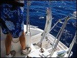
On Tuesday, January 26 we departed Grace Bay, Providenciales to sail around the west side of the island to the Sandborne Channel where we would enter the Caicos Bank to begin our transit to the Turks Islands. Shortly after departing Grace Bay outside of the reef surrounding Providenciales, we hooked two mahi, one of which we landed and enjoyed for dinner that evening at our rest stop on the Caicos Bank.
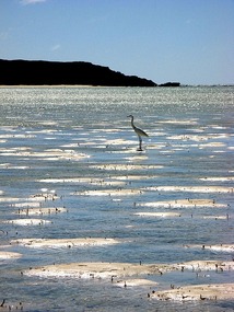
The Caicos Bank is a broad shallow sea resembling a large atoll with gin clear water that allows you to easily count starfish as you sail across
. We knew we could anchor overnight at a midpoint to our destination because the winds were projected to become quite mild. We entered the Bank around noon with our course taking us into moderate 10-13 knot wind. We stopped at sunset when we no longer had the daylight needed to spot any uncharted coral heads in our path, making it just about half way across - as far from anything as we could get on the Bank.
We set the anchor in 9 feet of crystal clear water. It was amazing - nothing in sight and the water only 9 feet deep. Because we had selected an almost ideal weather window for this crossing, we had a calm night with light winds and chop - perfect for grilling mahi and sleeping in the middle of nowhere, appearing to float above the ground. Our remoteness was apparent by the total lack of any other vessels or lights, except for the distant faint glow of Provo, over 20 miles away. In the cloudless sky, the bright 3/4 moon, whose craters we could count, obscured most of the stars, but after the moon set in the wee hours of the morning, the stars shown brilliantly as if you could reach and touch them
. Simply lovely.
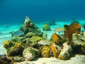
The next morning we continued on our route to South Caicos to stage for a crossing of the Columbus Passage (Turks Island Passage). Enroute in the deep water we hoped to see the Humpback whale migration that occurs this time of year. We arrived in Cockburn Harbor, South Caicos midday on January 27th and anchored in a beautiful setting near the northwest tip of Long Cay beside "The Admiral's Aquarium", a noted snorkel site, which we immediately suited up to visit in the existing calm winds and high sun. Aside from local fishing boats at some distance in Cockburn Harbor we were the only boat there.
We sat out a few days of high winds associated with a passing front, then left on January 31 to make the 22 nm crossing of the Columbus Passage (Turks Island Passage) to Grand Turk, the government center of the Turks and Caicos Islands (that the Brits took over last August). We had a nice sail, but caught no fish and didn't see any whales. We were in prime whale watching season in the Columbus Passage, which was the major reason we wanted to visit the Turks. We anchored right off the shore of Cockburn Town, the "capital". This was a challenge as the bottom here was a mix of hard limestone interspersed by small patches of sand. Hitting a good patch of sand for good holding was like playing whack-a-mole, but we finally got a good hook.
Approx
. 3,000 people live on Grand Turk versus Provo's 30,000+. This was a sharp contrast to Provo and more like the third world nature of most of the Bahamas and Caribbean region. There was a strong British influence apparent in the history and architecture. Again, we were the only boat there and when we walked around town, we were the only tourists. Things changed the following morning early when we saw a cruise ship approaching. We managed to make it ashore to visit the highly regarded museum early that morning before most of the horde arrived.
After our museum visit we departed Grand Turk for Salt Cay - only about 9 nm to the SSW where again we played anchoring whack-a-mole. But this time we weren't too concerned about getting a perfect hook as we were on the west shore of the island with an East (offshore) wind. The west shore of Salt Cay has no barrier reef and only a relatively narrow shallow section between the shore and water over 3000 feet deep. Again, we were the only boat in sight, so slipping anchor was of no concern
. We'd just drift out over the deep water....
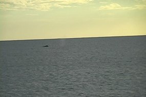
We went ashore and visited the small village. The island has 63 residents, down from its high of over 1,100 at the height of the salt industry less than 100 years ago. We found a really nice bar, Island Thyme Bistro, and visited with the owner for awhile. Afterwards, we visited the Bermudian style stone "White House", an 1840 building which was the Harriott salt merchant's operation and is being restored as a residence by descendants of the Harriott family. We were anchored directly offshore from it. While talking to two of the family members we finally saw a few whales cruising in the deep water just beyond where Pas de Deux was anchored. After returning to the boat we set up our deck chairs in the cockpit facing aft (west) and watched a few more whales go by while watching for a sunset green flash. We wondered where else in the world can you watch whales and green flashes simultaneously while hearing donkeys bray on shore...?
The next day we moved to the north coast of Salt Cay and anchored in pristine sand near some snorkeling reefs. No whack-a-mole here. The water colors here were amazingly brilliant. Our pictures will not do it justice.
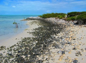
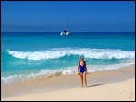
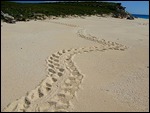
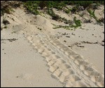
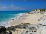
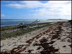
The following day, February 3, we sailed to Big Sand Cay, another 9 nm to the SSW. This uninhabited, beautiful small island is a nature sanctuary. With its broad fine sand beaches interspersed by white limestone outcroppings and gorgeous surf, it was certainly a highlight of our cruise so far. The anchorage was a broad sand bottom bay. Normally, stepping foot on a Sanctuary requires a permit; however we had a conversation with the head of the TCI Department of Environment and Coastal Resources when we were on the north shore of Provo and he said it was not necessary--we should just behave ourselves. So we swam approximately 100 yards ashore and hiked both the beaches and the reef strewn east side. We saw several examples of sea turtle tracks leading from the water to the dune line and back, with obvious egg laying locations. Just like on the Discovery Channel!
Big Sand Cay represented our furthest south and east destination. We celebrated with a dinner of filet mignon and a bottle of champagne to toast our accomplishment. The following morning, Feb. 4, three months to the day since leaving Norfolk on our six-month voyage, we "turned around" and began our next three months homeward bound, returning to a southwest anchorage off Long Cay near South Caicos Island.
Journey Southward to the Turks Islands
Thursday, February 04, 2010
 Big Sand Cay, Grand Turk, Turks and Caicos
Other Entries
-
101Installing the New Rudders
Mar 21320 days prior Vera's White Sands Beach Club and Marina, United Statesphoto_camera7videocam 0comment 0
 -
102Preparations for our First Sail of the Season
Mar 23318 days prior Vera's White Sands Beach Club and Marina, United Statesphoto_camera2videocam 0comment 0
 -
103Final Preparations for Transit to Annapolis
Mar 25316 days prior Vera's White Sands Beach Club and Marina, United Statesphoto_camera0videocam 0comment 0
 -
104Transit to Annapolis
Mar 30311 days prior Annapolis, United Statesphoto_camera0videocam 0comment 0
 -
105Recap of our Spring 2009 Refit
Apr 28282 days prior Annapolis, United Statesphoto_camera9videocam 0comment 0
 -
106Transit from Annapolis to Norfolk
Apr 30280 days prior Norfolk, United Statesphoto_camera4videocam 0comment 0
 -
107A Busy Summer in Norfolk
Aug 01187 days prior Norfolk, United Statesphoto_camera12videocam 0comment 0
 -
108Vacationing with Alize
Sep 12145 days prior Norfolk, United Statesphoto_camera0videocam 0comment 0
 -
109September Sailing Amidst Chores
Sep 30127 days prior Norfolk, United Statesphoto_camera0videocam 0comment 0
 -
110October Cruising
Oct 3196 days prior Norfolk, United Statesphoto_camera0videocam 0comment 0
 -
111Passage to the Bahamas: Anticipation
Nov 0492 days prior Norfolk, United Statesphoto_camera0videocam 0comment 0
 -
112Passage to the Bahamas: Under Way
Nov 0888 days prior Spanish Wells, Bahamasphoto_camera3videocam 1comment 0
 -
113Arrival at Spanish Wells, Eleuthera
Nov 0987 days prior Spanish Wells, Bahamasphoto_camera1videocam 0comment 0
 -
114Traveling Onward - The First Month
Dec 1254 days prior George Town, Bahamasphoto_camera21videocam 0comment 0
 -
115Our Journey Southward Continues
Jan 1025 days prior Clarence Town, Bahamasphoto_camera4videocam 0comment 0
 -
116Overnight Passage to Turks & Caicos Islands
Jan 1421 days prior Sapodilla Bay, Turks and Caicosphoto_camera1videocam 0comment 0
 -
117Visit to the Northern Shore of Providenciales
Jan 2411 days prior Providenciales, Turks and Caicosphoto_camera15videocam 0comment 0
 -
118Journey Southward to the Turks Islands
Feb 04 Big Sand Cay, Turks and Caicosphoto_camera16videocam 1comment 0
 -
119Passage Making Northbound to the Ragged Islands an
Feb 2319 days later Flamingo Cay, Bahamasphoto_camera6videocam 0comment 0
 -
120Our Northbound Trek Continues Toward the Berry Isl
Mar 0832 days later Great Harbour, Bahamasphoto_camera6videocam 0comment 0
 -
121Destination Freeport/Port Lucaya Grand Bahama
Mar 1539 days later Port Lucaya, Bahamasphoto_camera1videocam 0comment 0
 -
122Final Days in the Bahamas and the Journey Home
Apr 0358 days later Palm Beach, United Statesphoto_camera5videocam 0comment 0
 -
123Northward With a View of Shuttle Discovery Launch
Apr 0661 days later Fernandina Beach, United Statesphoto_camera7videocam 0comment 0
 -
124Destination Charleston, South Carolina
Apr 1772 days later Charleston, United Statesphoto_camera6videocam 0comment 0
 -
125More of Charleston and Our Sail to Beaufort NC
Apr 2277 days later Charleston, United Statesphoto_camera5videocam 0comment 0
 -
126Our Sail to Ocracoke on the Outer Banks
Apr 3085 days later Okracoke NC, United Statesphoto_camera10videocam 0comment 0
 -
127The Final Journey Back to Norfolk, Virginia
May 0186 days later Norfolk, United Statesphoto_camera0videocam 0comment 0
 -
128Day Sail with College of W&M Choir Members
May 0994 days later Norfolk, United Statesphoto_camera5videocam 0comment 0
 -
129Our Summer 2010 Maintenance aka How Time Flies
Sep 19227 days later Norfolk, United Statesphoto_camera2videocam 0comment 0
 -
130Preparing for Our First Passage to the Caribbean
Nov 06275 days later Norfolk, United Statesphoto_camera3videocam 0comment 0
 -
131Getting Underway (aka Whether and Weather)
Nov 07276 days later Norfolk, United Statesphoto_camera0videocam 0comment 0
 -
132Watches and Wind, Fishing and Communications
Nov 14283 days later Atlantic Ocean, Internationalphoto_camera16videocam 0comment 0
 -
133Landfall in the British Virgin Islands
Nov 23292 days later Frenchmans Cay, Virgin Islands USphoto_camera16videocam 0comment 0
 -
134Excursion to the US Virgin Islands
Dec 03302 days later St. Thomas, Virgin Islands USphoto_camera30videocam 9comment 0
 -
135Southbound – Just the Two of Us – Saba
Dec 10309 days later Nevis, Saint Kitts and Nevisphoto_camera21videocam 3comment 0
 -
136Journey to Les Saintes Passing Montserrat
Dec 15314 days later Terre-de-Haut, Guadeloupephoto_camera13videocam 2comment 0

 Big Sand Cay, Grand Turk, Turks and Caicos



2025-05-23