Passage from the Chesapeake to the Bahamas
Friday, November 09, 2012
 Little Creek, Virginia, United States
 Little Creek, Virginia, United States
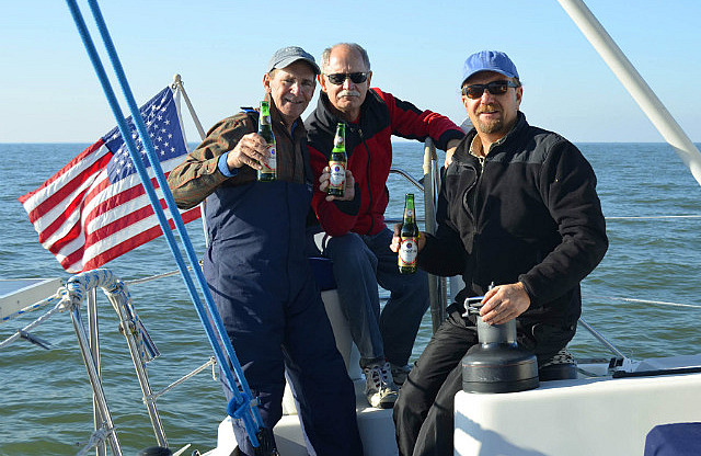
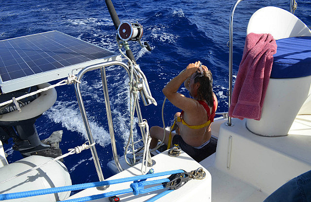
It was a beautiful autumn day as we departed Little Creek, Norfolk, Virginia, with light north winds. Departure time was 1355 on November 9, 2012. After passing over the south tunnel of the Chesapeake Bay Bridge Tunnel with full main and genoa, we were soon motor sailing down the Virginia Beach oceanfront in light conditions, furling the genoa before nightfall.
Our planned route would take us down the Virginia/North Carolina coast toward Cape Hatteras, turning left (ESE) to cross the gulf stream SE of the Cape at a specific, optimum location provided by our weather router, Chris Parker. His guidance has been spot on in all our previous passages. After exiting the stream near Chris' suggested exit point, we'd turn right to the SSW on a direct line to Harbour Island, hoping to be able to arrive during daylight and with calm enough sea conditions to enter the cut through the reef at the southern end of the island. That was the plan. Over the 4 to 5 day passage time, we'd have to keep close tabs on our arrival timing and the weather and sea conditions at Harbour Island to determine if arrival there would be safe. Our alternate destination was nearby Spanish Wells, our arrival point in 2009, which we'd switch to if our arrival in the vicinity would be unavoidably at night or with unsafe conditions, or both. We were familiar with the entry into the Spanish Wells area and were confident of conducting a safe, night time, foul weather arrival there.
The rest of passage Day 1
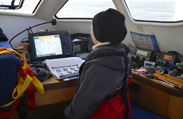
We established a 1800 (6:00 pm) to 0600 (6:00 am) 12 hour watch schedule with each of us taking a three hour watch. Donna (ladies first) chose the 1800-2100 watch and Dave assigned himself the 0300 to 0600 watch, staying awake to monitor Chris Parker's weather broadcast at 0630. Bob and Wally ended up swapping the other two watches keeping Donna on her toes as to who to wake up if 2100 passed with no relief. To their credit, one of them always showed up on time.... We agreed not to have a formal day time watch schedule and handle lookout responsibilities ad hoc, as in our three previous passages together most of us were alert and paying attention during the days.
Unlike previous passage departures, there were several other cruising boats within sight and on parallel courses. This kept watch standers busy at night, trying to keep track of lights. Overnight the wind remained light, but shifted to the SW. Bob reset the genoa on his watch.
Passage Day 2, Saturday, November 10
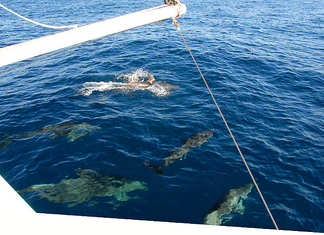
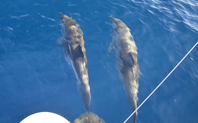
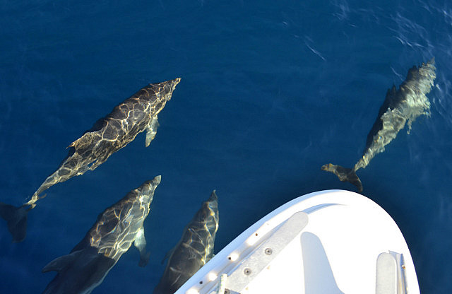
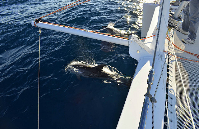
At daybreak several southbound cruising boats were still within sight and we were still motor sailing. We crossed a water color boundary around 1130, suggesting we were entering the Gulf Stream way earlier than expected, but there was only a small water temperature rise. Not detecting any adverse current, we concluded this was not really the Stream and maintained our course for the predicted entry waypoint. At 1300 and a few miles prior to reaching the entry waypoint, we entered bluer and warmer water and turned left to the exit waypoint. We were in the Stream. In the calm conditions, it was benign. Wally reeled in our first fish, a Little Tunny, but not being a good food fish, it was released. Excitement nonetheless. Our afternoon entertainment also included a fun visit by playful dolphins. We all gathered on the bow and cameras were clicking. They stayed with us for several minutes.
By 1430 the wind had become light and variable and we furled the genoa and dropped the mainsail. These conditions had been forecast. But it was a beautiful, cloudless sky and it was getting warmer.
The numerous other cruising boats within sight along the NC coast were soon gone, either spread out too far to see or on courses to other destinations. We were alone. Even the VHF radio chatter was gone. We exited the Gulf Stream around 2100 and turned right, SSW towards Harbour Island.
Our relatively slow progress so far indicated a Wednesday arrival at Harbour Island. But the forecast suggested our pace would improve substantially as we got an expected wind increase. It will be all downwind once the wind arrives and may become quite boisterous....
Passage Day 3, Sunday, November 11
The winds remained light early Sunday morning. So far, the nights had been peaceful, sparkling with stars, meteors, and a crescent moon. As if making up for being absent the first two days of our passage, the wind reappeared with gusto with daylight. By 0700 the wind was increasing from the ENE and we unfurled the genoa. By 0815 with everyone awake, we raised the mainsail to the second reef and shut down the engine. The wind continued to increase gradually throughout the day, building to ENE at 15-25 kts by evening, with no end in sight. Along with the wind came the seas, and a rough ride. The wind direction placed it on our beam, so we could make a fast, direct course to our destination. But this also meant we had the seas on the beam which could be uncomfortable. Our passage had shaped up to be two days of motoring and two days of hanging on....

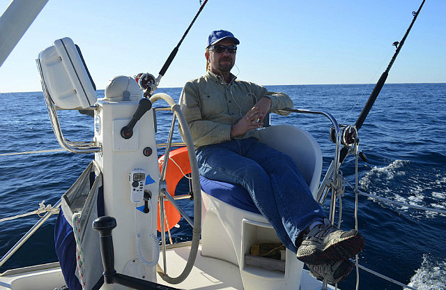
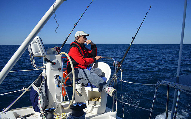
Before the strongest wind arrived this day, Wally reeled in a dinner-for-four size Mahi. In the afternoon, Bob landed a Skipjack tuna. We had the Mahi for dinner. As the wind increased, that would be the end of our fishing for now. In the rough conditions it was best to stay seated. At 2400 we reefed the genoa to slow down and smooth the ride a bit.
Passage Day 4, Monday, November 12
It was very fast and rough during the early morning, as the winds remained in the high teens to low twenties. Our noon to noon distance made was 200.7 nm and we now expected to make landfall Tuesday evening.
The high wind and seas were forecast to be present for the rest of the passage, including at our originally planned destination Harbour Island. Because this would make passage into the cut through the reef there too risky, as well as likely being at night, we changed our destination to the large easy-to-enter protected bay adjacent to nearby Spanish Wells. This was our arrival point in Nov 2009, so we had first hand knowledge of it. This arrival point also has the advantage of providing safe entry at night, so we could keep up our speed as fast as would be comfortable and not have to slow down substantially just to arrive during daylight.
Later in the day the wind and seas moderated a bit and we fully unfurled the genoa to keep up our speed. It was more comfortable than 24 hours earlier. Aside from the high winds, the temperature was warmer and tee shirts and shorts were unpacked.
Passage Day 5, Tuesday, November 13
Early Tuesday the wind remained 15-20 with higher gusts, but the direction backed a bit to the NE, slowing us down. Our midnight to midnight distance made was 197 nm. We shook out one reef in the main. Our subsequent noon to noon distance made was 185 nm. As we slowed and the seas shifted further behind the beam, it was safe to fish again. But nobody told the fish. This was the first blue water day we could remember not catching a fish.
Night fell off the coast of Great Abaco and we began hearing VHF chatter. We could see the night time glow from Harbour Island, but our course was taking us to the west of it to the smaller glow of Spanish Wells. Entering the Northeast Providence Channel, between Great Abaco and Eleuthera, meant commercial shipping traffic to and from Nassau would increase, but the visibility of large ships at night is very good, even better than during the day. The night glow from cruise ships, lit up like cities, can be seen before the ships come over the horizon. But small fishing boats are another matter....
As we approached and then paralleled the reef strewn northern end of Eleuthera, the autopilot was still following the SSW route on the chartplotter that we'd been following since changing our destination to Spanish Wells - to a waypoint at the entrance of the large bay into which we'd turn sharp left to our final waypoint, just off the beach at Meeks Patch, a small island inside the bay. It was pitch black, with no boundary between the black sea and sky, but we had only about 2 nm to go to the bay entrance waypoint. We were in water depths less than 100 feet. On the chartplotter, our position was shown correctly, moving slowly right on top of the wide, reddish dotted line that represented our route and intended path. But in the blackness ahead of us there was a small, low white light whose distance wasn't obvious. We were pointed right at it and we initially concluded it was beyond our waypoint where we'd turn into the bay. After a few minutes we concluded it wasn't moving left or right, so perhaps it really was a distant, stationary light on the shore several miles beyond our waypoint. But it got brighter. Maybe is was actually a slower small boat on our same course that we were catching up to – or on the opposite course heading toward us. Or maybe it was an anchored boat, but who would be anchored out here in the middle of the night? It was about 2200. We turned on all our motoring navigation lights, even though we were still under sail, to help ensure that we'd be seen. As the light got brighter still, we decided we better assume it was a boat and Dave turned on the radar to try to see if it could be spotted to determine its distance. Nothing. The radar clearly showed the shoreline exactly where it was supposed to be to our port side, but there was nothing on the screen directly in front of us. No matter, whatever it was, it was getting closer and if it was a small boat radar might not see it. We had plenty of sea to our starboard side, so Dave disengaged the autopilot and turned to starboard. Almost simultaneously, we heard a hail on the VHF, "You commin down on me, mon! You commin down on me!" Assuming the hail was for us, Dave answered, “Are you a boat off Egg Reef? What is the size of your vessel?” “Ya mon, 25 foot fishing boat.” “OK, OK, we see you and have turned away.” Another closer look at the radar showed a small reddish blob on the screen, right below the reddish dotted line of our route. It had probably been there the whole time, hidden below the route line. This might call for a change to the color of the route line!
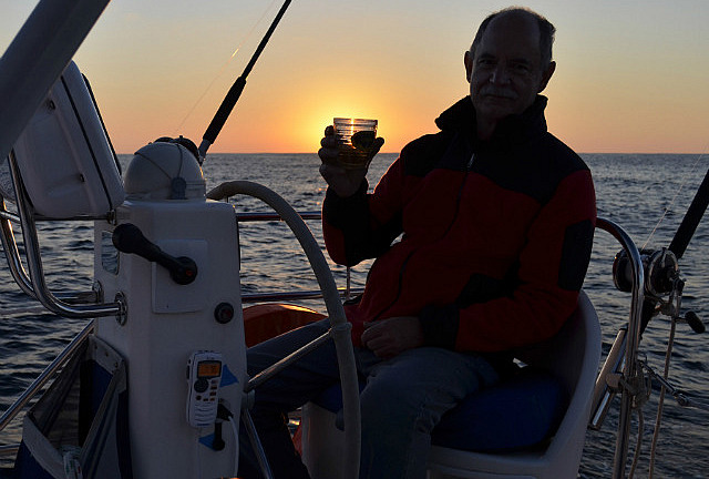
After the fishing boat encounter, in just a matter of minutes we furled the genoa, started an engine, turned up into the wind at our waypoint entrance to the bay, and dropped the mainsail. It took about an hour to motor the six miles directly upwind inside the bay to Meeks Patch where our spotlight illuminated the shore of the small island and our depth sounder showed decreasing depth. Finally, the spotlight revealed a sandy bottom and we dropped the anchor. Arrival time was 2333, Tuesday, November 13. Midnight rum.
Passage distance from Little Creek was 750.5 nm; 4 days, 9 hours, 38 minutes. Avg. speed, 7.1 kts.
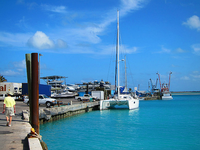
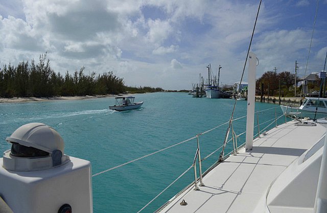
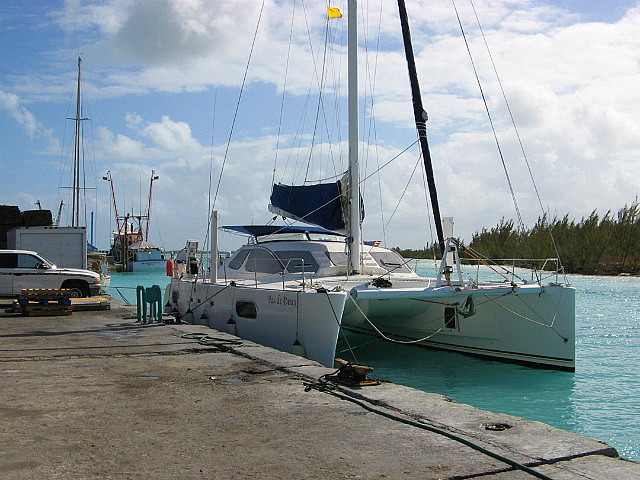
At 0900 Wednesday morning, November 14, we raised anchor and moved the short distance into Spanish Wells, docking at the Government Dock right in front of the Customs Office. Donna and Dave cleared the boat and crew into customs with no problems and afterward Bob and Wally went exploring ashore. We stayed on the dock several hours and even washed the salt off the boat windows with fresh water. Then on went the sunshades. It was warm and humid and we finally felt like we were in the islands. We left the dock and moved back out into the bay to anchor off the small settlement of The Bluff. A dinghy trip ashore and short walk around the “quiet” settlement allowed us to work up an appetite for grilled pork tenderloin back on the boat.
Notes to cruisers: If passaging in the fall off shore from the US north of Charleston, SC to the Bahamas, do not rely on landing in the popular and shortest destination of the Abacos (or Harbour Island) due to the unreliability of sea conditions in the entry cuts. On both of our passages to the Bahamas (2009 and 2012), entry through the Abacos cuts would have been unsafe. An American woman's life was lost there in November 2010. Spanish Wells offers a very reliable destination and is an official point of entry. The North Eleuthera airport is nearby for departing crew members.
If not headed for the local marina, you would dock at the Spanish Wells government dock to clear customs. Entry into the harbor, while narrow, is straightforward. The dock is industrial and very dirty. We learned after the first time to put a wet towel on the deck to prevent black footprints from getting all over the boat after being on the dock.
Other Entries
-
Aug 2873 days prior Norfolk, United States
 -
Nov 081 day prior
Drayden, United States -
Nov 09
Little Creek, United States -
Nov 145 days later Spanish Wells, Bahamas
 -
Nov 167 days later
Eleuthera, Bahamas -
Nov 2819 days later
Little San Salvador Island (Half Moon Cay), Bahamas -
Dec 0324 days later
Cat Island, Bahamas -
Dec 1536 days later
Long Island, Bahamas -
Dec 2849 days later
Acklins Island, Bahamas -
Feb 0689 days later
Samana Cay, Bahamas -
Feb 1295 days later
San Salvador, Bahamas -
Feb 18101 days later
Conception Island, Bahamas -
Feb 25108 days later
Rock Sound, Bahamas -
May 13185 days later
Marsh Harbour, Bahamas -
May 19191 days later
Norfolk, United States -
Dec 24775 days later
Drayden, United States -
Dec 151497 days later
Abraham’s Bay, Bahamas -
Jan 251538 days later
Great Exuma, Bahamas -
Feb 101554 days later
Sampson Cay, Bahamas -
Feb 271571 days later
Andros, Bahamas -
Mar 121584 days later
Marsh Harbour, Bahamas


2025-05-23