 Dawson Creek, British Columbia, Canada
Dawson Creek
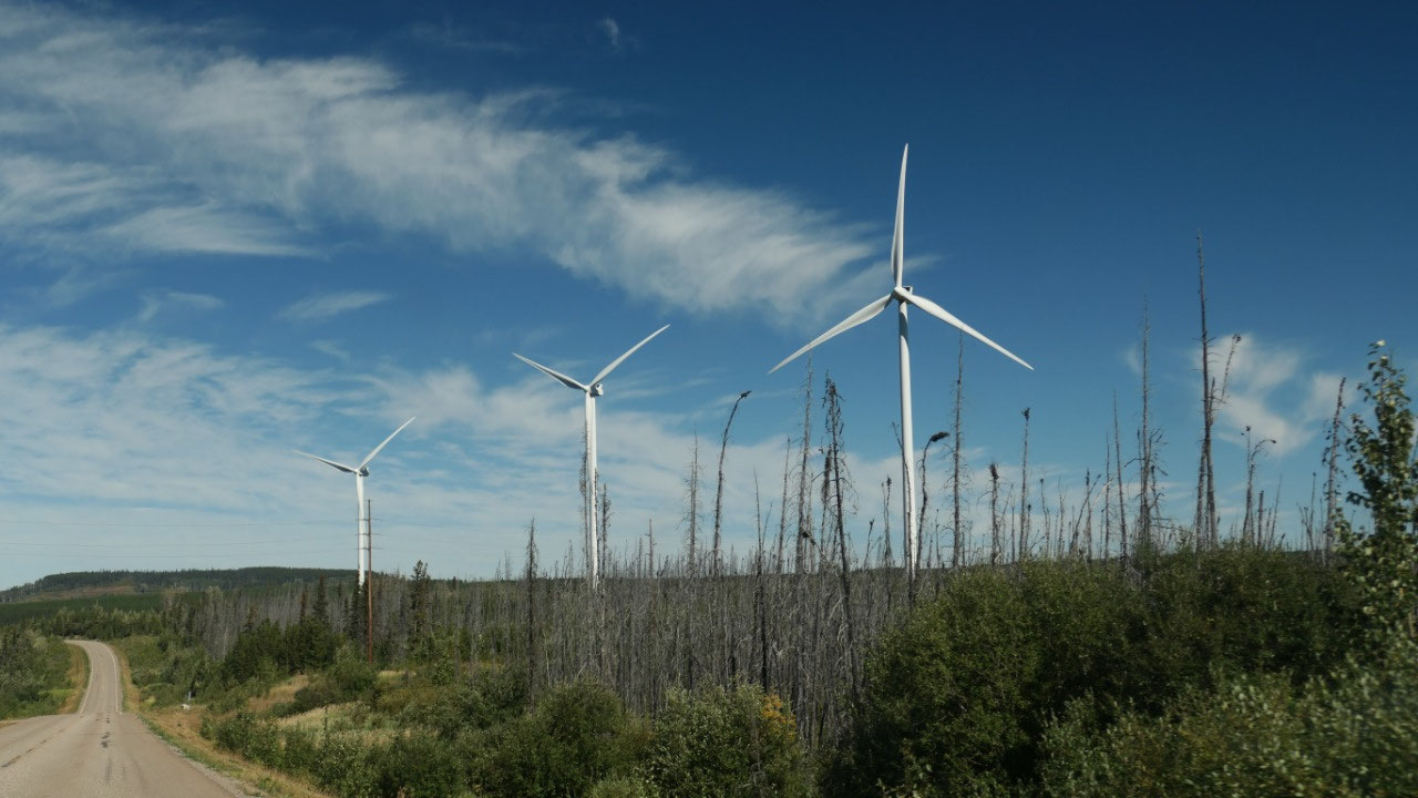
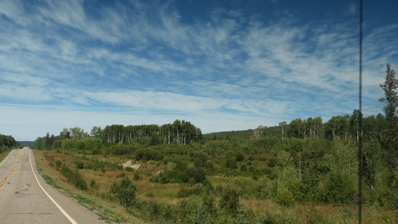
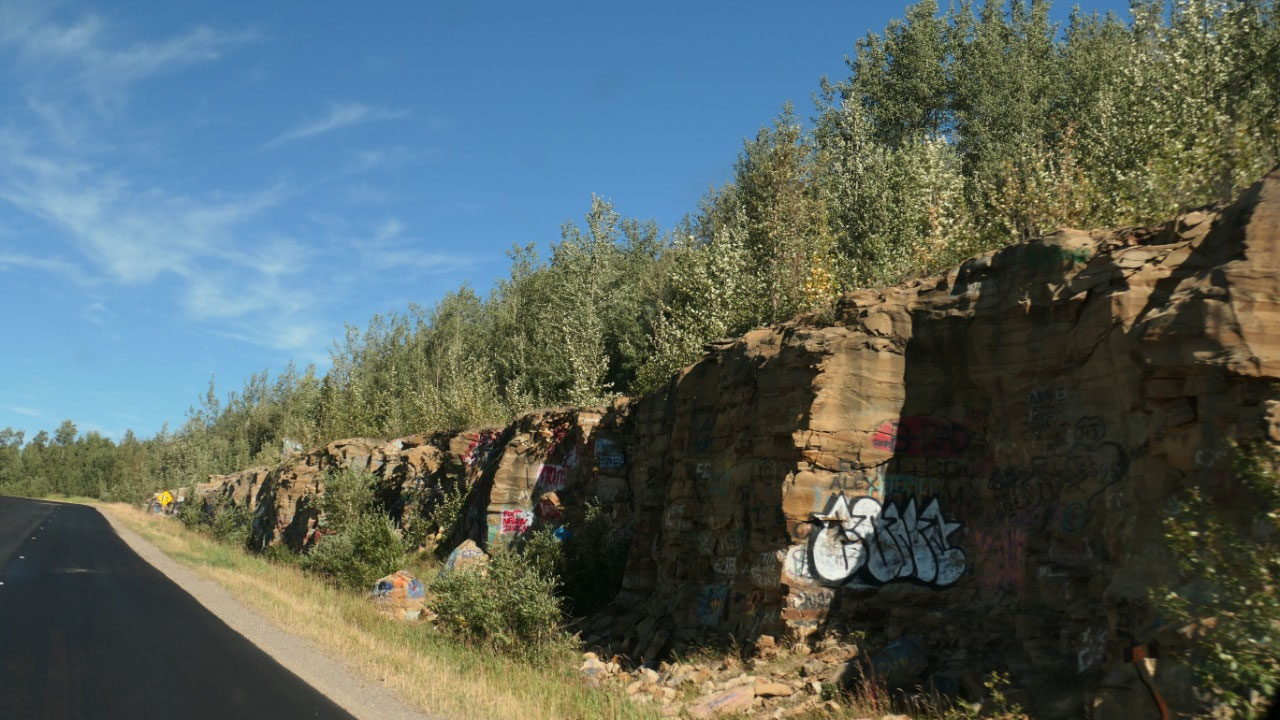
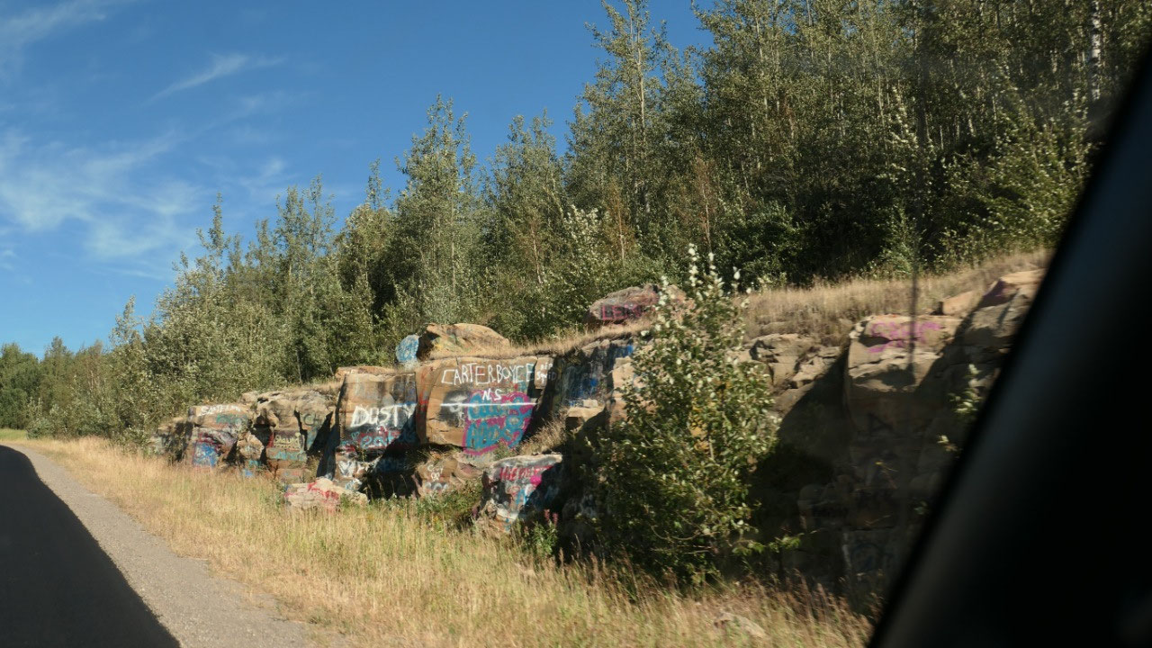
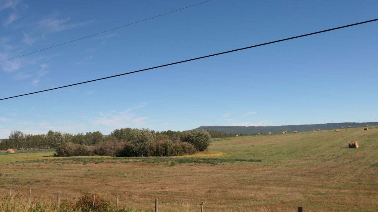
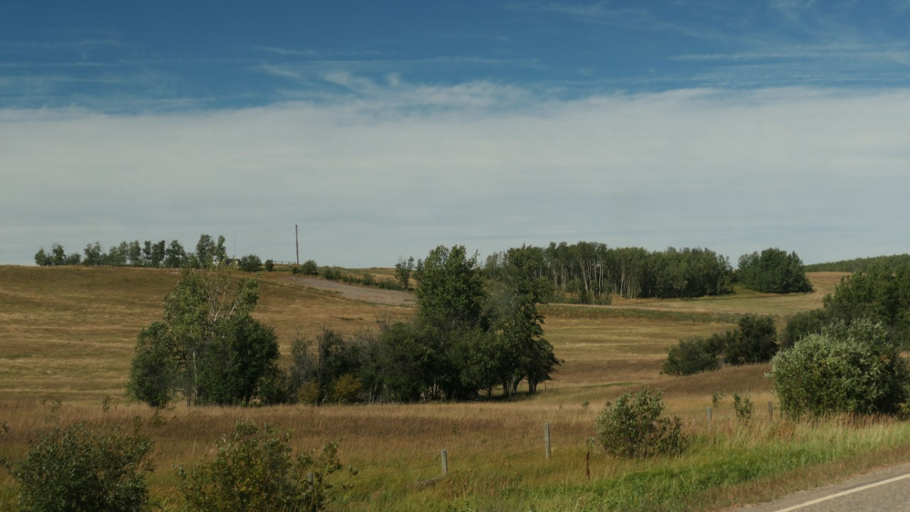
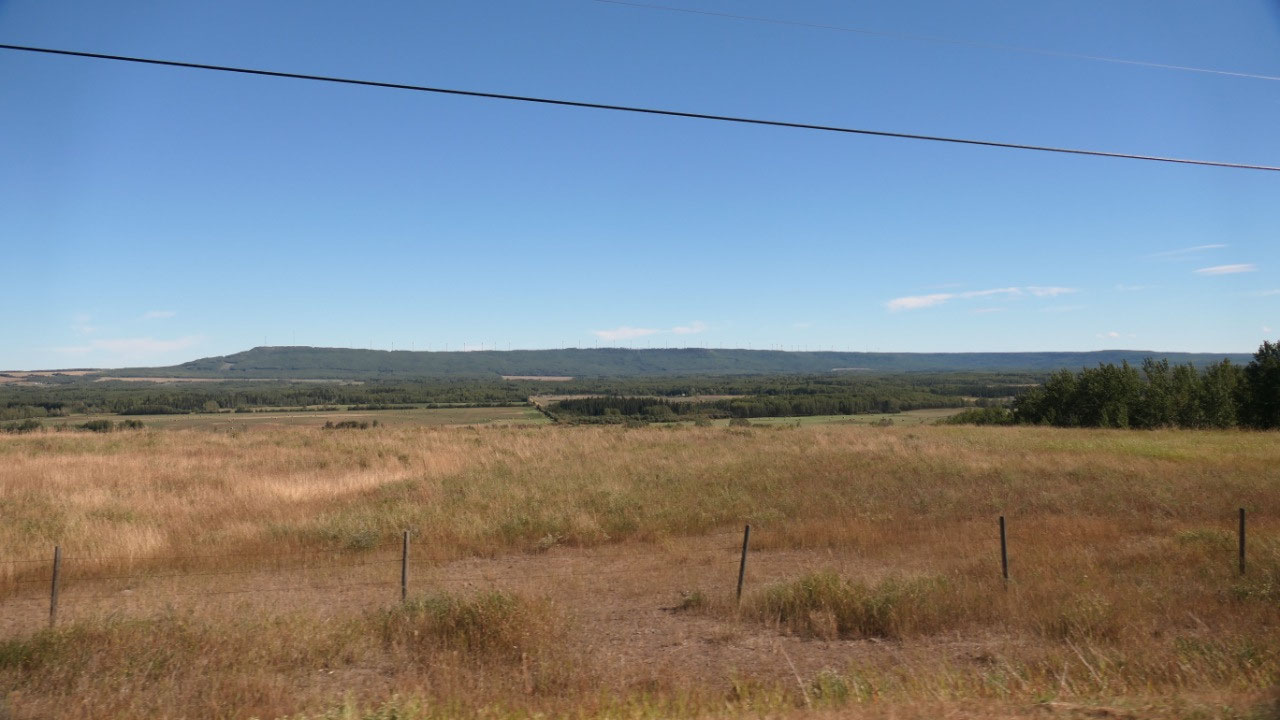
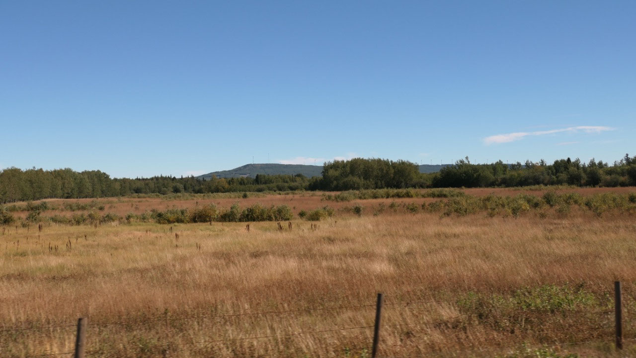
On the road through windmills
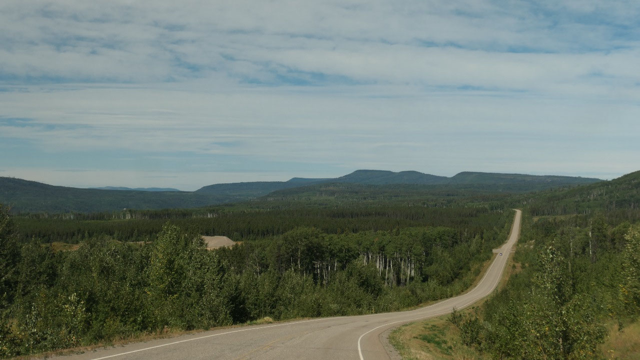
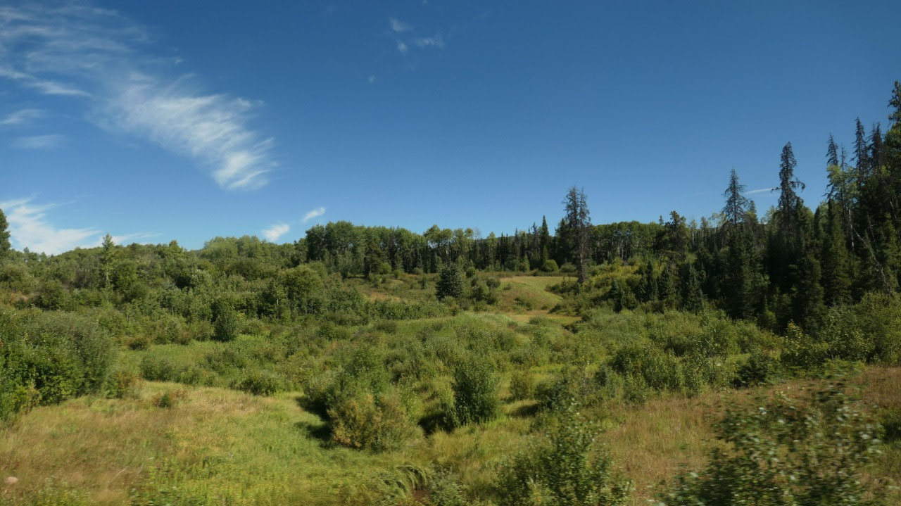
We then continued on and decided not
to stop anymore as it is super hot and we were hoping for a nice spot to relax
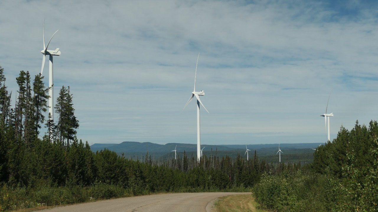
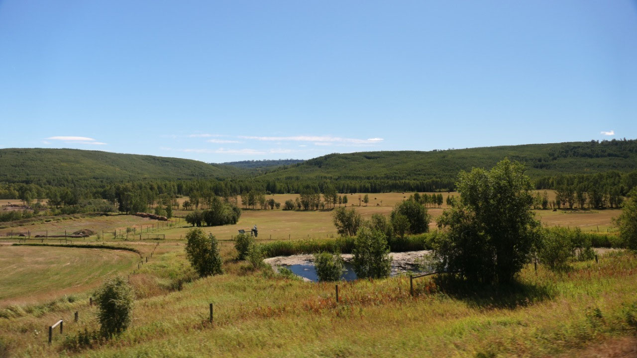
near Dawson Creek. As we drove we came by a lot of windmills – which was kind
of nice to see, especially since there were lots as we drove further along –
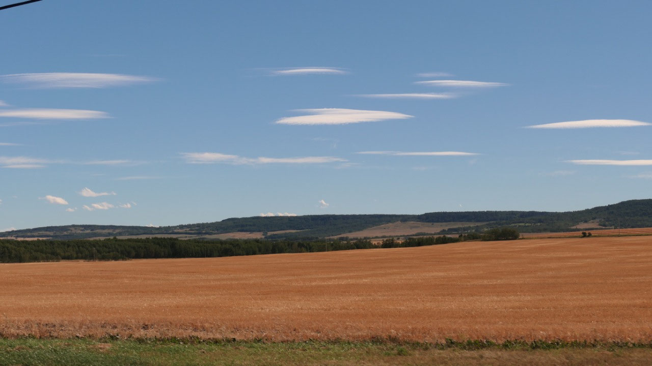
they were all on top of the Heritage Highway summit. Then we went down towards
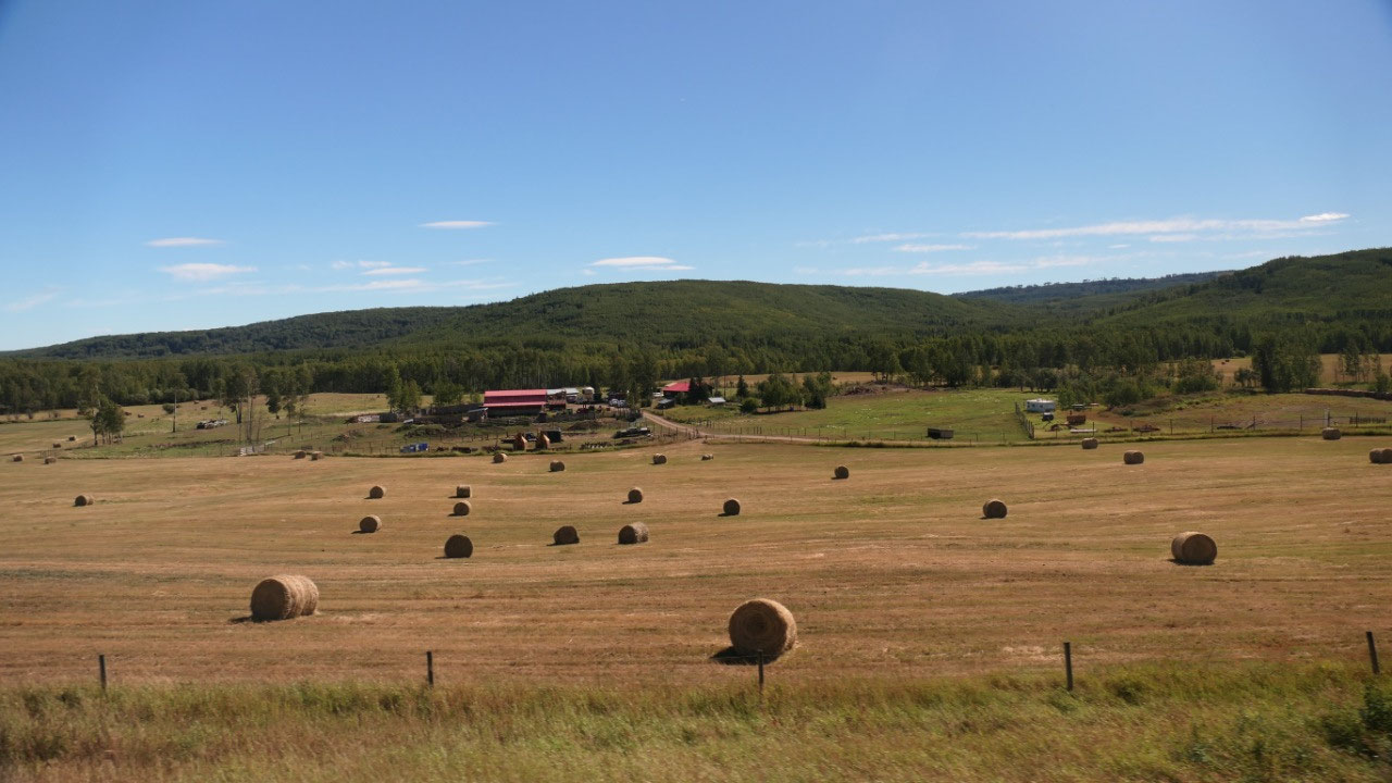
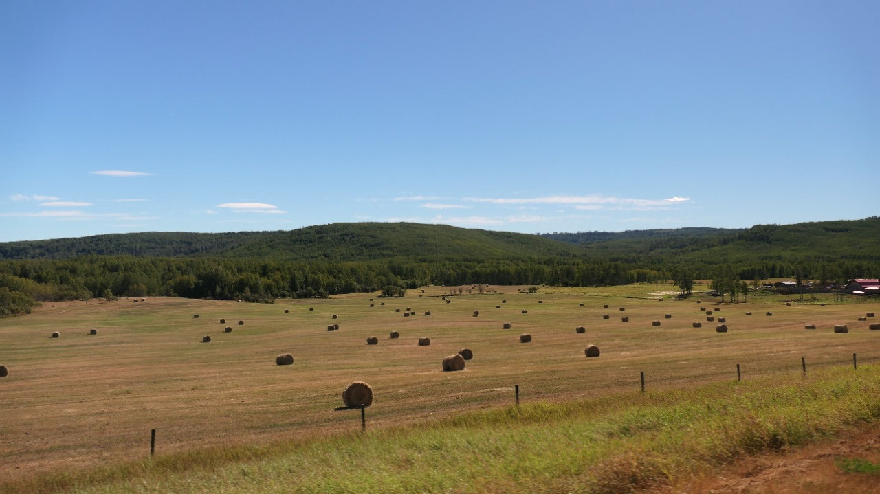
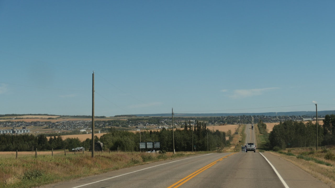
Dawson Creek and we entered Farm land… wow!!
Checking our engine light in Dawson
Creek
Our first stop in Dawson Creek was to
check what is wrong with our most important thing we brought along: our truck.
We saw along the road the Elite Auto shop and the guy was super nice and
checked it all out and re-set it, gave Paul a card with the code and what it is
as well told him what it could be – and now we hope that the code doesn’t come
back. We also went to a pharmacy here to fill Paul’s prescription – now we can
come back at 4 pm.
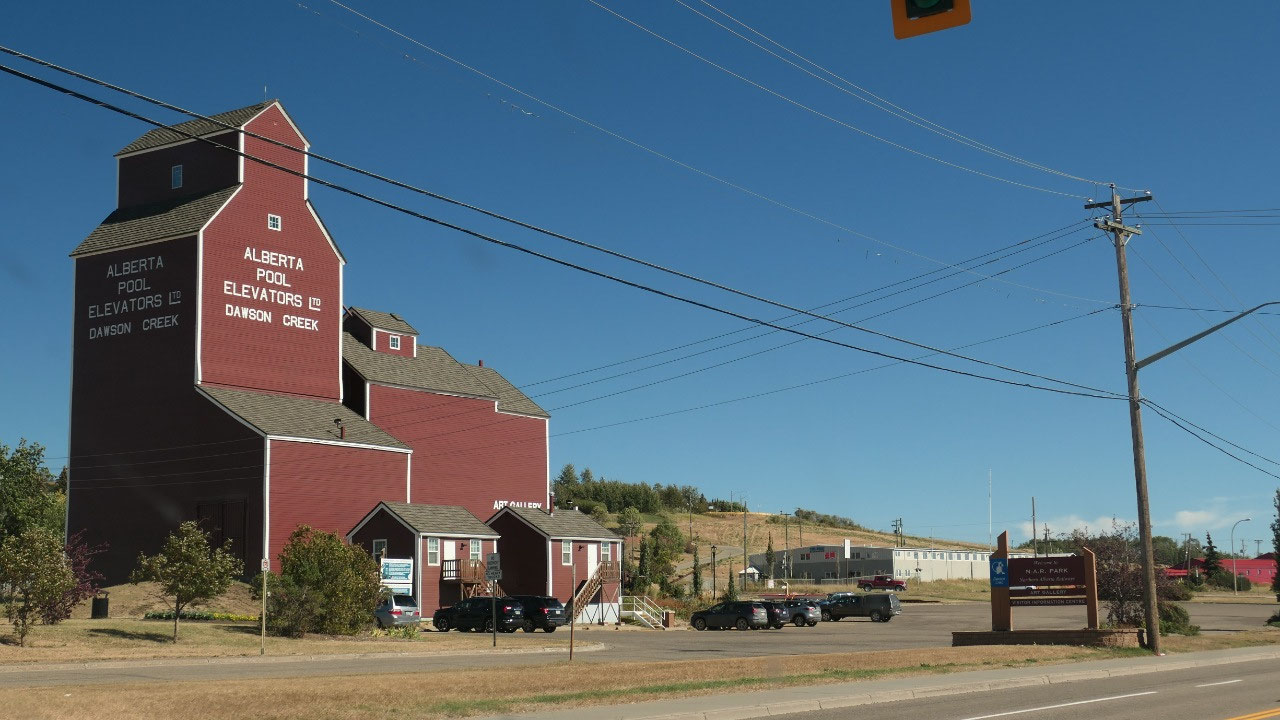
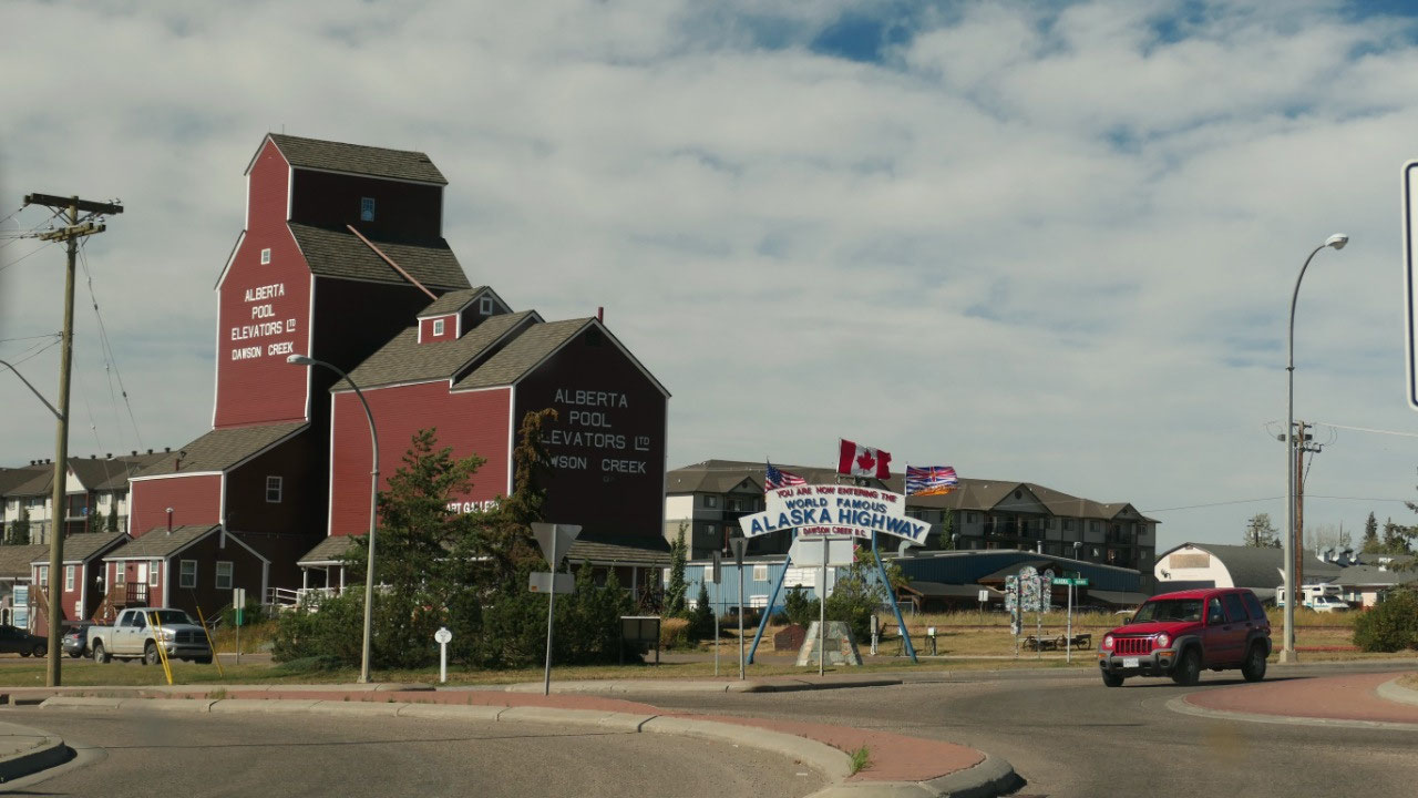
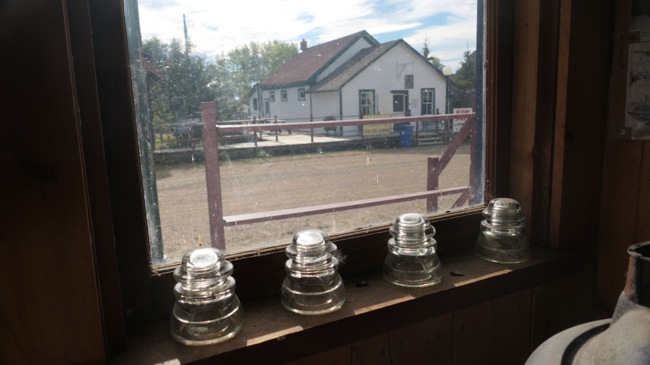
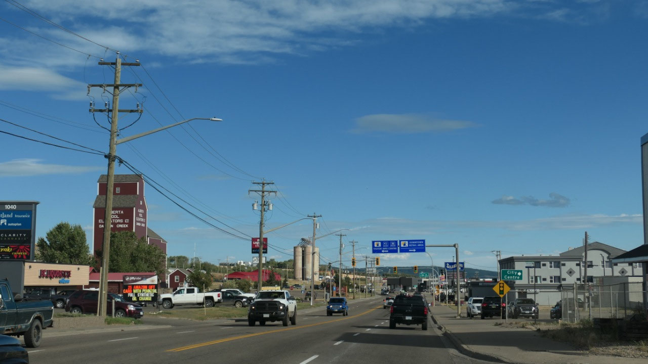
Visitor info near the grain elevator
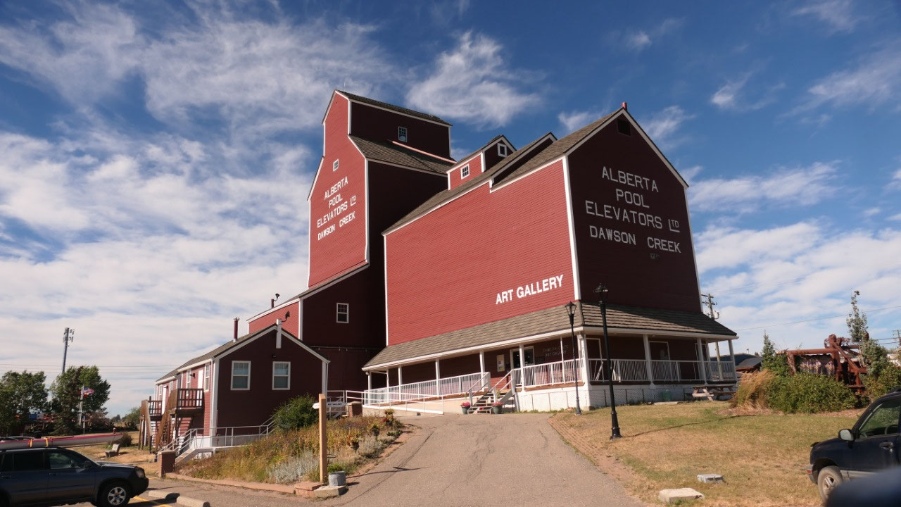
Next stop is at the Visitor info,
where Paul complained es they didn’t have a parking in front of the info center
– but it was in front of one of those super cool grain elevators – which we
like so much, so we could admire that one too.
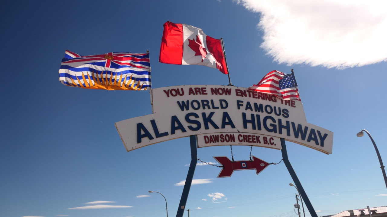
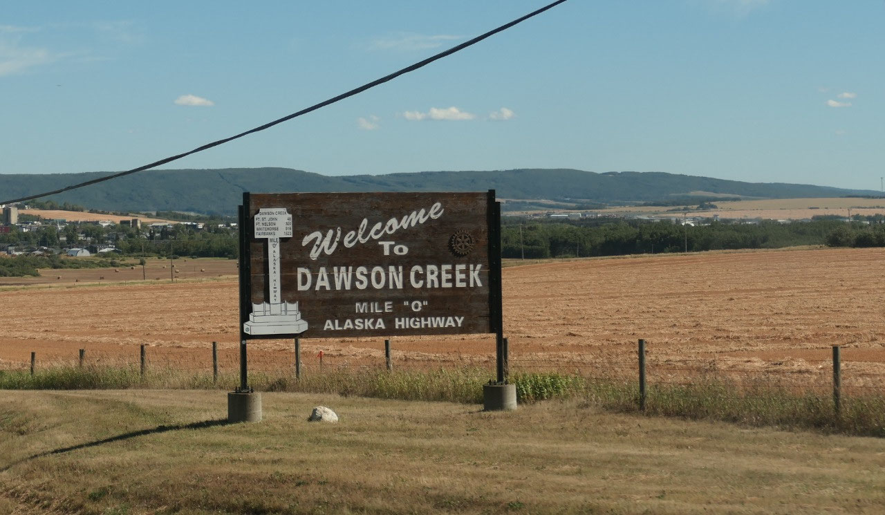
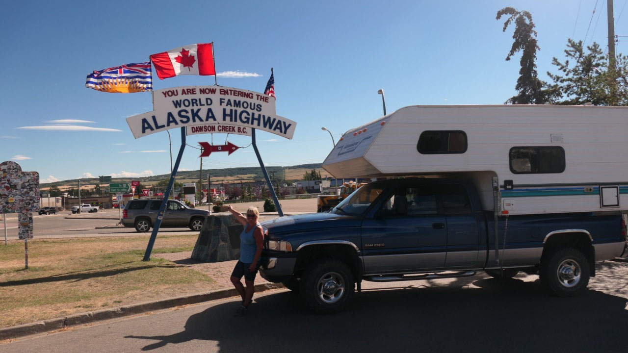
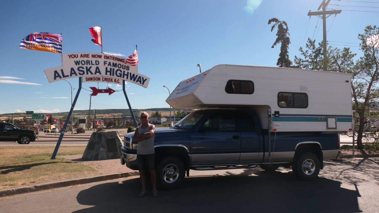
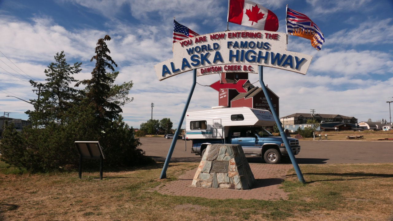
And let’s not forget before leaving we
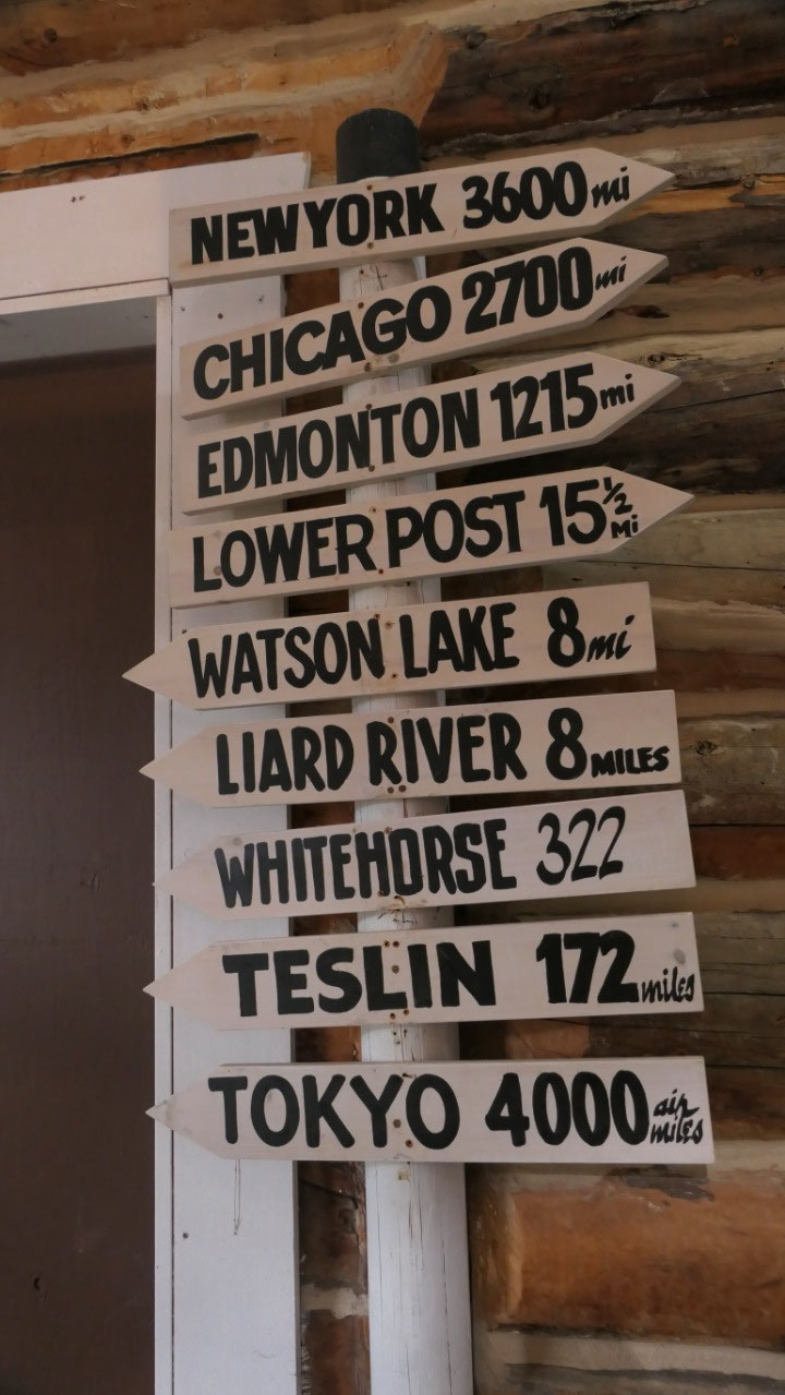
had to park our truck near the sign “Welcome to the Alaskan Highway”
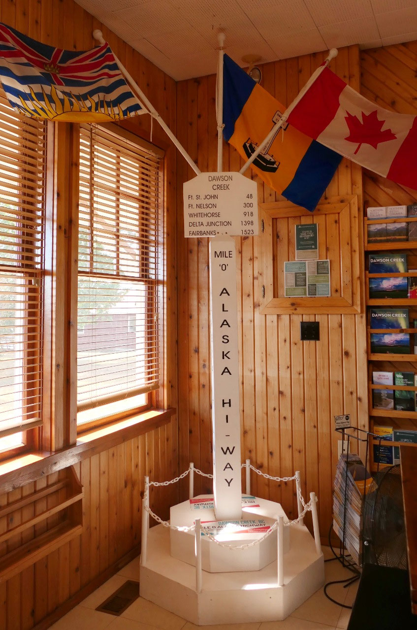
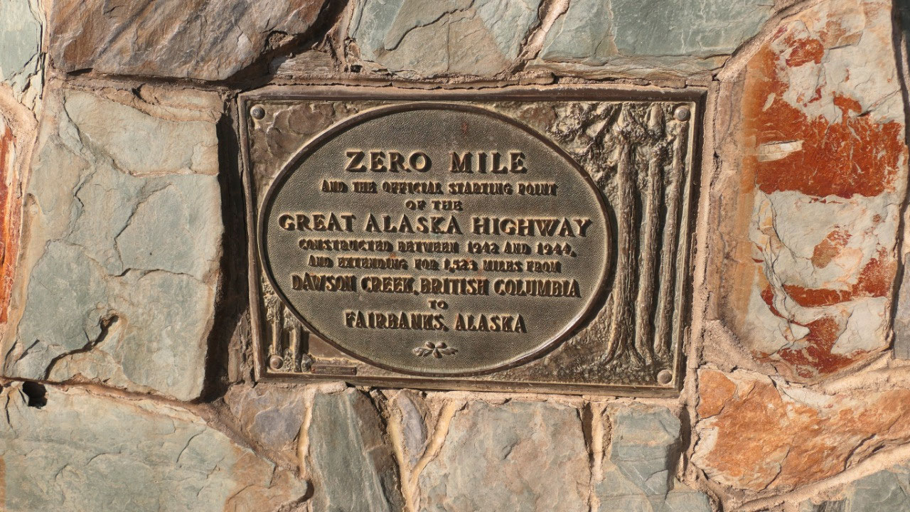
- It was on this spot where they surveyors placed the transit as they plotted the route the highway would take – the Alaskan Highway is measured from this spot
- “Standing there is such surreal. You cannot help but think of those who came before”
- In the middle of the traffic circle where the Alaskan highway starts is the Surveyor statue which points northwest along the path
The town at Mile 0 – Dawson Creek:
- 1879 during the search for a railroad route through the rockies Dr. George Mercer Dawson led a survey through this valley
- 1898 was the start when fur traders, prospectors, survey parties
- 1912 the Canadian government was issuing homestead grants to settlers
- 1929 the railroad came through here, the railway and the grain elevators attracted more settlers
- 1931 the town buildings were moved to what is today Dawson Creek
- 1939 a small wave of refugees from the Sudetenland (northern czecheslovakia) settled in the area
- 1942 here they started the overland route to Alaska – making Dawson Creek Mile 0: here is the official starting point of the Alcan
There is no park to cool down here
Ok as per the lady in the visitor info
the best and only park to cool down and relax is the Rotary club Splash park –
so we went there and were super disappointed as this was a small spot, no real
nice place to relax as it was only the splash park for kids and benches for the
Moms around. Time for coffee and then Gine said let’s check out:
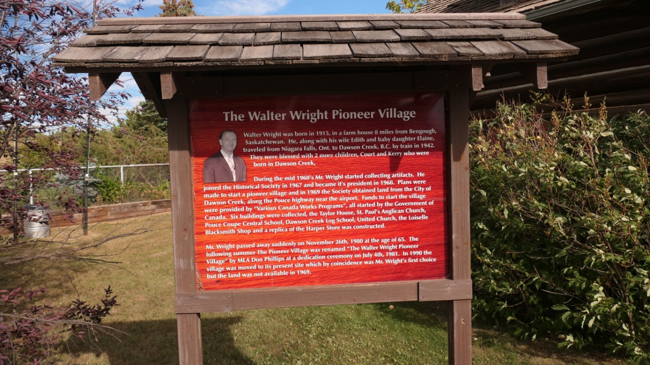
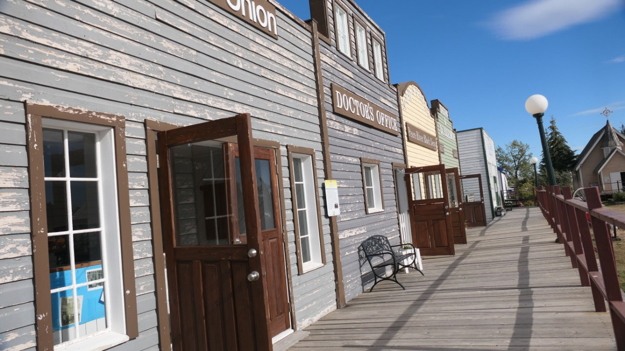
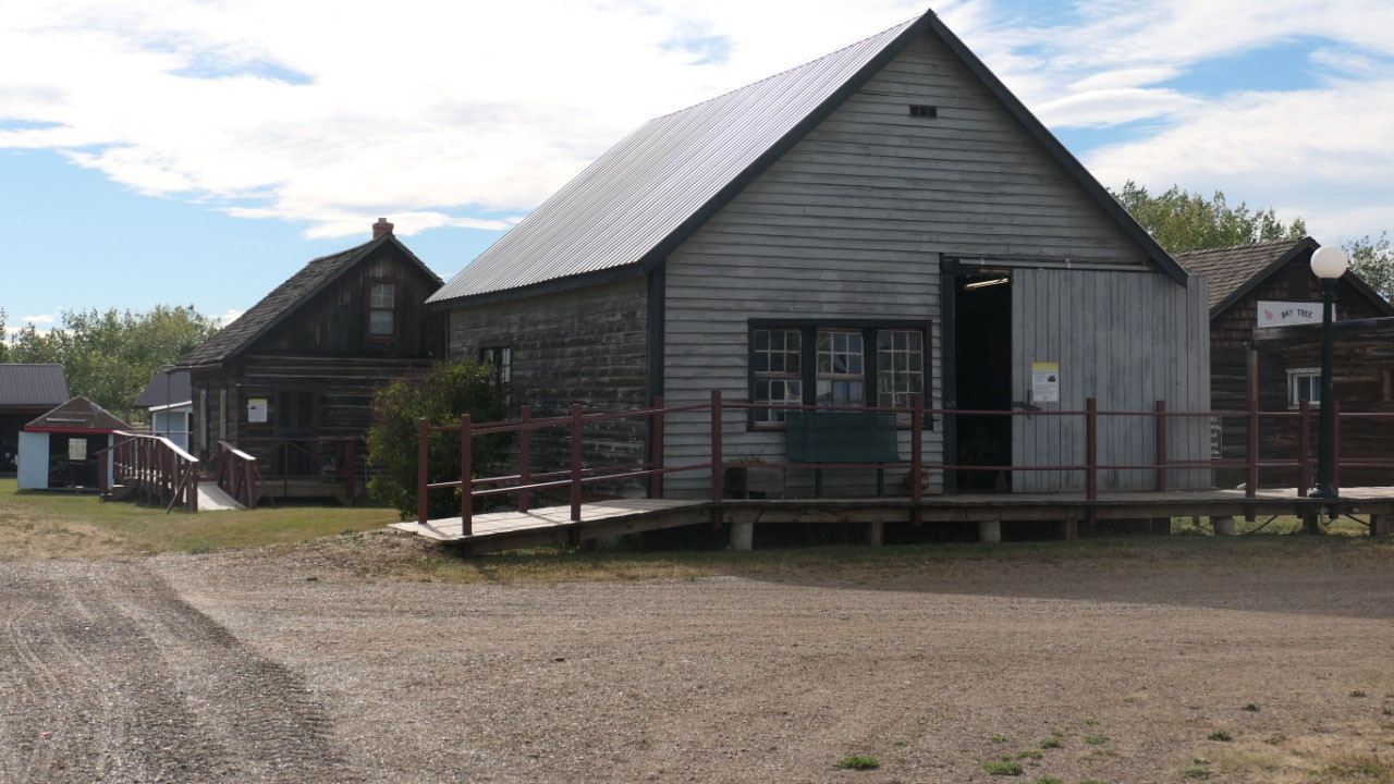
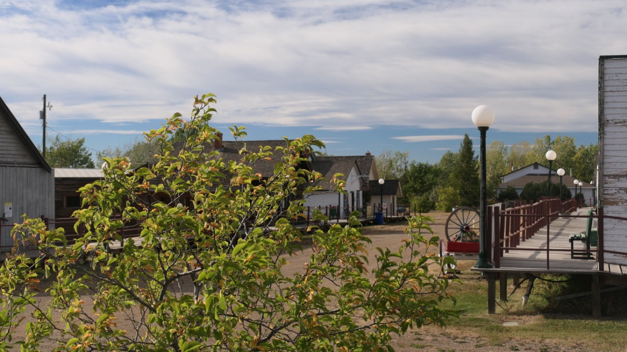
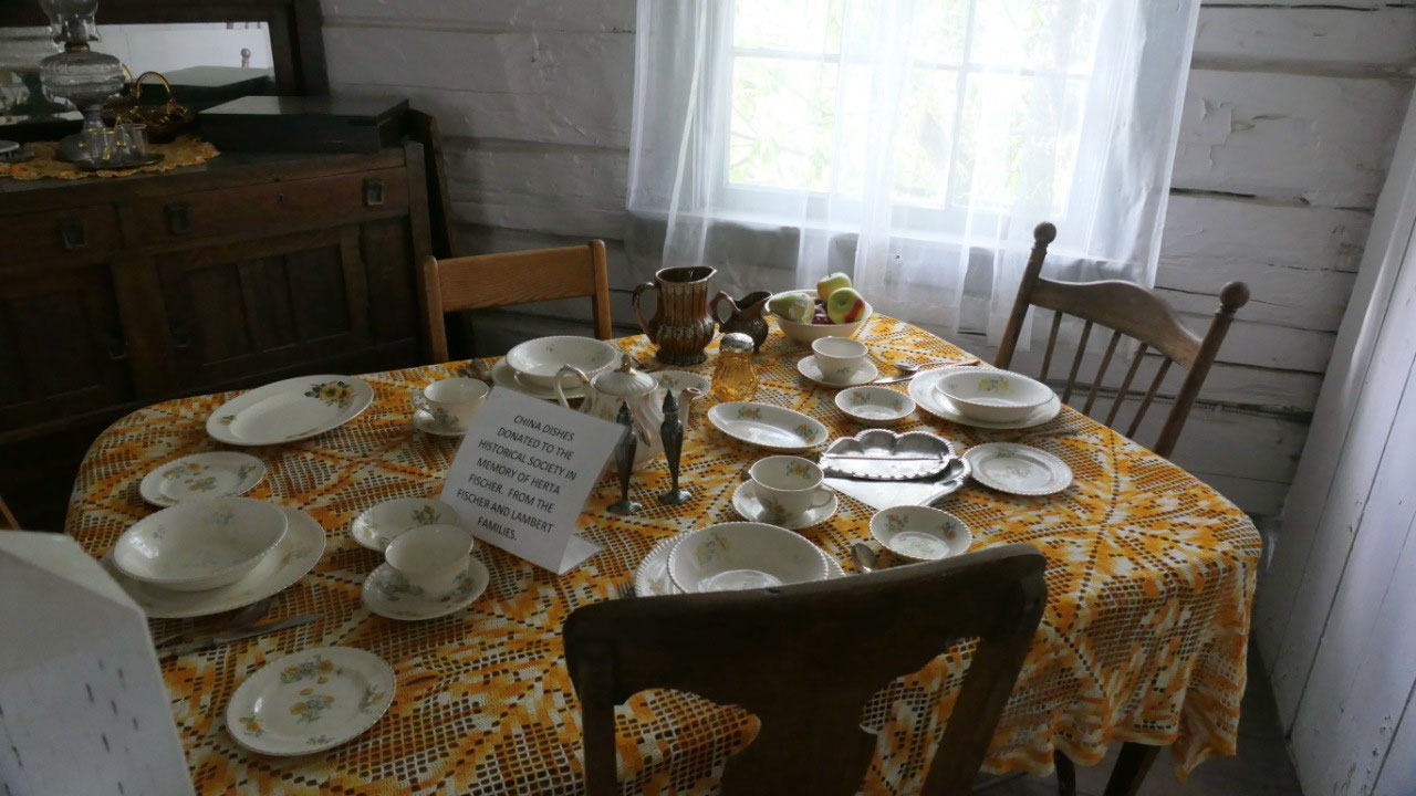
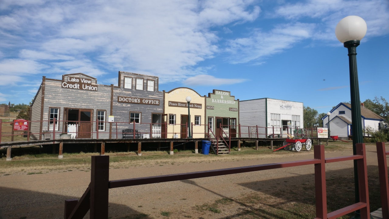
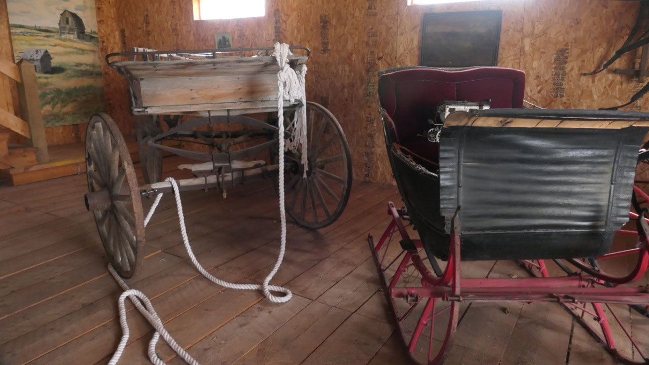
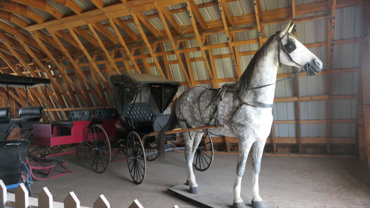
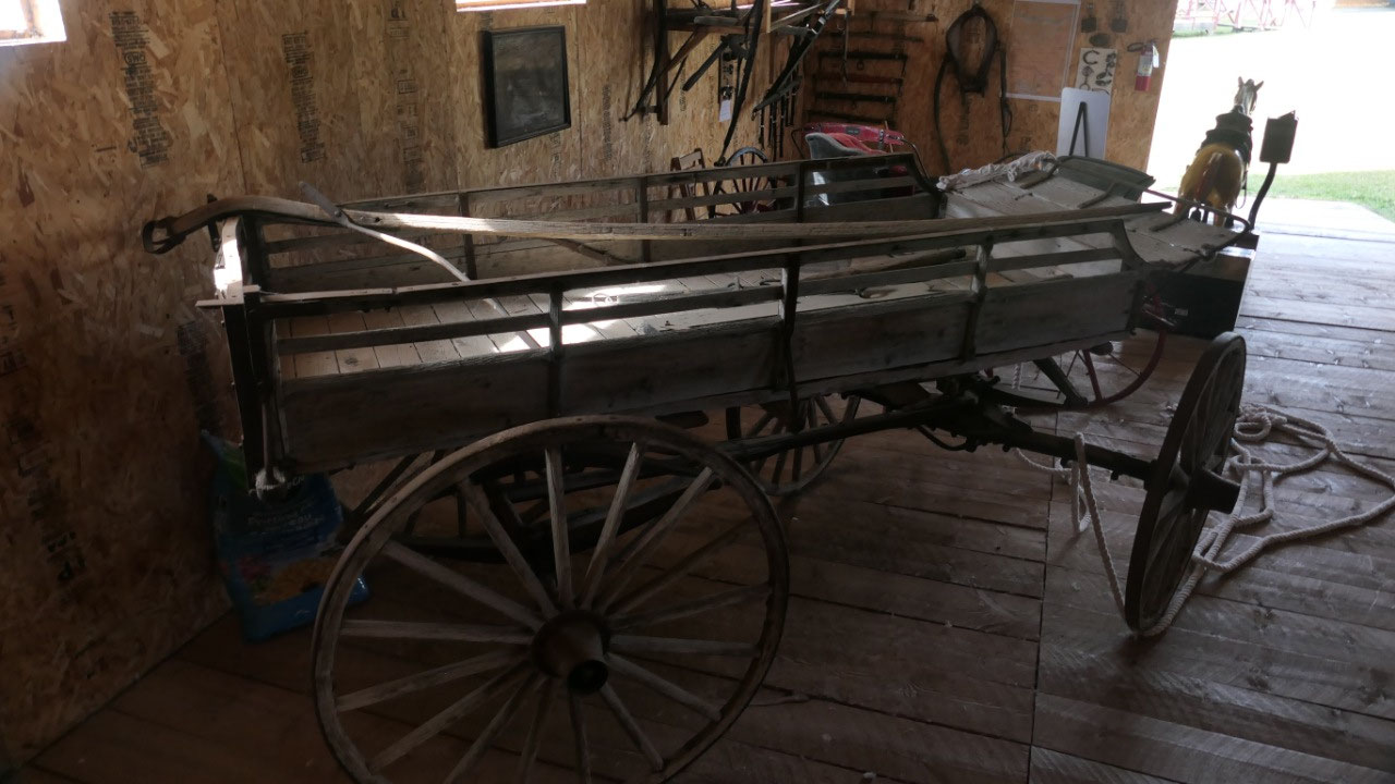
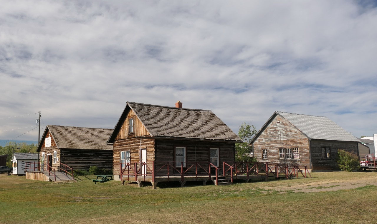
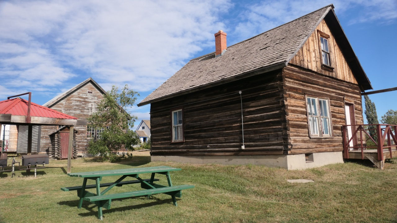
The Walter Wright Pioneer Village
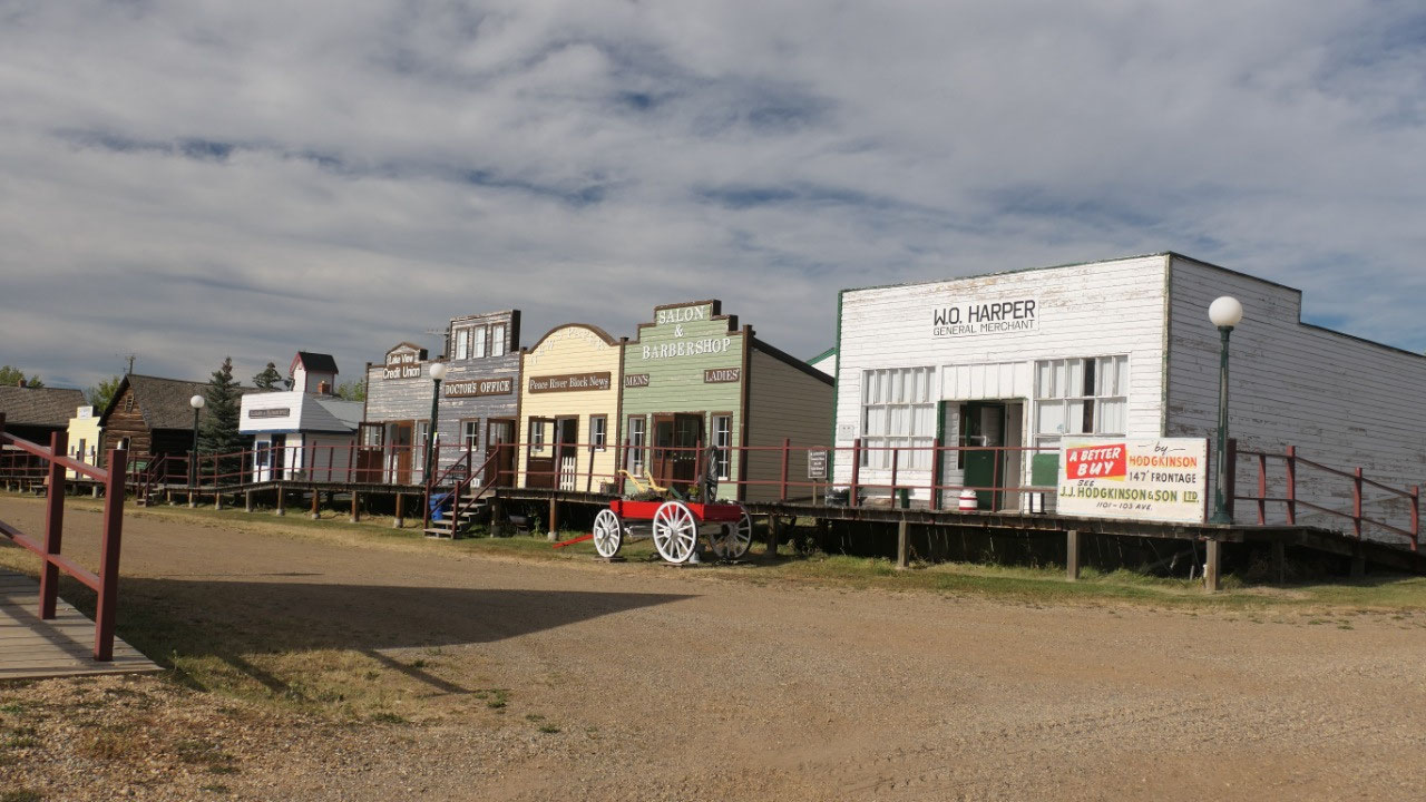
Now this is a bit complicated, as
there is the big parking lot and the sign and then there is a house right at
the “entrance” area saying “Mile 0 campground office” as I didn’t needed a
campground I started to walk around but it clearly must be there somewhere. So
after checking with the guy from the office, yes inside the Museum is the
Alaska Highway exhibit and the museum is free and the entrance is through the
campground office. So back to Paul for update and then Gine went back to visit
“old Dawson Creek” – as per Paul he saw enough of those old houses and pioneer
buildings, he doesn’t need to see more so he stayed in the camper enjoying
himself.
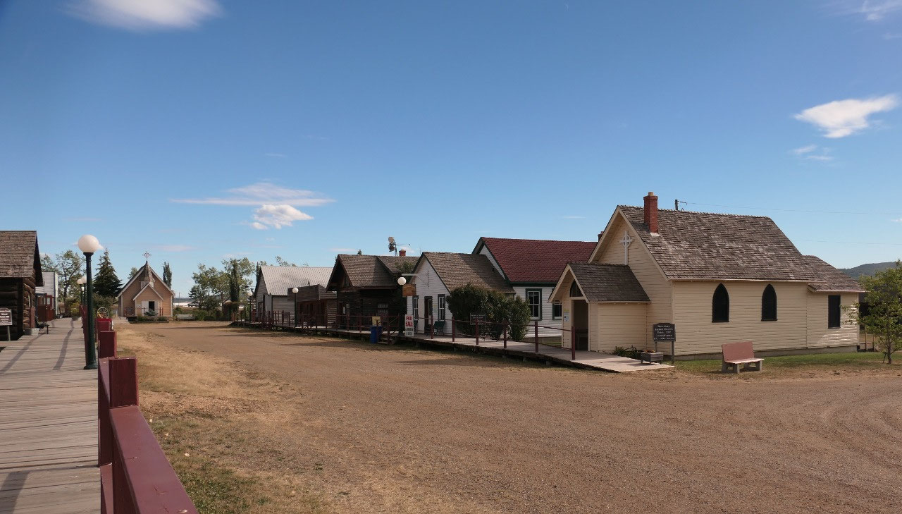
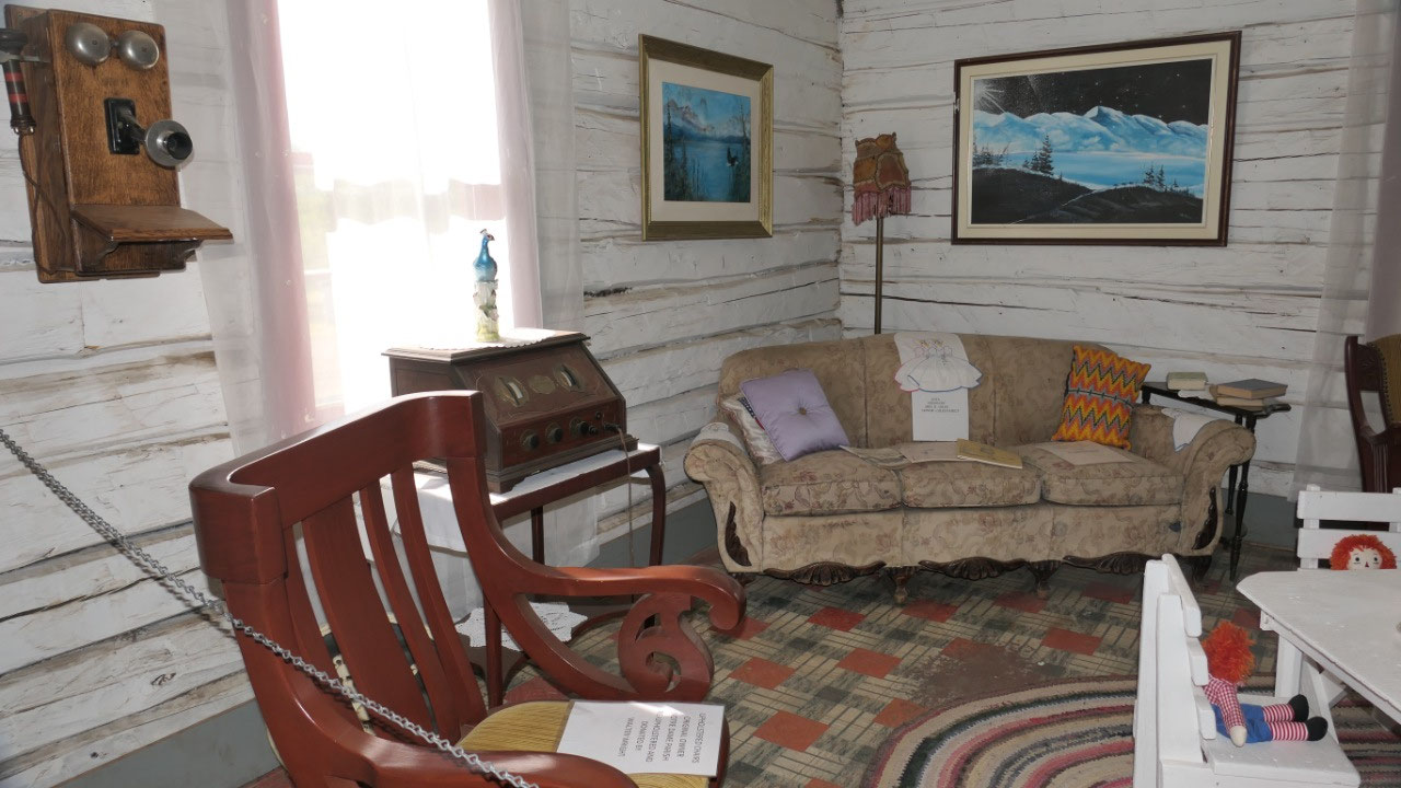
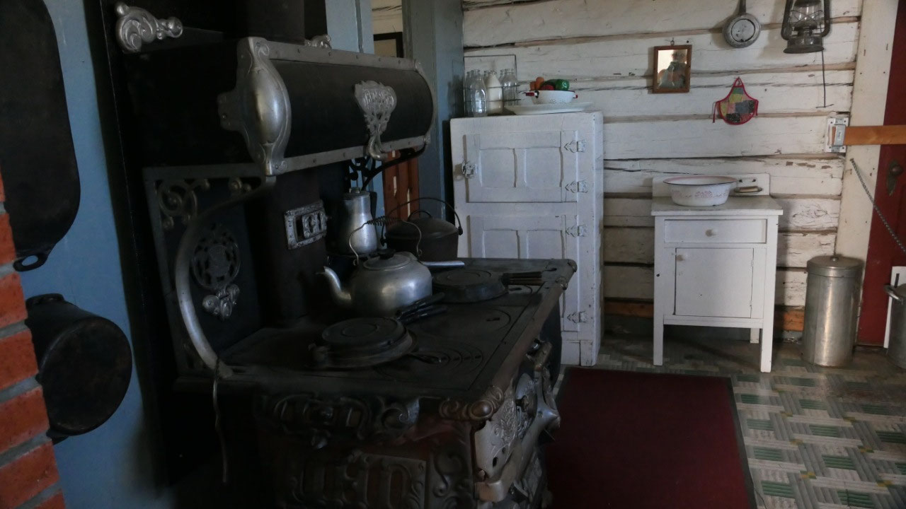
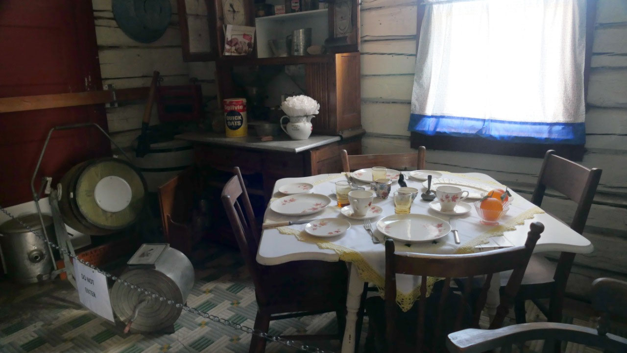
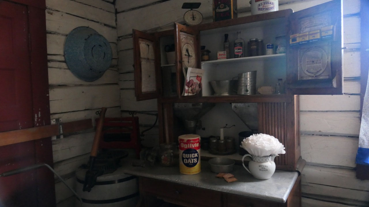
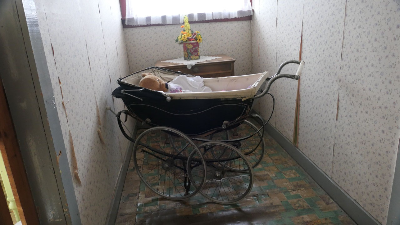
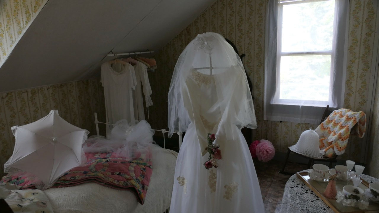
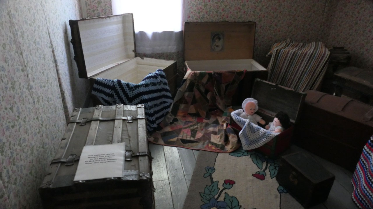
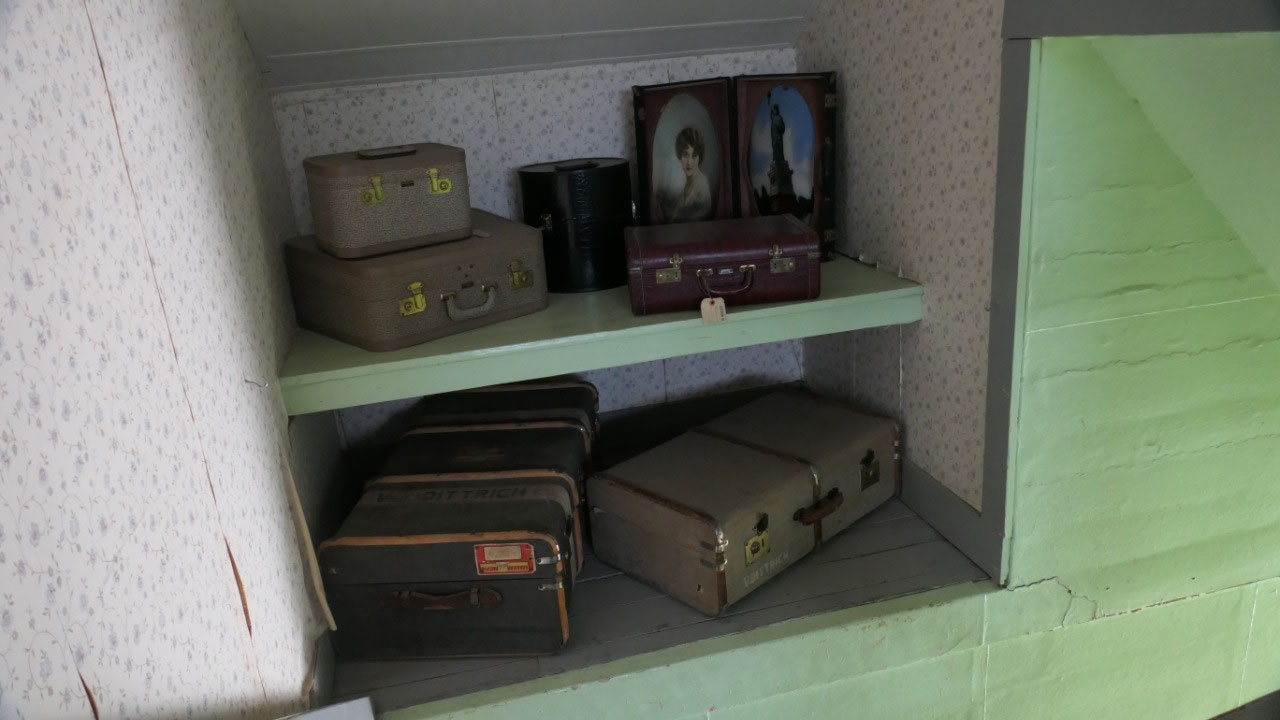
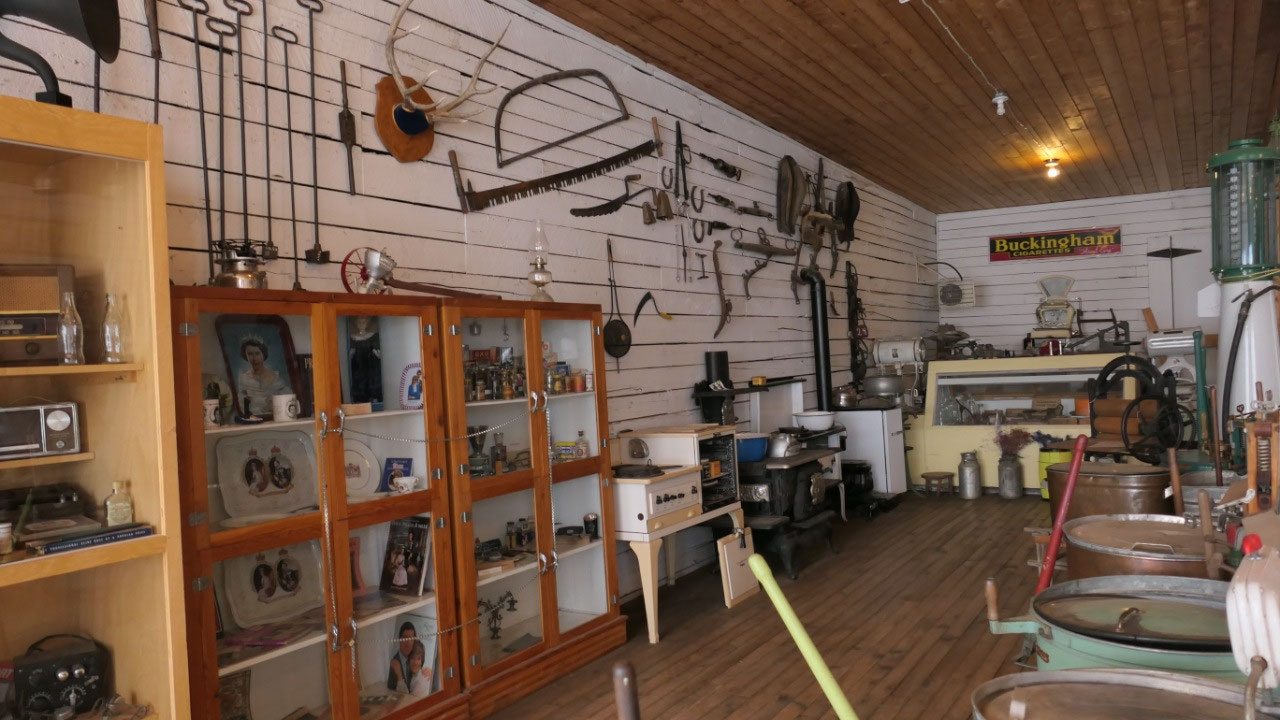
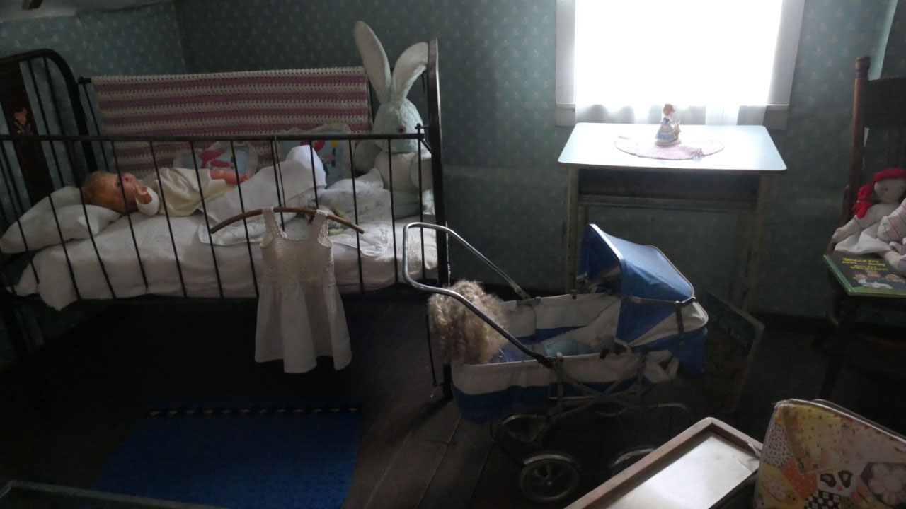
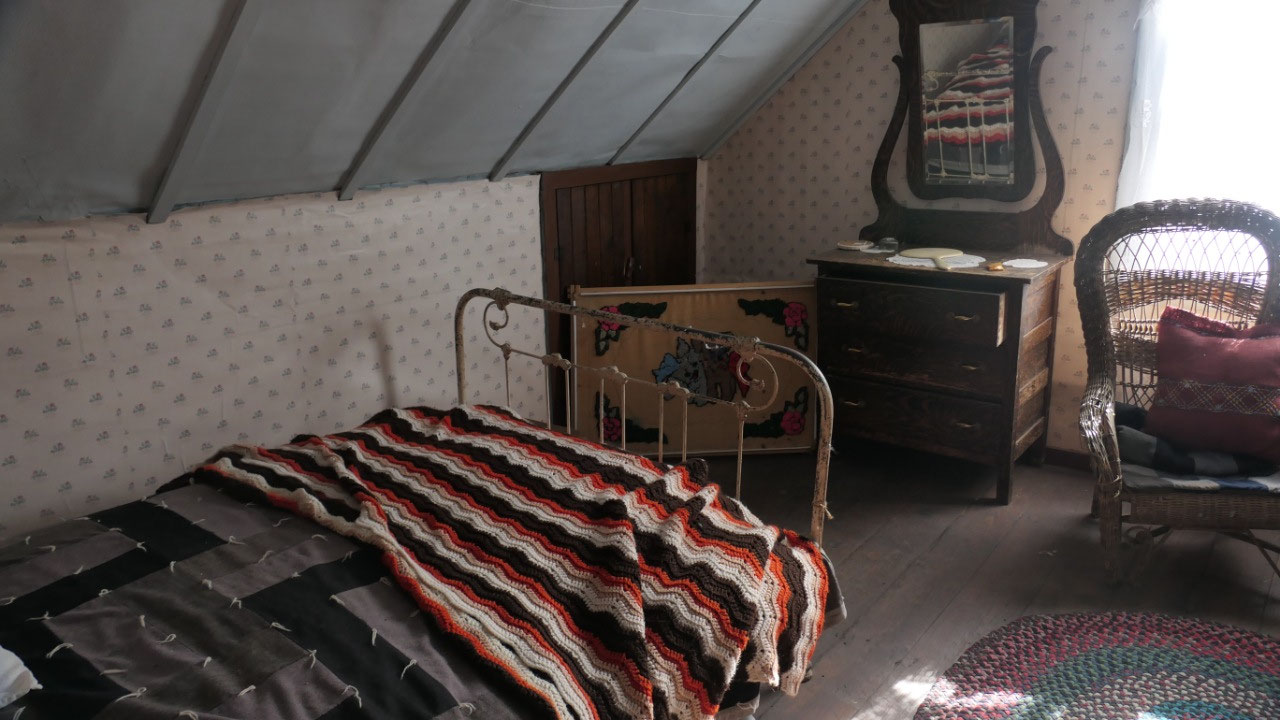
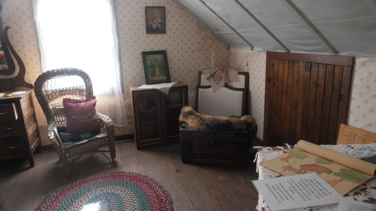
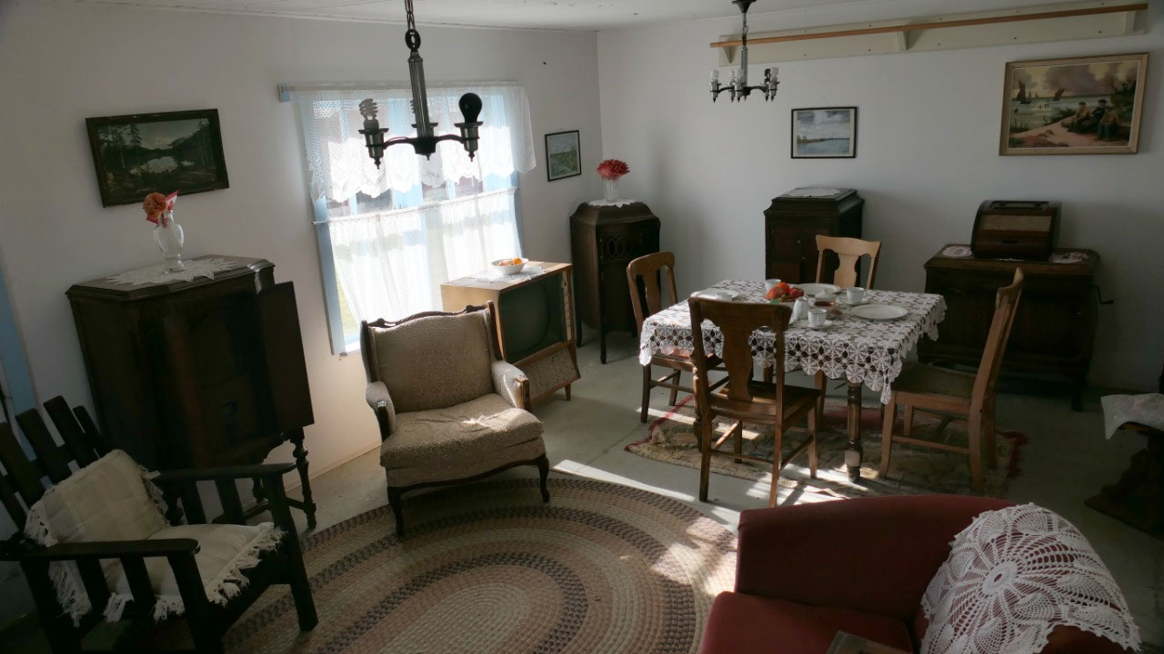
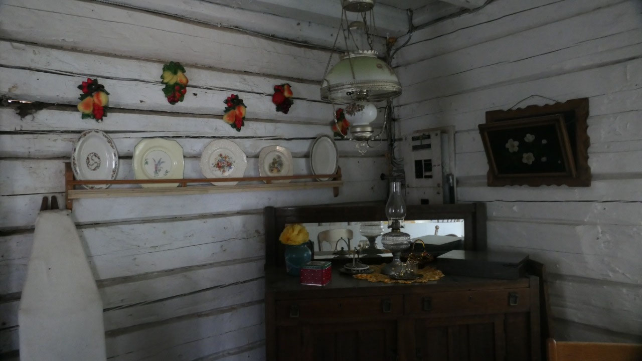
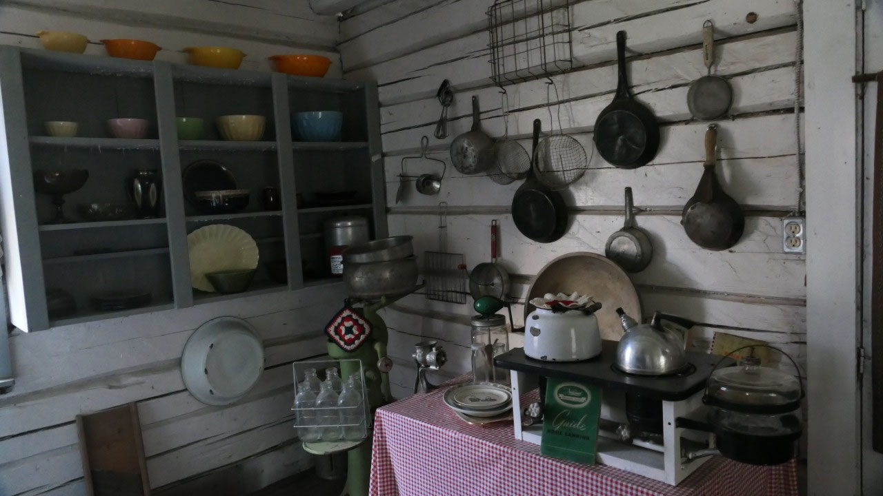
So what was all to discover here: it
was fun to walk along the street and on the board walks and peak inside the
different houses – schools – stores – churches they brought here and discover a
bit of the life in the old days here:
- Walter Wright a local of Dawson Creek hat the passion for the preservation of the area’s pioneer history and his dream got realized in 1970 when they formed the Walter Wright Pioneer Village: he started collecting artifacts in the 1960s – he was born in 1915 and passed away at the age of 65 in 1980
- Mr Wright was the first President of the south Peace Historical society and they built the street with pioneer buildings from 1912-1950 – with boardwalks and a main street to give it the charm to go with the buildings
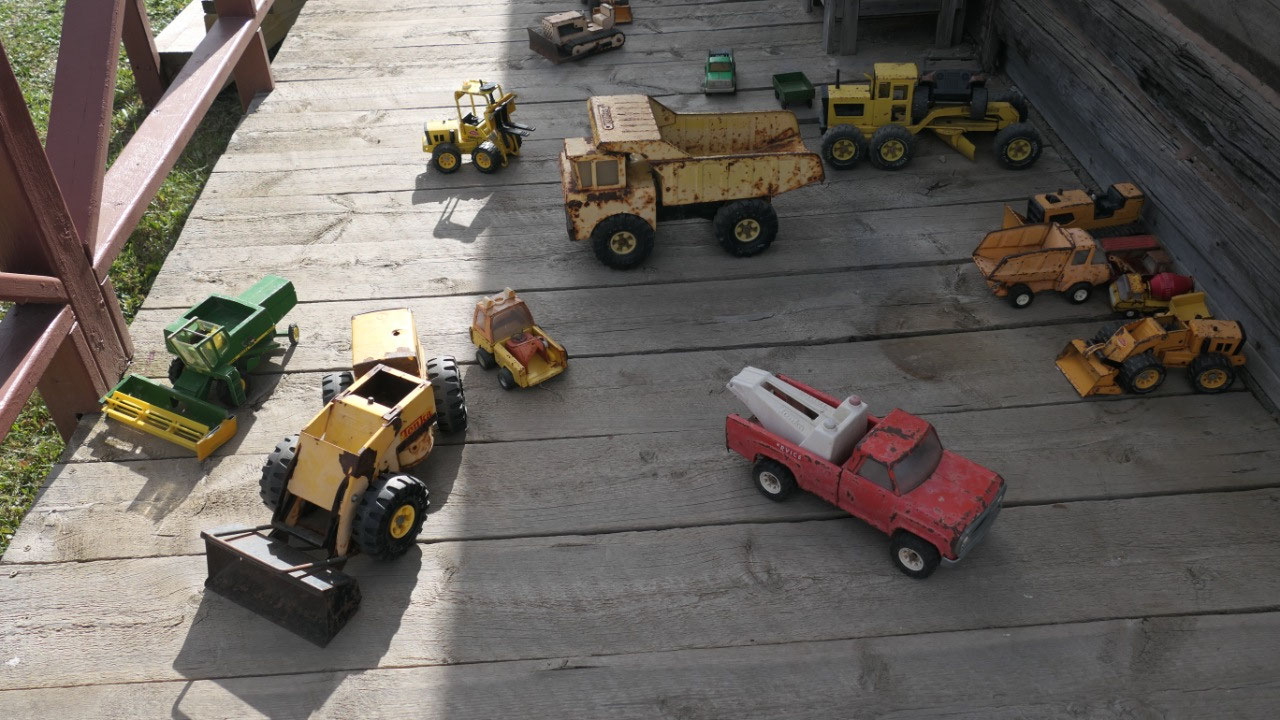
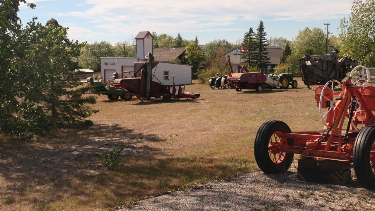
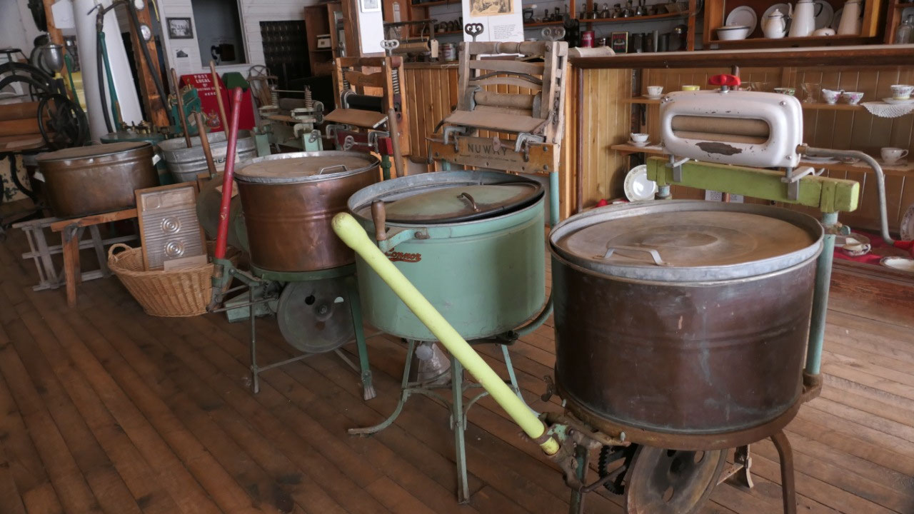
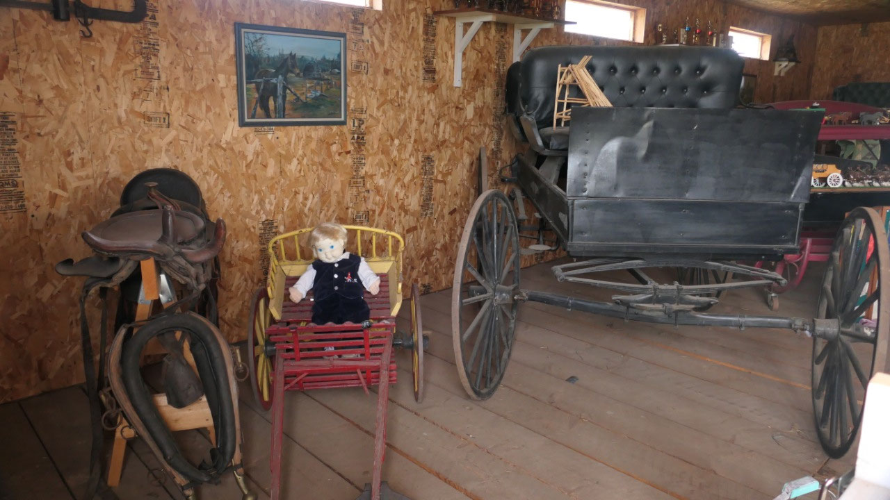
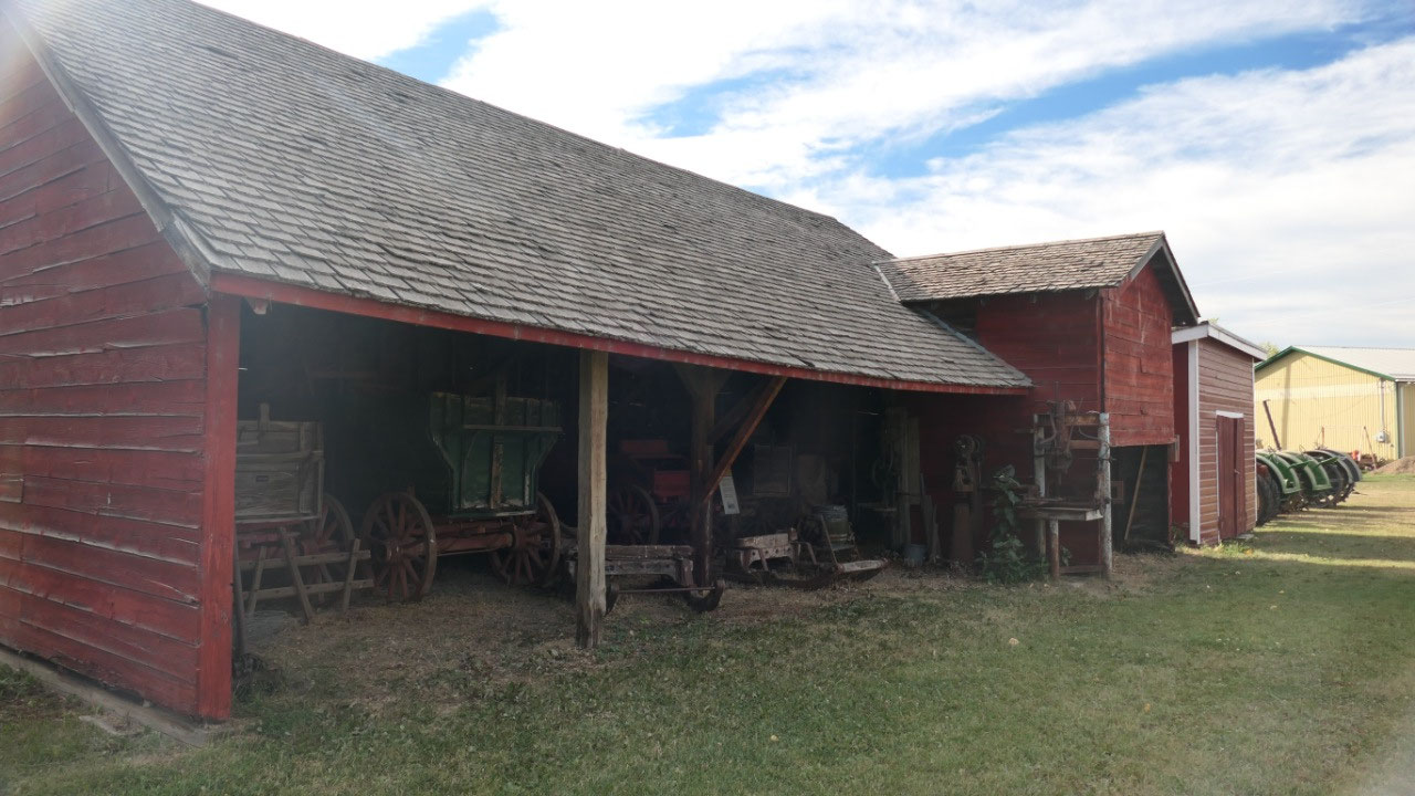
- They are all original buildings which got moved from the surrounding countryside – to complete the picture they collected donations of artifacts, vintage vehicles and farm machinery to tell the story of the area’s first settlers
- It opened official in 1992 as part of the Celebration of the 50th anniversary of the Alaskan Highway
- Dove tail joints: this is a technique so two pieces of wood fit together like pieces of a puzzle: a wedge shaped piece was cut out of each log and then the projections of one fitted into the recesses of the other
And what was all to see here and the
stories about the people – which is always very interesting, as I often wonder
why people came here.
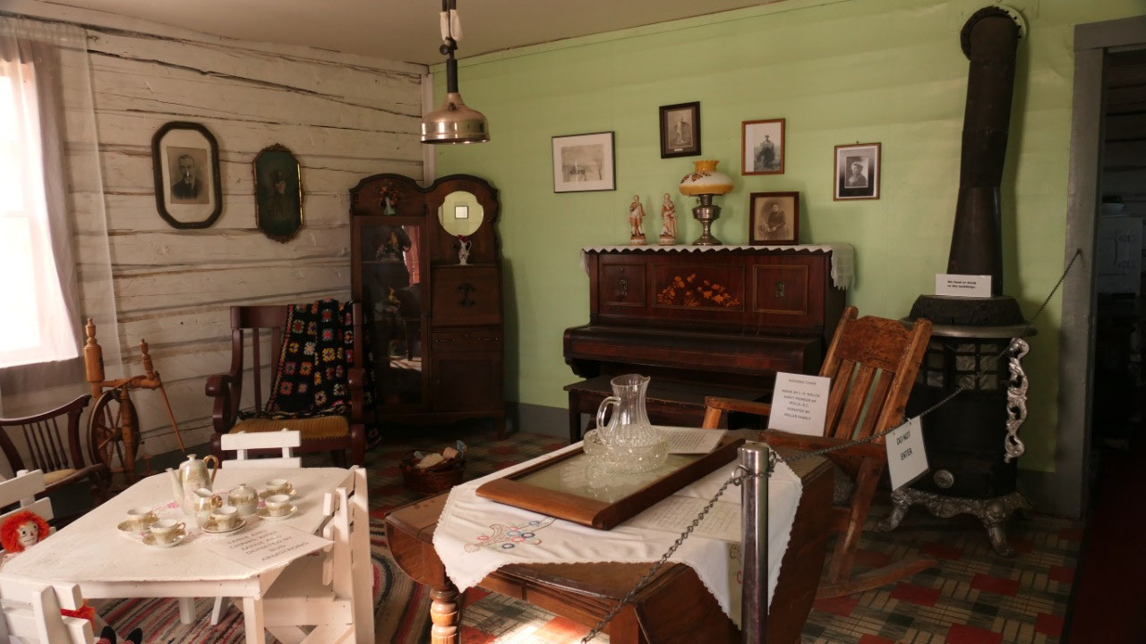
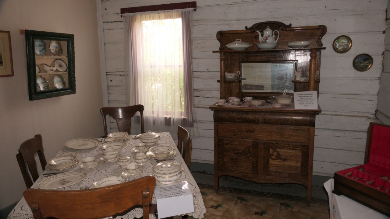
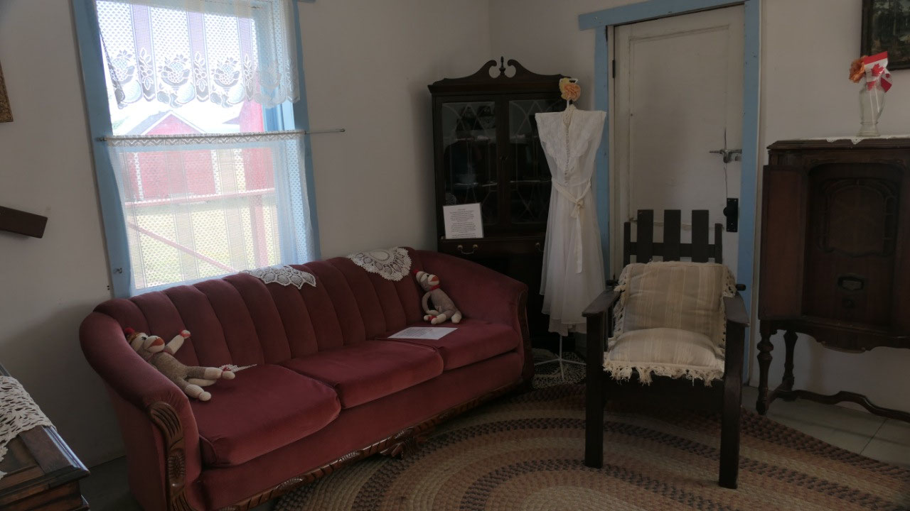
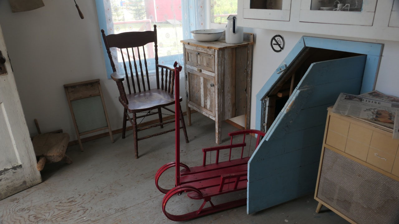
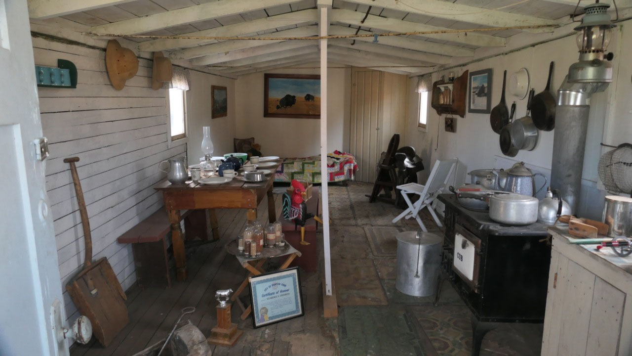
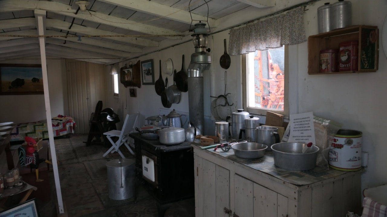
- Taylor House: in 1912 Fred and his sister emigrated from England to Calgary. Their Dad believed in the theory as many other pioneers that the further you get away from civilization the more freedom you have. In 1916 he came here to see the wilderness and liked it so much, in spring 1917 they filed a homestead for their children an made it a home. The house we see here was built by Fred and Alice it took them a whole year, both remained unmarried and lived in it for 20 years. (Look closely on how the caulked the log homes: in the northern climate with the harsh winters and hot summers you need a durable structures: here they used what they had like old rags soaked in tar)
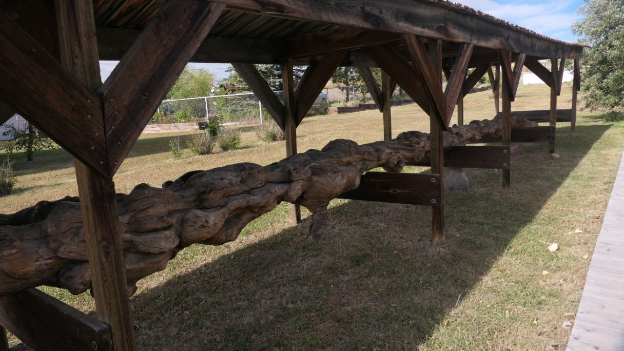
- Burled Spruce log: they had a 50 ft burled spruce – what is interesting is on how long it is: as burls are not killing a tree but they weakend it so that it is more vulnerable to disease that can kill – the largest burled trees are found in BC and also here in the Dawson Creek area. Burl starts life as a small tumor on the tree that is caused bu a fungi, insects or bacteria: a slight irritation to the bark causes a gall which grows to become a burl a bumpy disfiguration. Once started the burl grows with the tree each year builts its own growth rings – the ones in the burl are spaced furter apart as the burl grows much faster than the tree. The hardness of wood is related to the rate of growth: that means inside the burl the wood is softer – it makes a very attractive grain
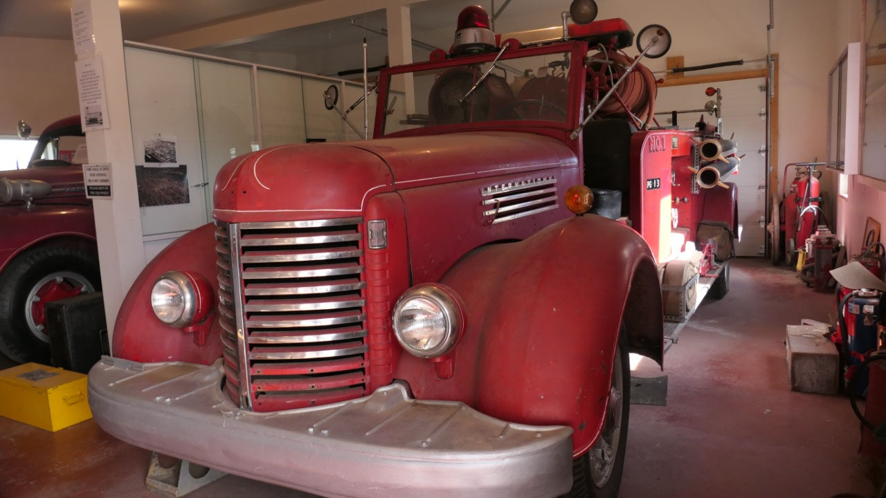
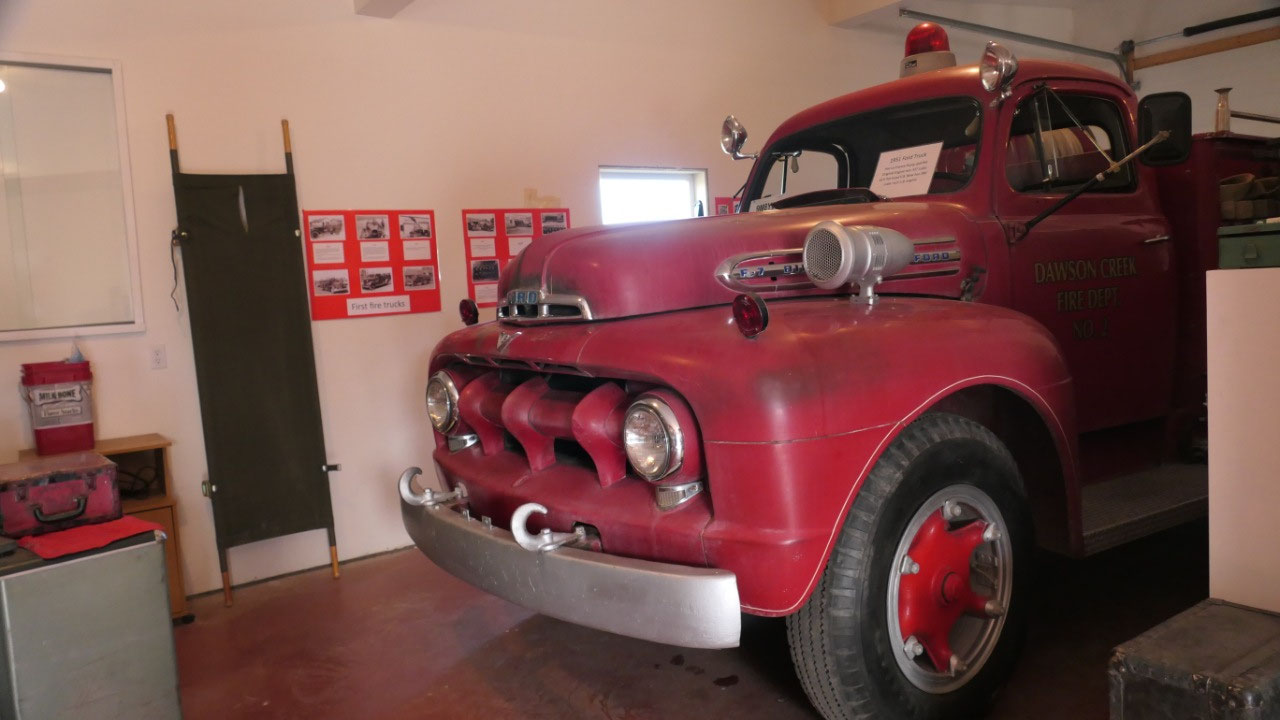
- Fire hall from 1940: a quick peak to some old fire trucks. Dawson Creek got it’s first fire department in 1938 – at the beginning it was volunteer and then you got 1 $ paid a day and in 1941 they got the first motorized fire truck it cost 250 $: it carried 200 gallon of water and had no pump presuurized CO2 forced the water through the hose
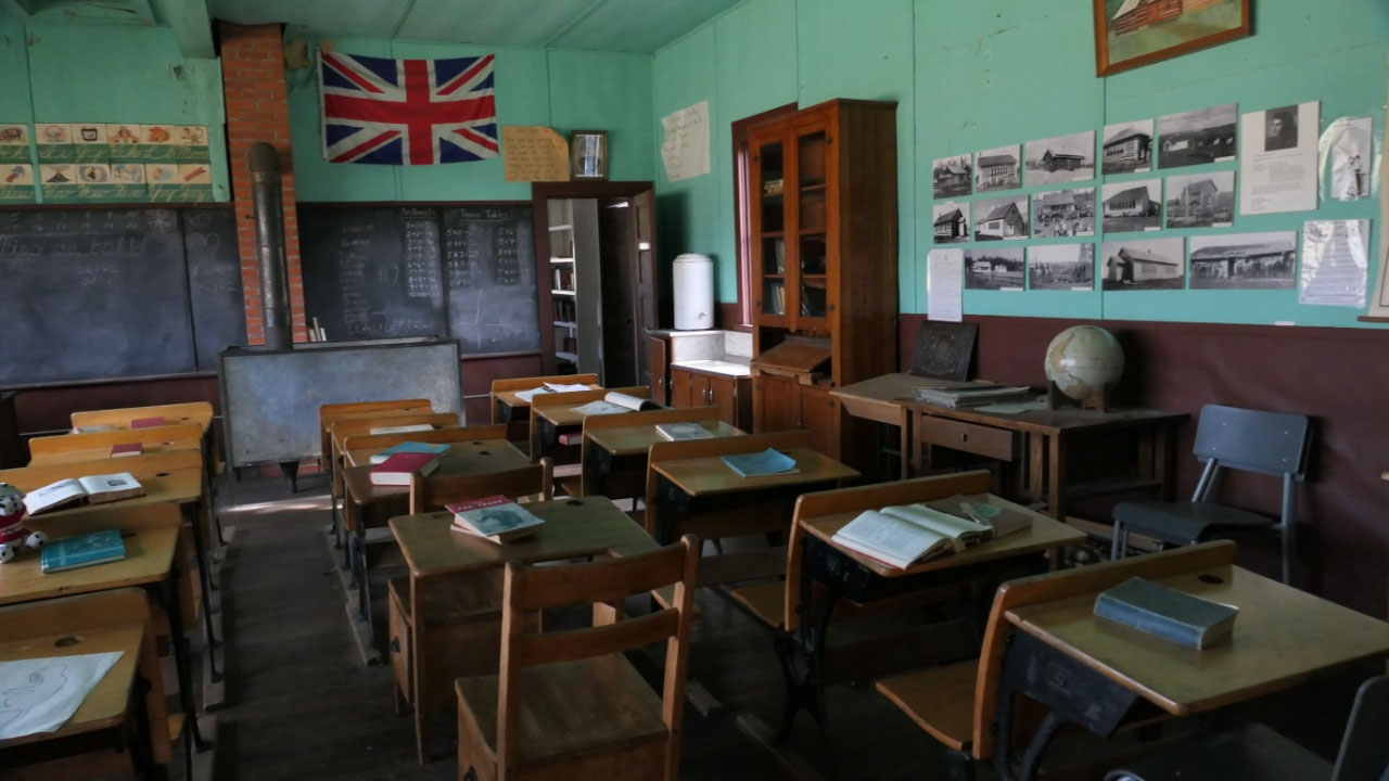
- The Dawson Creek school house from 1916: they closed the school in 1918 due to a lack of students, but then with all the new settlers they reopened it in 1919. In 1933 it was too small for the 88 students. When they built a bigger school the “old school building” was given away and a family moved it to their farm and used it as animal shelter and today it is back here
- The Peace Coupe Central School from 1918 was built by the community and all done by volunteer work. In those days as the school only had a woodstone the parents decided when it was too cold to go to school in winter but then they also decided when there were extra school days in summer. By the way in the back of the school was the living quarter of the teacher: it’s called the Teacherage (what I thought is cool inside they had all the important dates of BC’s history – so I got also a history lesson, learning things like that in 1866 Vancouver Island and BC united before since 1958 Vancouver Island had it’s own governor
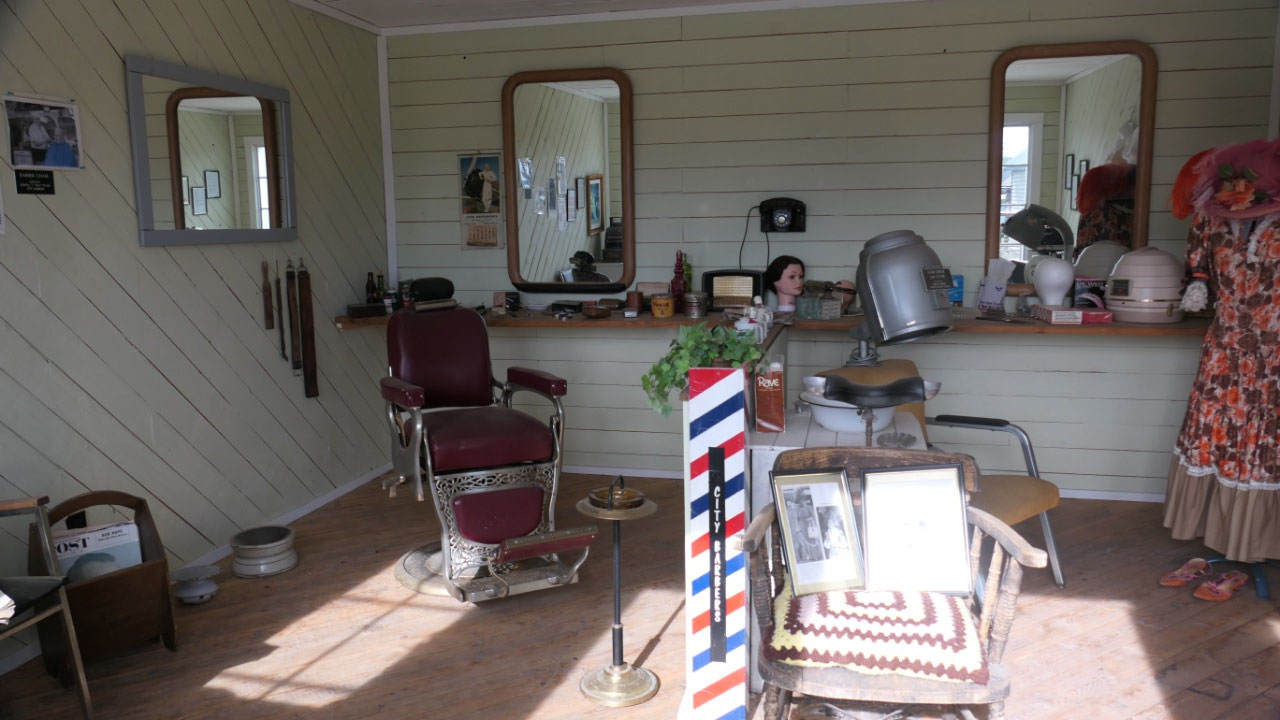
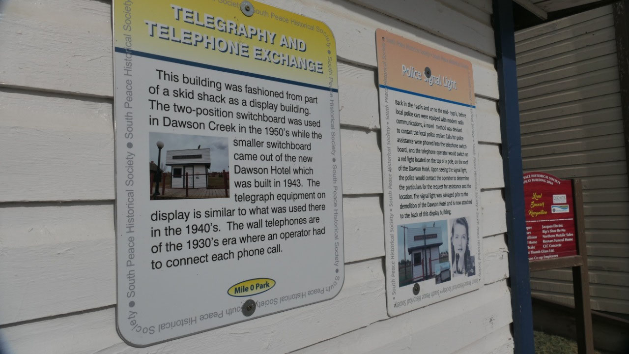
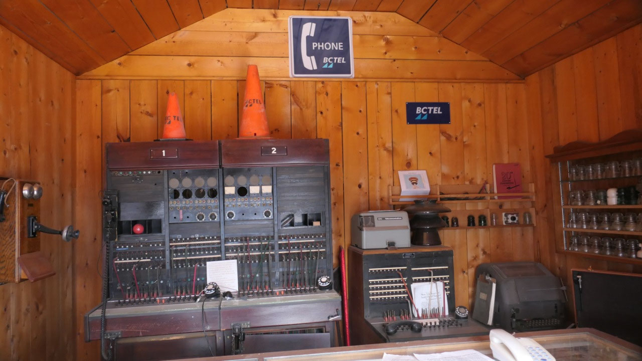
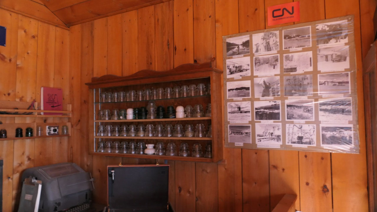
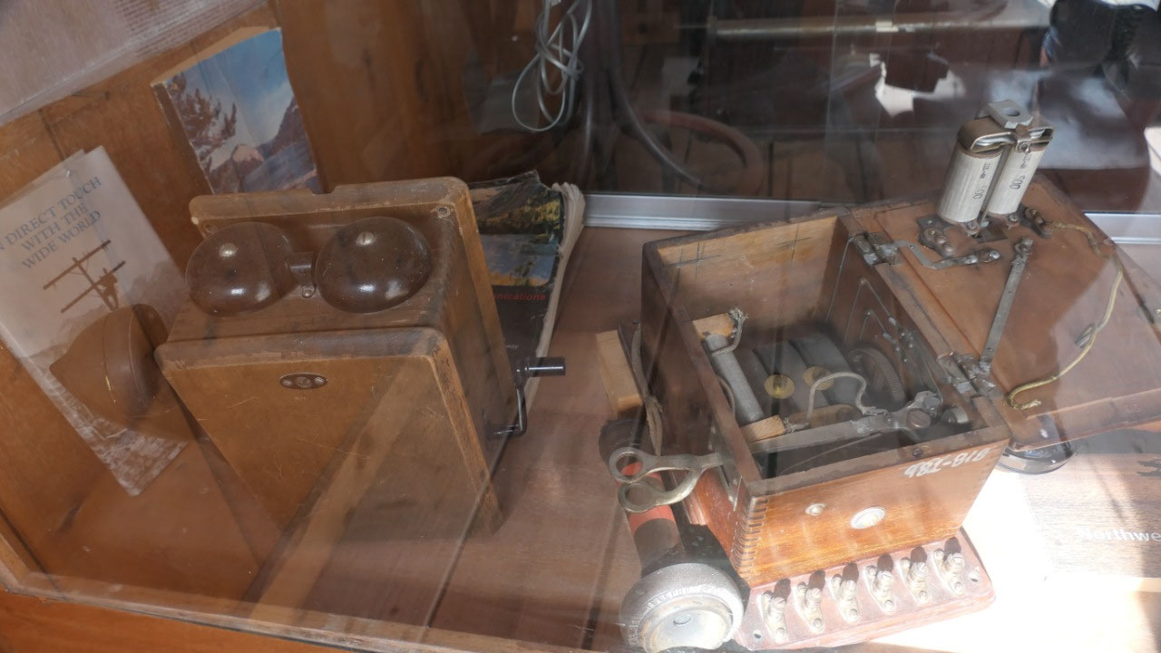
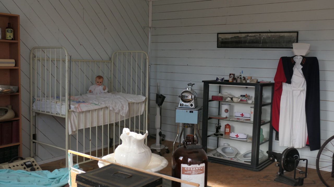
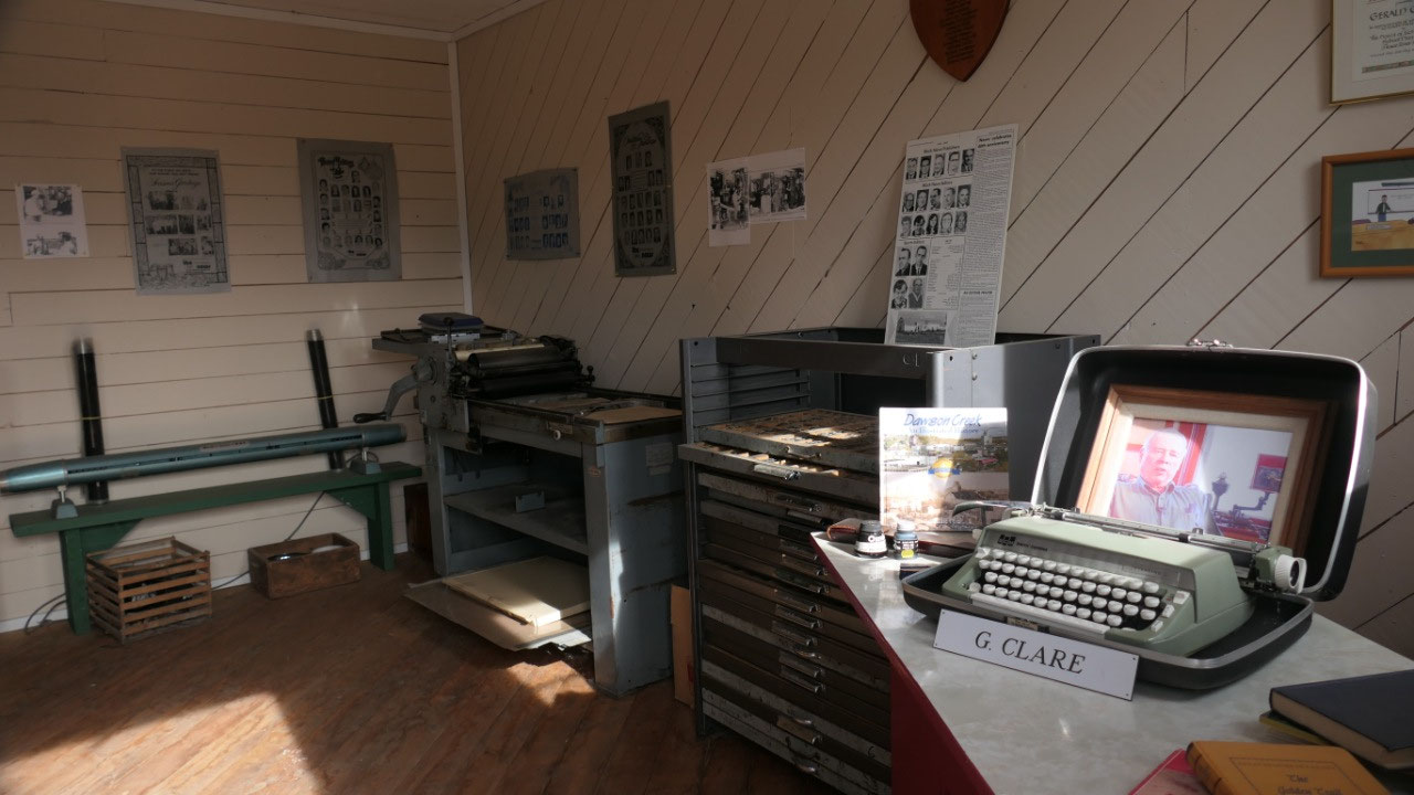
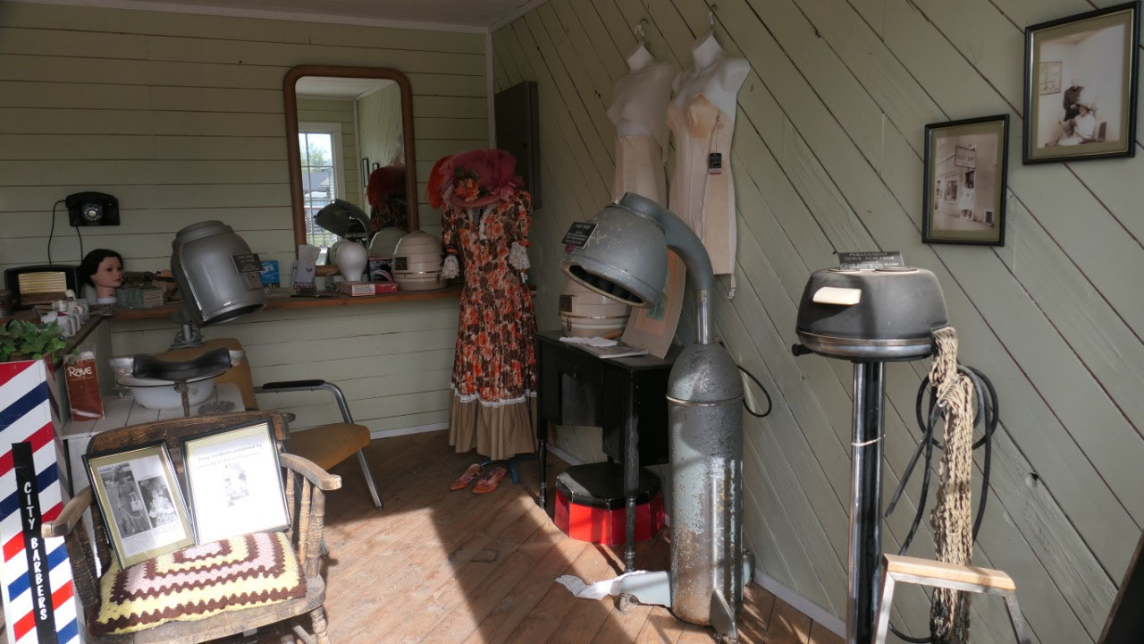
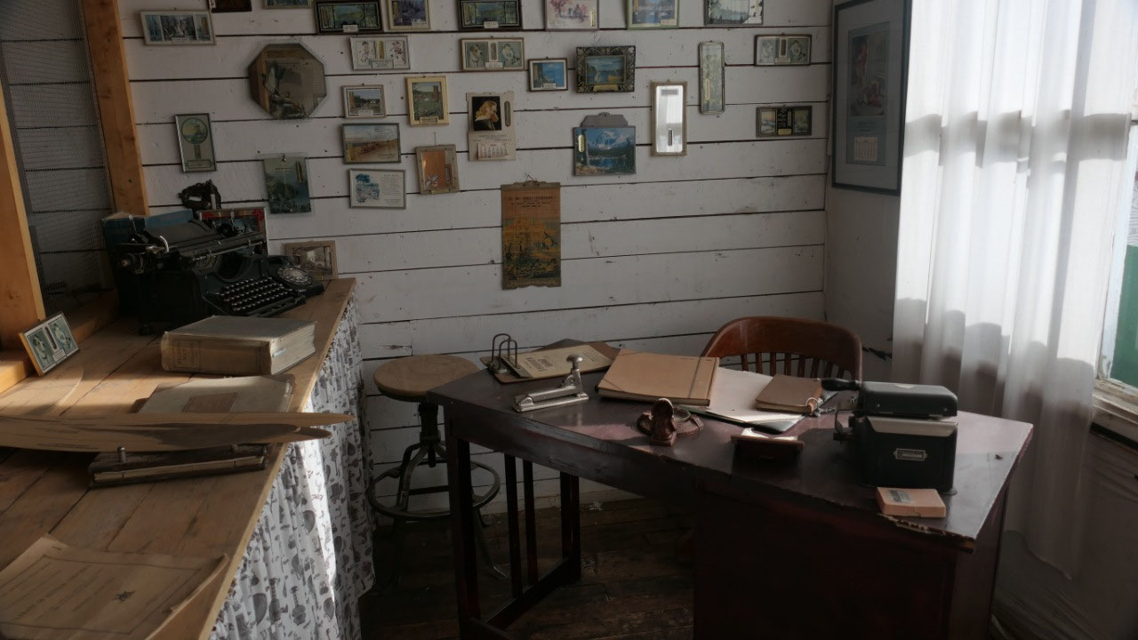
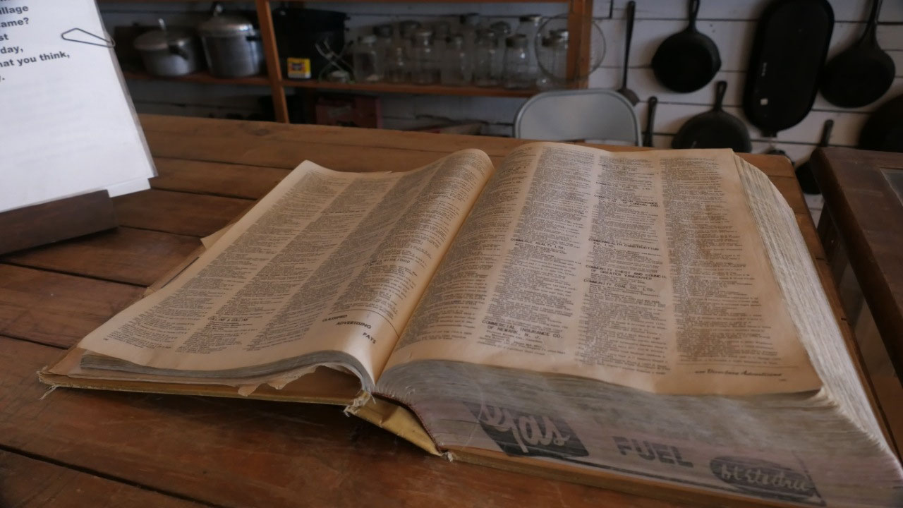
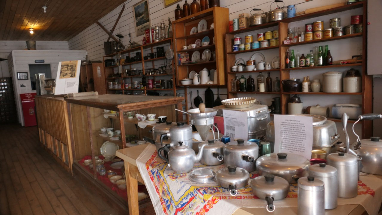
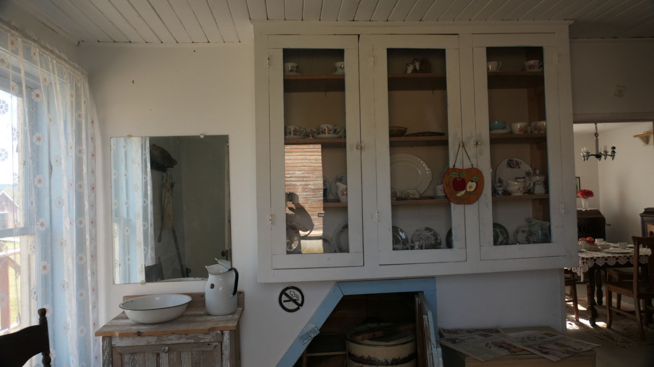
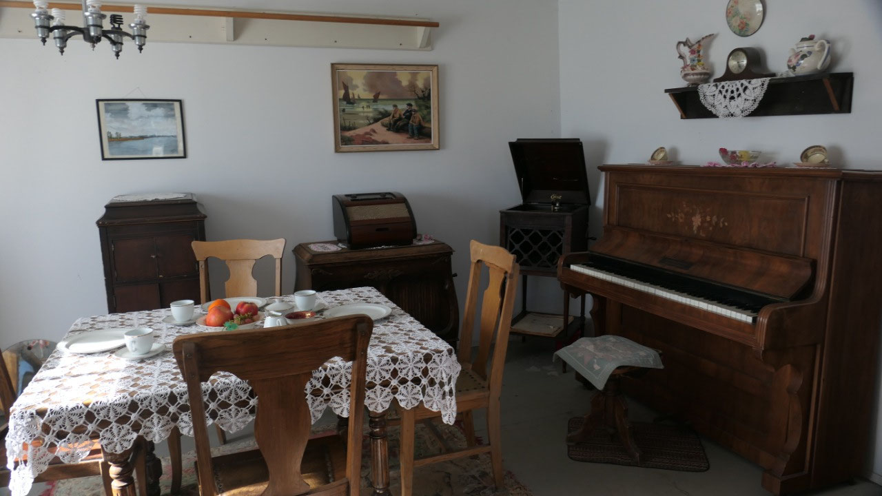
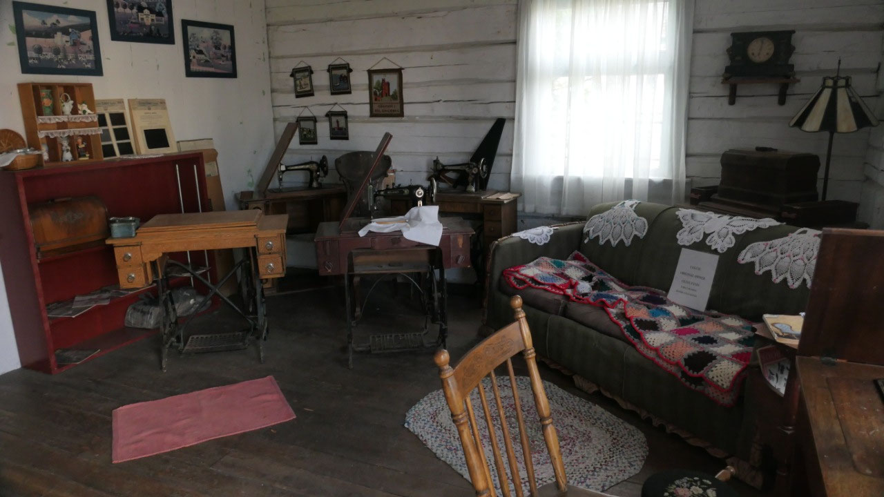
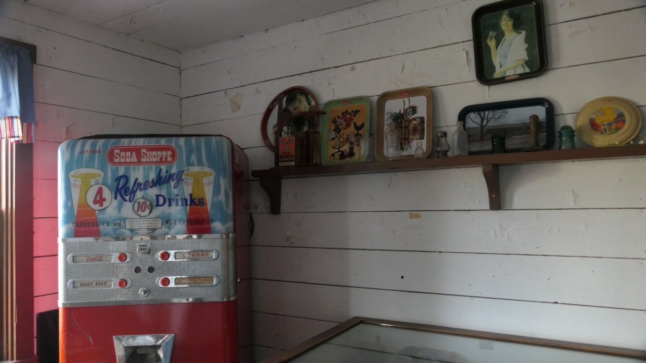
- The stores along the boardwalk were several small stores to look inside and sometimes it is funny when you look at dates: the locksmith opened in 1971, the telegraph and phone exchange with an old switchboard from the 1950s and the small switch board from the hotel (so that the calls could be transferred to the hotel rooms), the multiplex house was built in 2014 so they had space for all the different artefacts nicely organized: a bank, a newspaper office, a doctors office, a barber shop – it’s fun to check them out
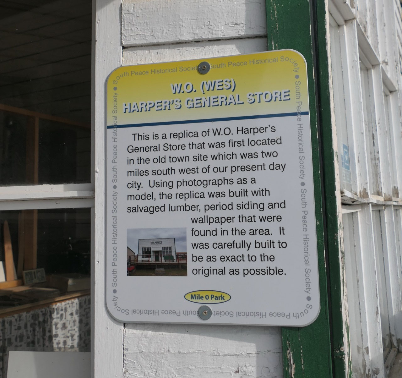
- Harpers General Store: it is a replica and made after old photographs and made with salvaged lumber and wallpaper from that area – now it looks like it did once.
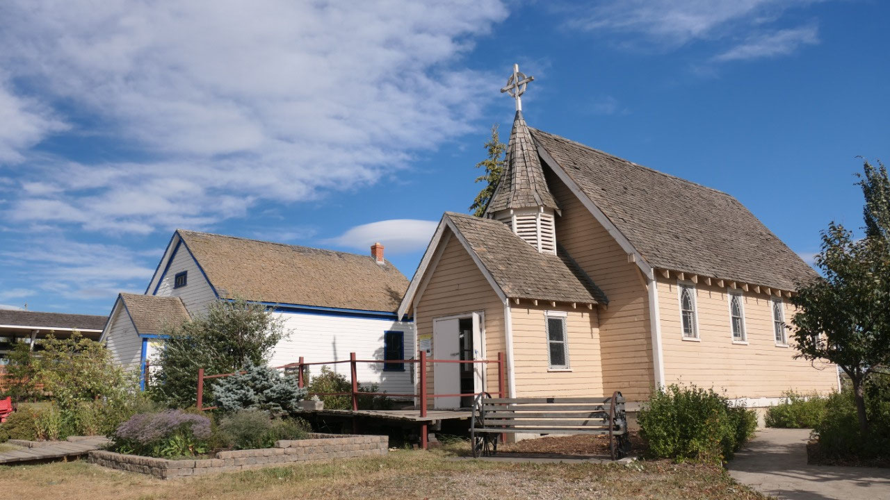
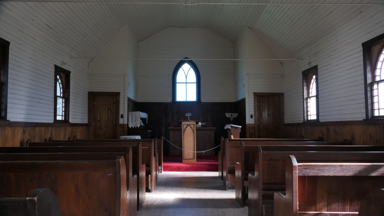
- St. Pauls Angilcan Church: built by volunteers in 1919 and local fundraising, one year later when the church was still unfinished the first couple married in it in July 1920. This church moved 3 times until it ended up here. The church was closed in 1958 and it 1970 it got donated to the city of Dawson Creek and got moved here in 1990
- Marion House: by the way Marion was the last name and built by two brothers from east Canada, they were attracted by the advertisement in the Peace River area, in 1914 they worked for the Grand Trunk Railway as camp cooks in Prince George, and then after 11 days of travel they bought a homestead. The house was completed in 1917, the crudely covered walls were first covered with newspaper, then heavy brown paper and later wallpaper. The curtains were made from flour and sugar sacks which were bleached.
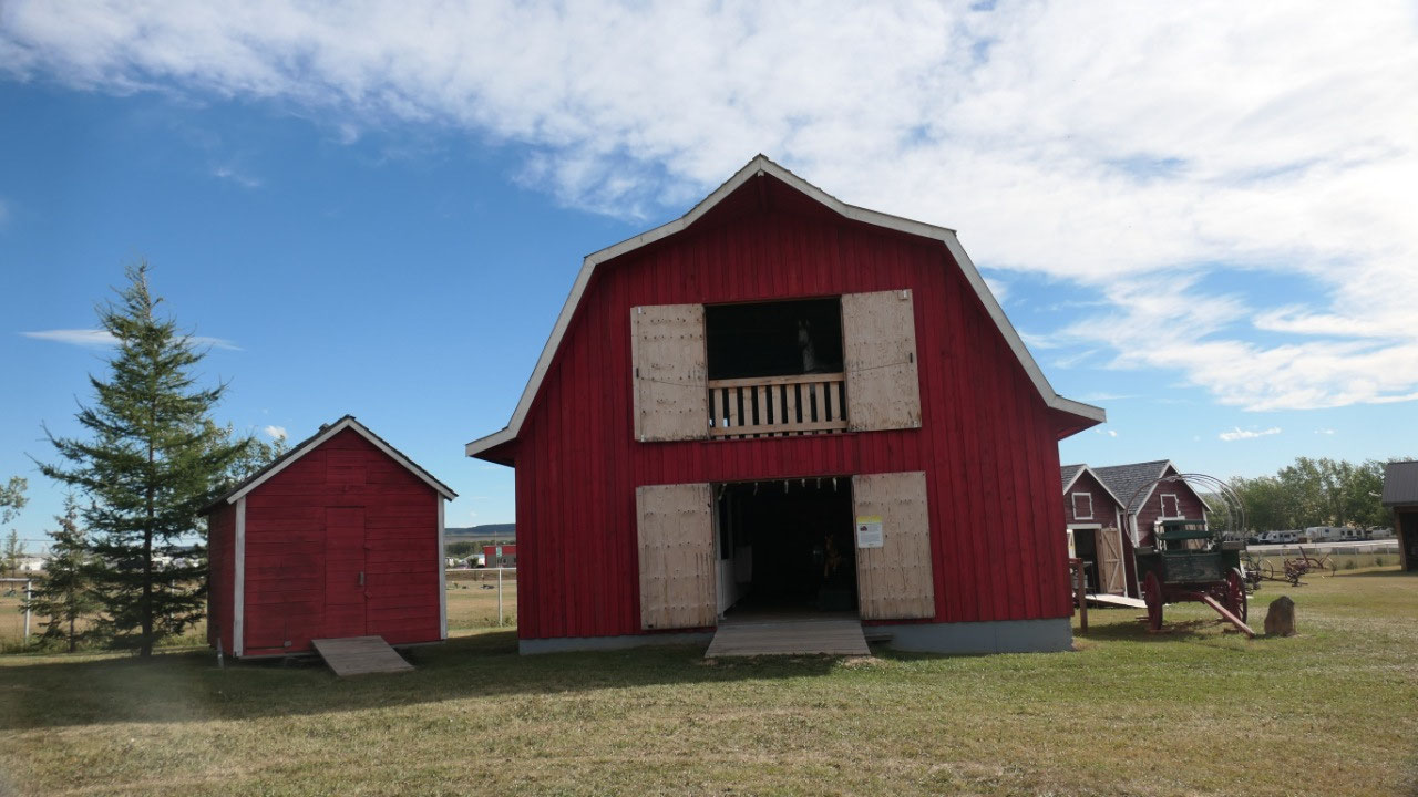
- The Red Barn: the first original barn became so unstable because of rotten logs from a manure pile along a wall and needed to be demoslished and then in 2010 the replica got built. What was super cool when you go upstairs you see a “horse” looking out of the window.
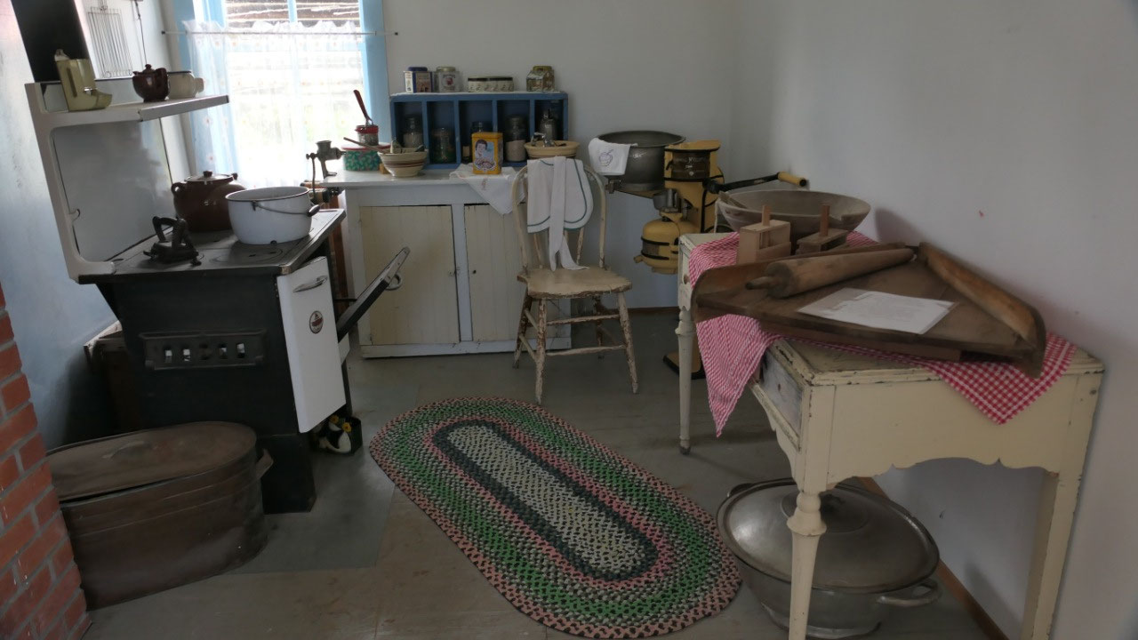
- A little mobile cookshack: this was used in the 1940s/50s during dreshing times, it is really like a kitchen on wheels
- Johnson-Davies House: he came to the Peace River area in 1929, after he married they built this house in 1936
- Boundary united church: built by hand, logs cut and pulled from the bush to the sawmill, and got built in 1931, the first preacher came in 1933 Russel Ross, he was a busy man and he would travel to 3-4 different villages , in summer he drove a Model T and in winter by horse. He lived in a room in an hotel in town, and because he was always on the road he was called the “saddlebag preacher” the church was used until 1969, when the congregation voted that it should be preserved.
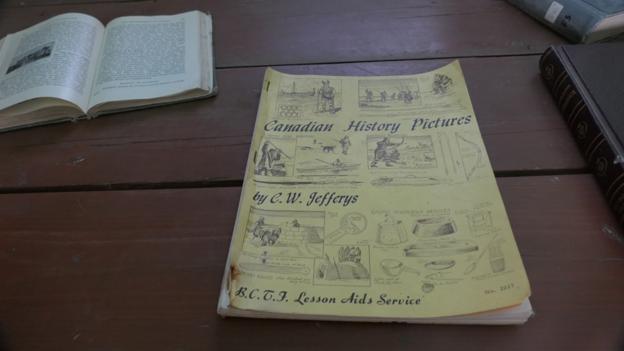
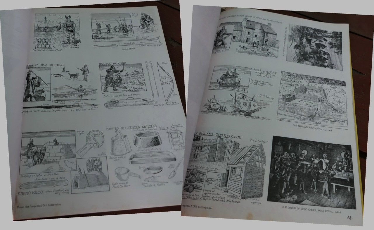
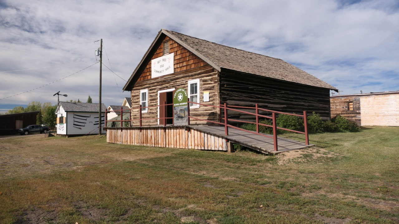
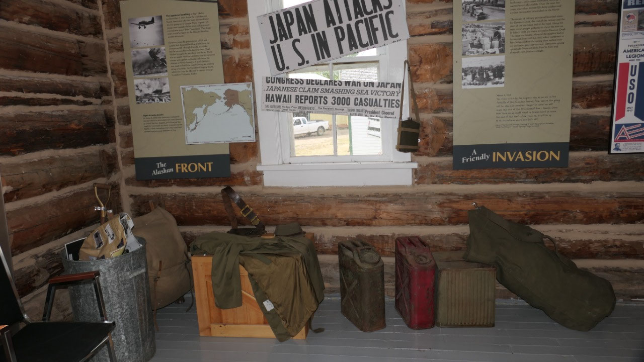
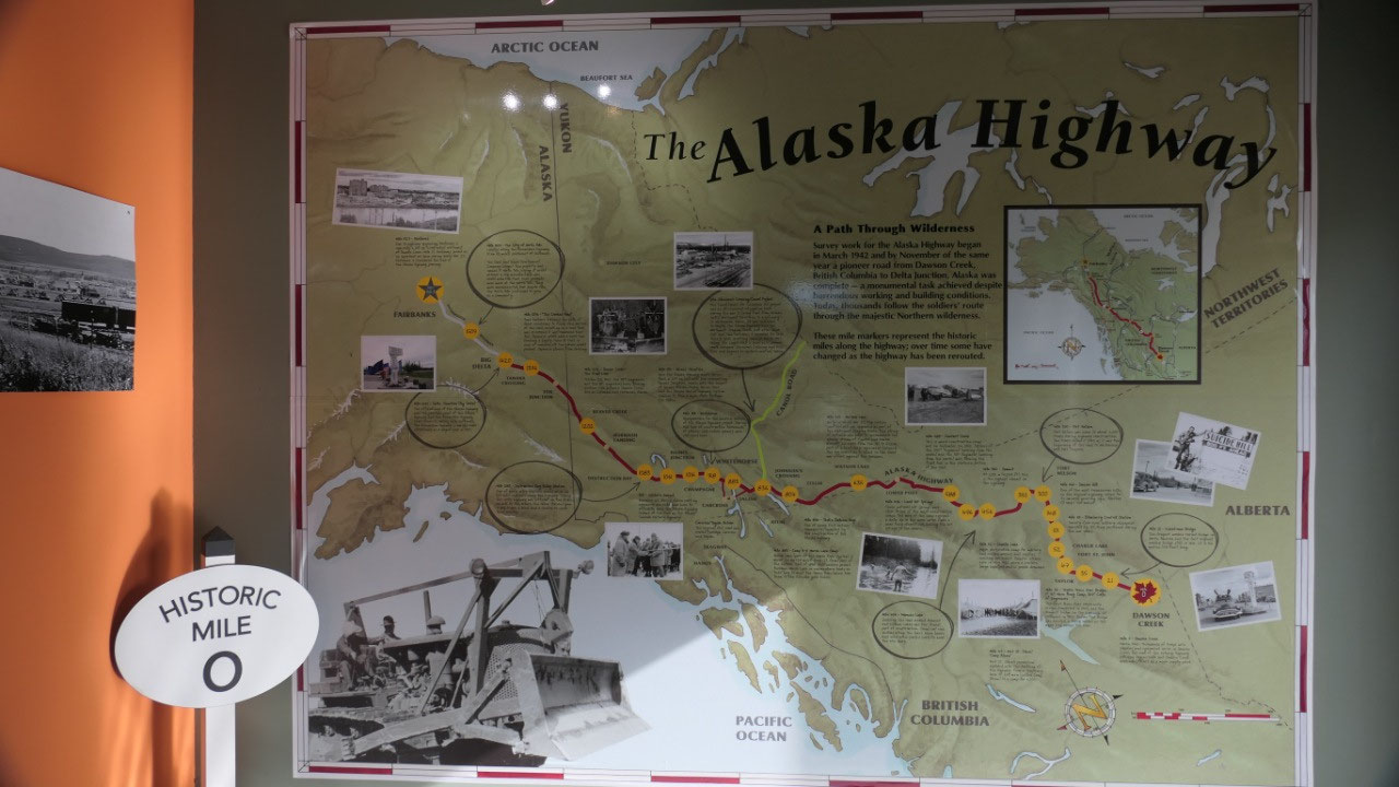
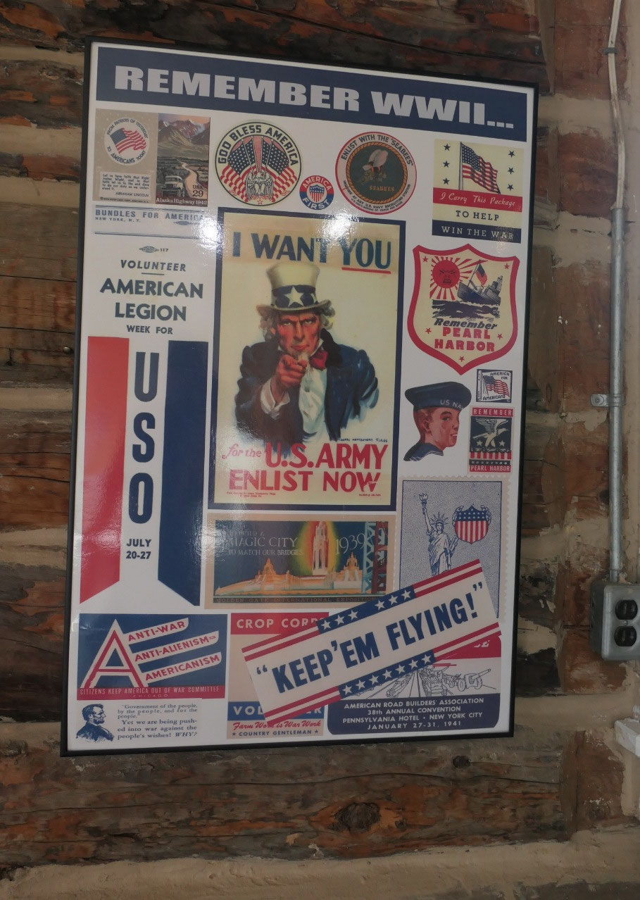
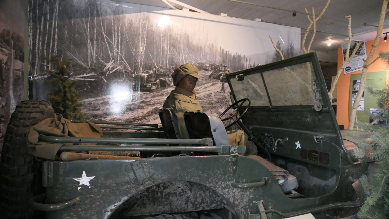
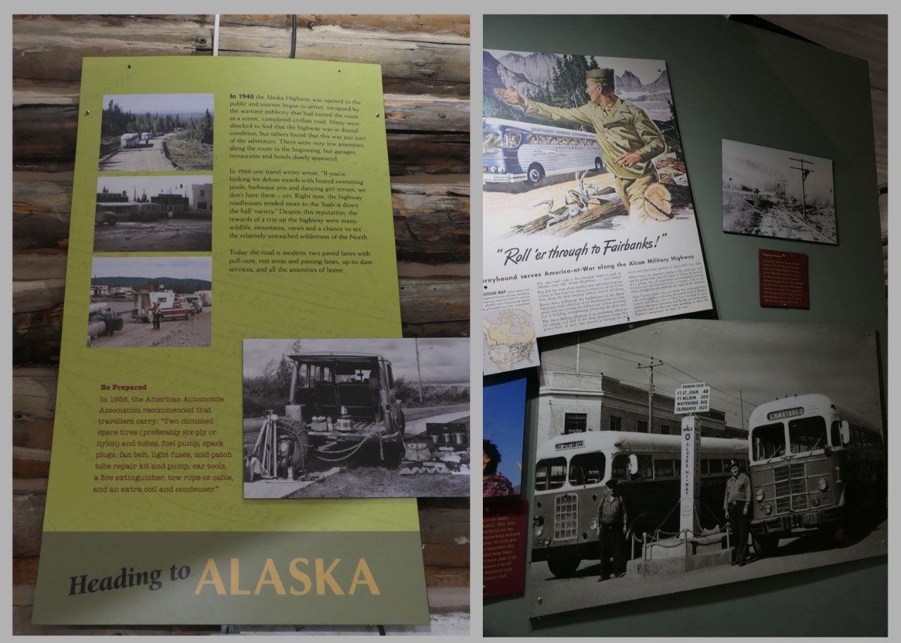
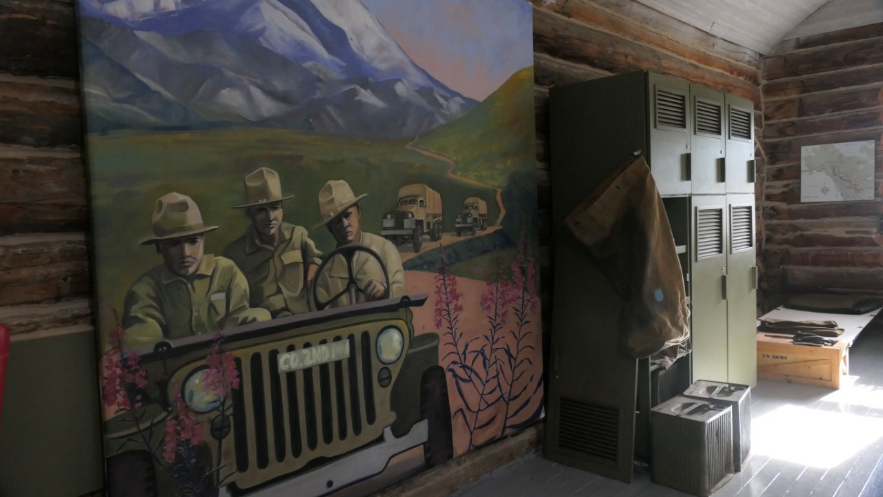
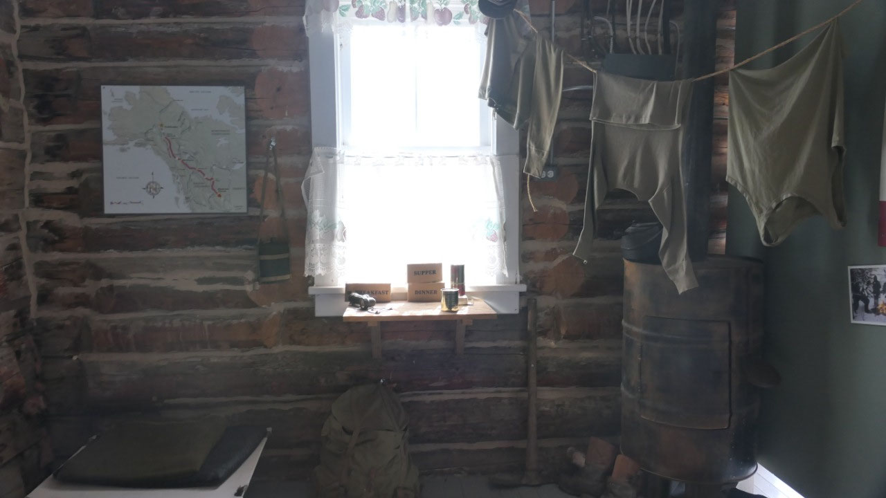
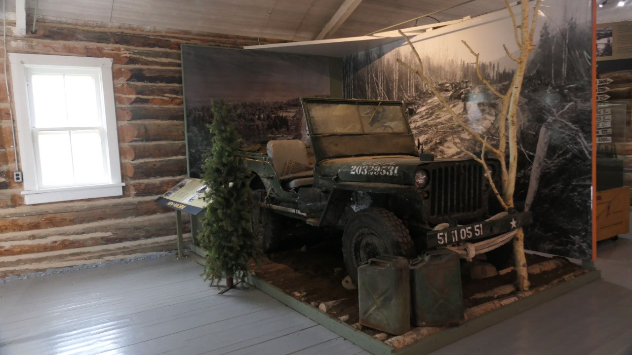
- Baytree Hall: is a community hall from 1931 – the first dance they held here, was when it had no roof, but then if you dance enough you stay warm and today here you can learn about the Alaskan Highway, they had an old vehicle there and lots of info about the building of the highway, we drove now the whole Alaskan Highway from the end in Delta Junction (or Fairbanks) to here and the Mile 0, we learned a lot on the way, but there is always something else you discover and it was cool to see a map of the whole highway with some important points along the way and what happened there. The Alaksa Highway house takes you back into the 1940s and the life of the soldiers and civilians who worked to built the highway, to get involved in the challenges and hardships they experienced:
What’s to learn about the Alaskan
Highway – your gateway to Adventure:
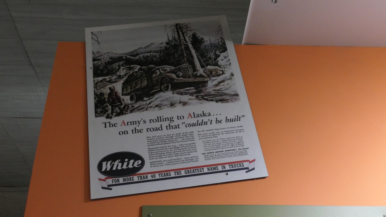
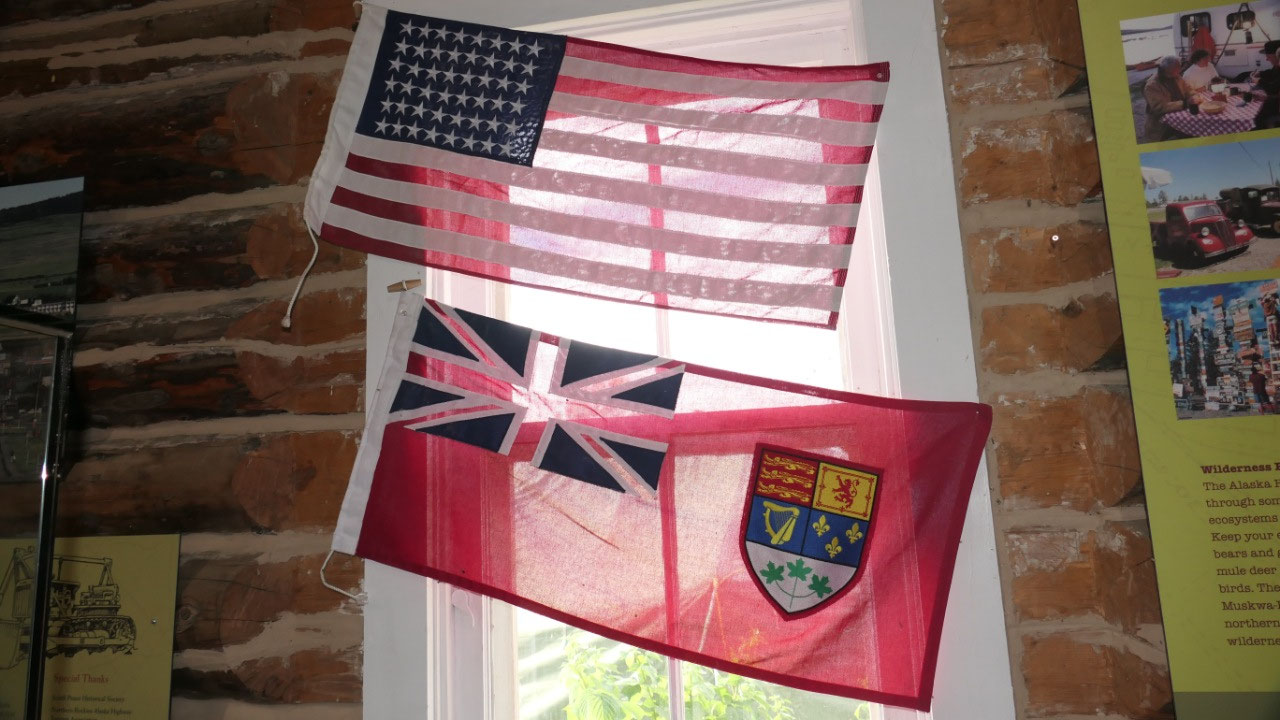
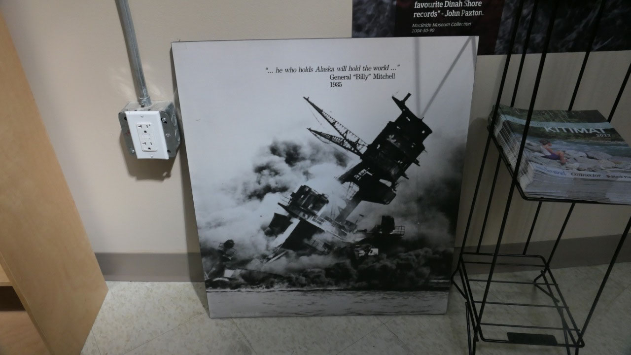
- And yes, for years the government in the US and Canada “talked” about building a road, Pearl harbour brought it into focus and suddenly a quick decision was made by President Theodor Roosevelt. Once the decision was made it went fast. To speed up the process they build from both ends: Dawson Creek, Whitehorse and Delta Junction. By the way Canada only agreed to the construction if the US would bear the full cost and that all facilities in Canda were to be turned over to the Canadian authority at the end of the war
- By the way they had 2 major routes a Route A and B they discussed in 1931: Route A started in Vancouver and went via PG – Hazelton and Atlin to Whitehorse: 1275 miles and Route B from Prince George via Fort St. James, Dease Lake, Atlin to Whitehorse 1250 miles. In 1942 the American Army ignored all previous plans and choose this one connecting the airfields
- On March 9, 1942 the first engineers arrived here: overnight the small town of 500 to a peak population of 10.000: tent cities sprang up on the farmers fields. They had to hurry as many supplies had to move up to Fort Nelson before the spring thaw melted the river
- The railway station here was the end of the steel and was sometimes homes to thousands of military and civilian workers. Dawson Creek became a clearing house for supplies. In Spring 1942 600 carloads of tractors, bulldozers, fuel and supply arrived here from Edmonton to dispel along the road
- One of the worst mishaps during building happened here, when in Feb 1943 60.000 cases of dynamite exploded in the town center injuring many but miraculously only killed five. The explosion levelled a whole city block
- Today’s Mile 0 is where once a plain four-foot post marked the site: this one was put in when in 1946 a car hit the original one
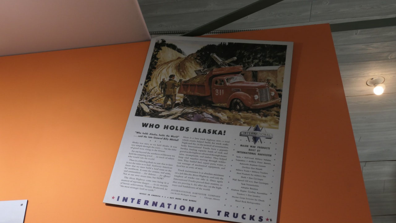
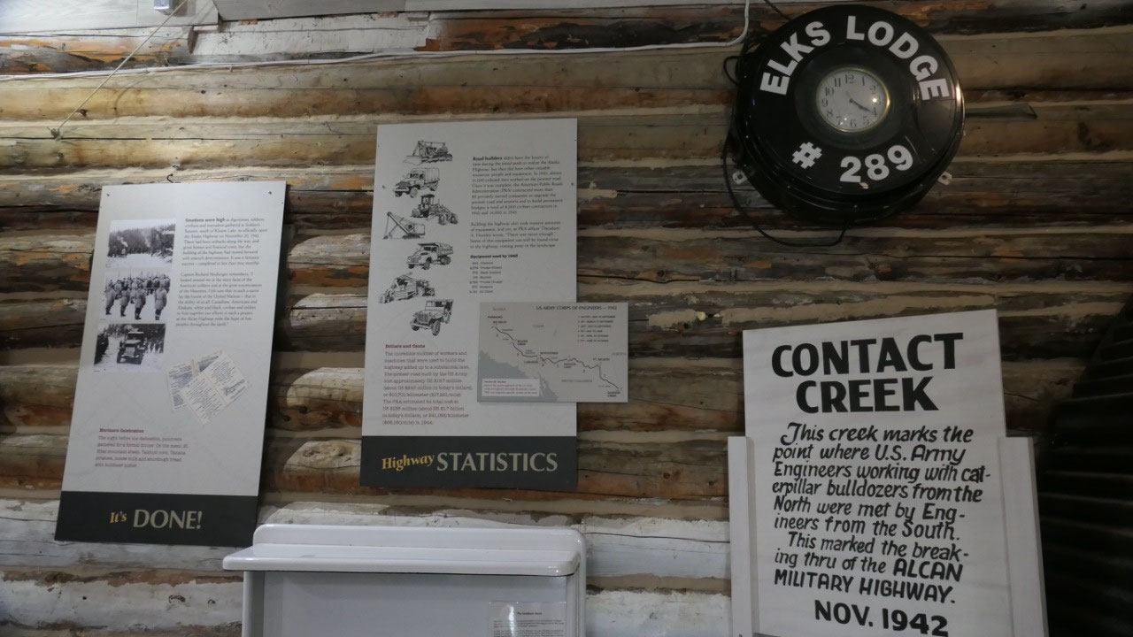
- The total cost of the highway was over 140.000.000 $ - the construction feat is unsurpassed, 11.000 troopers and 16.000 civillians were employed and they used 7000 pieces of equipment (most of it still hangs around)
- There are 133 bridges and 8000 culverts in the 1523-mile long highway (until Fairbanks)
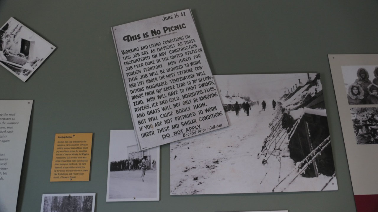
- If you wanted to be part of it “Help wanted 1942 add said”: “Men hired for this job will be required to work and live under the most extreme conditions imaginable: Temperatures will range from 90 degree above zero to 70 degree below zero. Men will have to fight swamps, rivers, ice and cold. Mosquitos, flies, gnats will not only be annoying but will cause bodily harm. If you are not prepared to work under this and similar conditions do not apply”
- It took 8 month and 12 days to complete (it was then a rough gravel road), it opened in 1942 for the military only
- The road roughly followed an existing string of airfields: the Northwest Staging Route which run from the US prairies to Fairbanks
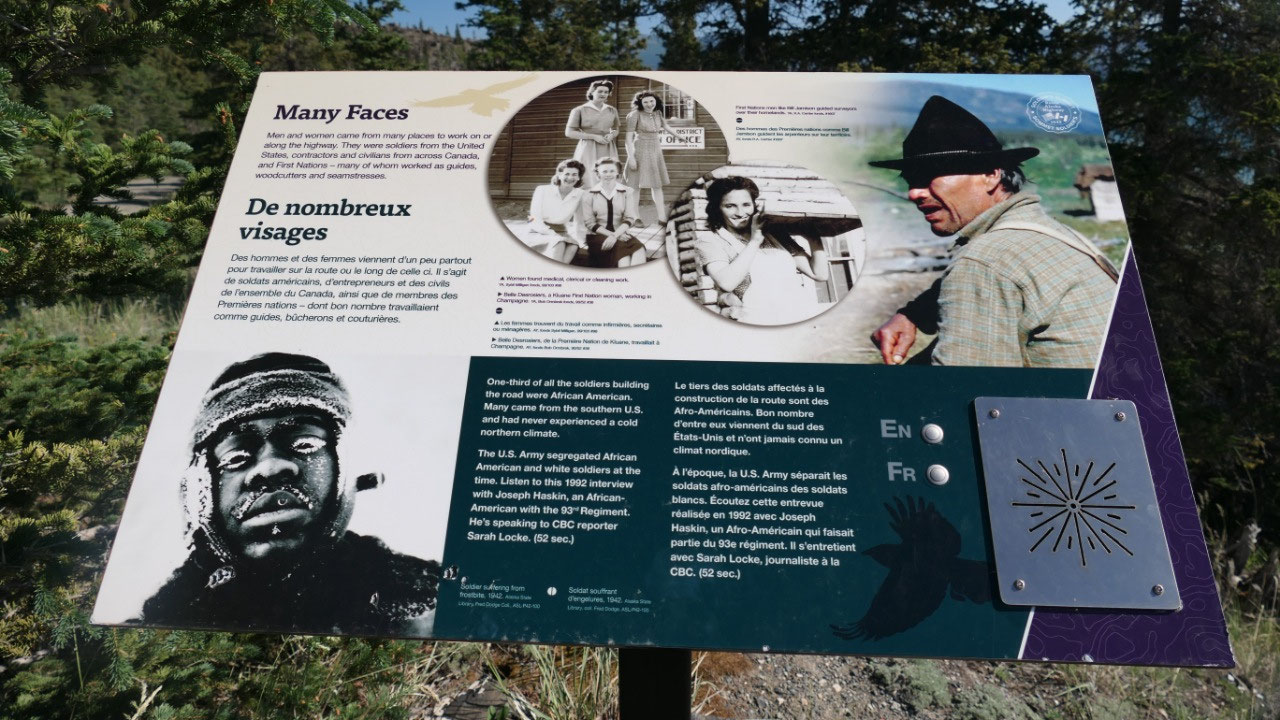
- Equipment: many of the soldiers had no experience using the heavy equipment and didn’t know on how to keep in a good conditions.
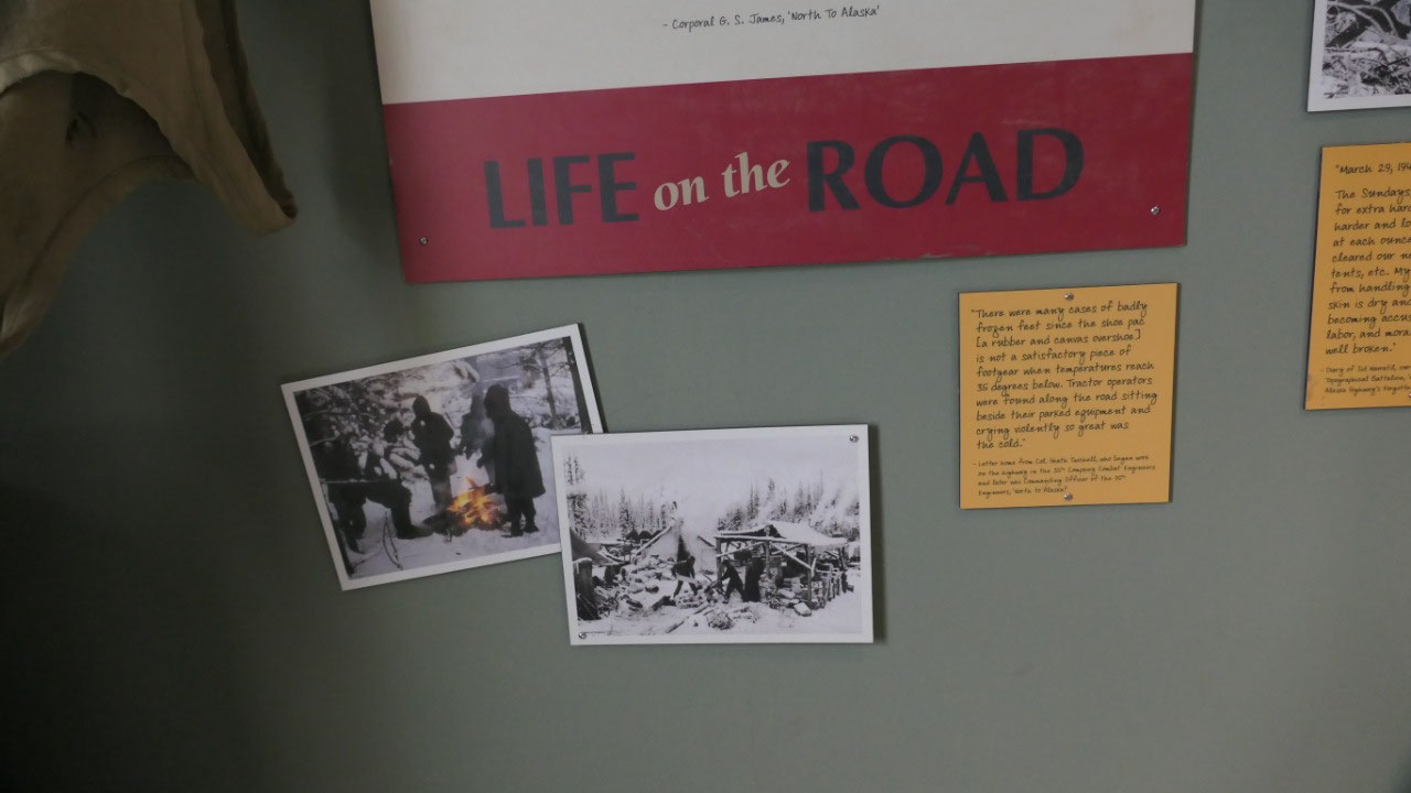
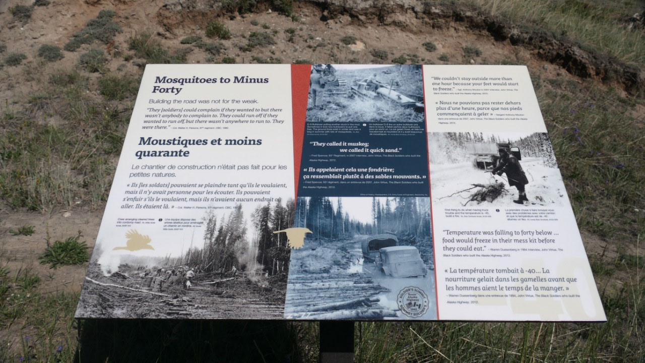
- The cold: freezing lubricants made transmissions to seize, when vehicles broke down and no help was nearby some men froze to death as they came from the south and didn’t know how to keep themselves warm. And if not deadly winter conditions in summer there were swarms of mosquitos and black flies. People worked until they dropped, some slept near their machines. Fatigue, hypothermia and accidents were part of the life.
- As the spring came and it thawed much of the road into a muddy mess
- Surveying was not easy, as there was nearly no knowledge and no maps, an initial survey was done by air and then they pushed through unknown territory, they had some first nations guides. Much was done by sight like climbing on a tree or on a equipment and then choose a point in the distance and then work towards it. There was no time for planning
- The truckers got paid by the ton-mile, so many trucks were overloaded, driven to fast and drivers drove to long without a break or sleep (by the way they even had a female truck driver)
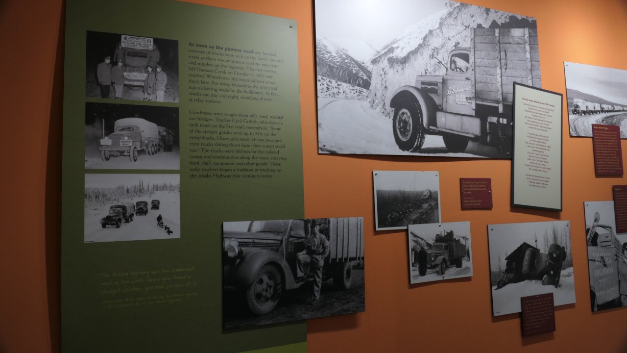
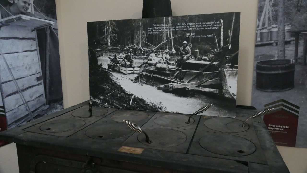
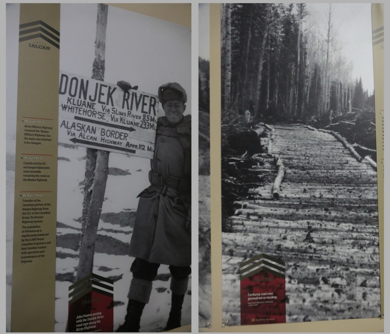
- Once the surveyor had blazed a center, three bulldozers followed to create a 18-24 m wide opening, then the dozers came to clean up the mess (they could do 3-5 km when the ground was frozen), then they build temporary bridges, culverts, ditches, or they had to lay down a corduroy road (a bed of logs) so that the road was not sinking into the boggy wet muskeg
- Sikanni Bridge: while stationed at the river the black soldiers of the 95th regiment bet their pay cheques that they could break all records in bridging the river. They often got insufficient equipment, clothing and accommodation and their skills were ovten overlooked. They got hand tools instead of machinery (they went to the all white regiments). And they won their bet: the bridge was completed in 84 hours half the time usually required for bridge construction
- Until 1964 the road was maintained by the Canadian Army and then taken over by the Department of public works in Ottawa – by the way road improvements shortened the highway by 56 km
- This highway changed the life in the north forever as the isolated communities were linked to the world, it replaced riverboats which was the primary transportation, brought telephone, established towns and government offices
- As soon as the road was completed convoys of trucks were sent up north, the first one left on Oct 24, 1942 and reached Whitehorse 166 hours (almost 7 days) later, the trucks run day and night switching drivers at the relay stations – parts of the road was the clearing from the bulldozers, some of the steeper grades were 24%
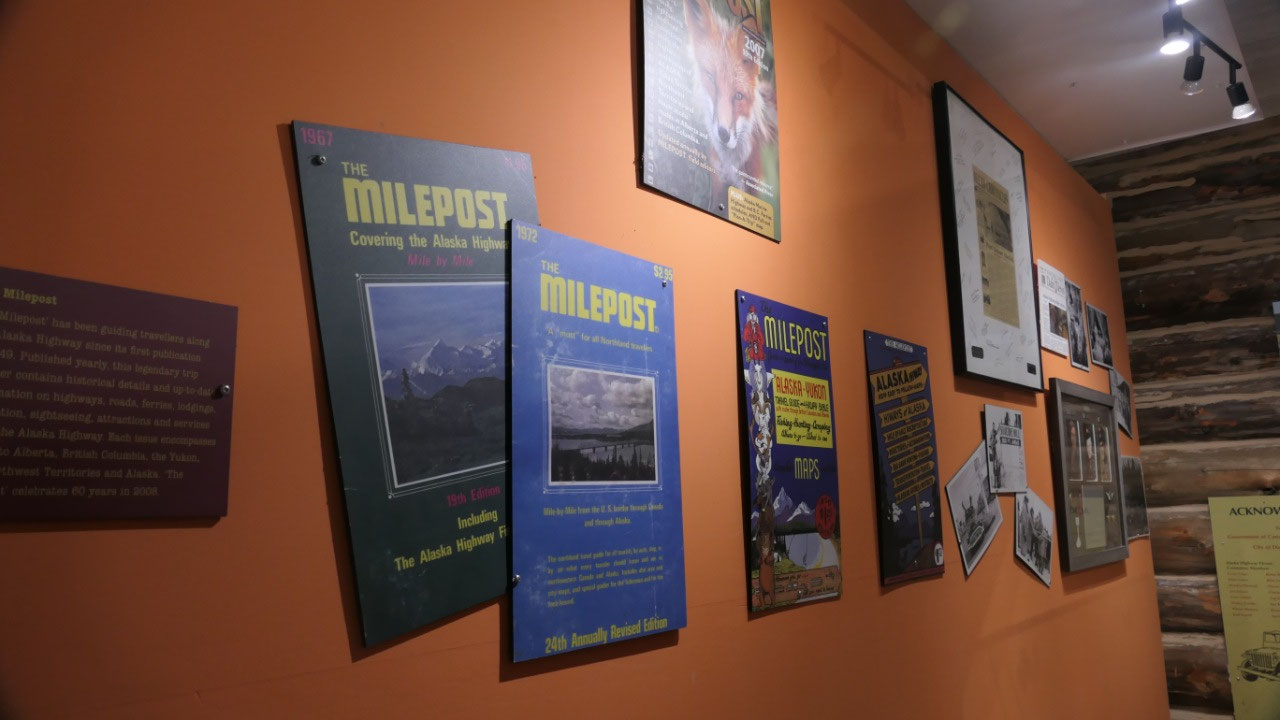
- In 1948 the Alcan was opened to the public and tourists began to arrive, still in 1958 it was recommended that you carry 2 spare tires, tubes, a fuel pump, spark plugs, fan belt, fuses cold patch tube repair kit, pump, car tools, fire extinguisher, tow rope and extra oil. By the way the Milepost was guiding travelers along the Alaskan highway since 1949. By 1960 the Alaskan portion was completely paved
- The Alaska Highway – the Lasting Legacy: it still fascinates and impresses, in 1996 it became the 16th international civil engineering landmark
- In 1947 the highway was marked with mileposts and many towns and lodges were known by their historical milepost – the Canadian portion is now marked with km post after the reconstruction. Since Alaska hasn’t changed the original mileposts there is amileage discrepancy of 40 miles when you cross the border
Highlights along the Road – and most
we visited:
- And in case you wonder: it’s 970 km to the Yukon Birder – 892 km through the Yukon to the Alaska Border and then another 1422 km until Delta Juntion where it joins the Richardson Hwy for the last 167 km to Fairbanks
- Mile 0: Dawson Creek – the end of the railway, this was the supply point and the major terminus for troops, supply and equipment
- Mile 21: Kiskatinaw Bridge the longest wooden curved bridge in North America and the last still original bridge in use (as of today)
- Mile 35: Taylor – here was the longest bridge along the Alcan, but it collapsed in 1957, the bridge was built in 1943 – before you had to use the ferry
- Mile 47: Fort St. Johns: this was camp Alcan, in1942 the town exploded from a population of 200 to 6000
- Mile 52: Charlie Lake a major distribution camp, yes we were here, as here the ship sunk
- Mile 101: the Blueberry control station was a 24/7 military checkpoint
- Mile 148 the famous suicide hill, this treacherous hill had the greeting “Prepare to meet your maker”
- Mile 162: Sikani Chief River Bridge: this was one of the first bridges completed on the Alaskan Hwy and built in 84 hours with a 300 ft span by the African American soldiers
- Mile 300: Fort Nelson, 2000 troops were here and they called it Zero, as it was the beginning to the road to Whitehorse and Fort Simpson
- Mile 392: the Summit 1295 m is the highest point of the highway
- Mile 456: Muncho Lake: building the road around this lake and Kluane Lake was the slowest part of construction because they had to cut shelves into the rock – today we enjoy the view as we wind along the lake
- Mile 496: Liard Hot springs – the men in the camp enjoyed a daily dip in the warm waters here- and once a week the women were allowed to use it (Gine liked the cute picture attached to it, to see the sexy backside of the guys)
- Mile 524: Fireside – once a huge fireplace burned here night and day to warm passing soldiers and construction workers, in 1982 the 2nd largest fire in BC history destoyed the area
- Mile 588: Contact Creek – here the construction teams met on Sept 24, 1942 forming a final link on the southern part
- Mile 627: the Yukon Border Crossing: the highway corsses the BC-Yukon border six times, this is the official crossing
- Mile 635: Watson Lake – early in WWII Watson lake airfield was upgraded as part of the Northwest Staging Route and it accommodated lots of fighter and bomber planes on route to Russia to assist the Soviets in a war effort against Germany – today the signs show you the way
- Mile 804: Teslin – this was one of the many first nations communities impacted by the building of the Hwy
- Mile 836: Johnsons Crossing and Canol Project (Canadian oil), the Canol was an oil pipeline build during the war to bring the oil from Normans Wells in the NWT to Whitehorse, it was intended to supply the Alaska highway, but because of the cost and timeline it operated less than one year shutting down in 1945
- Mile 883: Marsh Lake Camp, this lake is part of the Yukon River System and part of an historic 1898 trail, as gold seekers passed through here. By the way the original route went here for a detour to Tagish and Carcross
- Mile 918: Whitehorse – here was the headquarter for the western section
- Mile 1016: Haines Junction – here the Alaska Hwy meets the Haines Hwy which connects the Yukon with the seaport of Haines
- Mile 1061: Soldiers Summit – on Nov 20, 1942 a ribbon cutting ceremony was held here for the official opening of the Alaskan highway at that time they called it the Alaska Canada Military highway – and yes we were there
- Mile 1083: Destruction Bay Relay Station – those relay station were built 100 mile apart along the hwy, as the hwy was difficult on trucks and drivers, at this stations they could take a break and repair their vehicles
- Mile 1202: Beaver Creek – the Final Link: in Oct 28, 1942 two more engineers met here as another link, they encountered here permafrost and scraped off the insulating oayer and made it into an ice-bottomed mud bog
- Mile 1376: the Crooked Road – the road builders here followed the path of the least resistance to finish, resulting in a road which was so crooked it was rumoured that the Japanese would have a hard time bombing the supply train and that it would prevent the Japanese planes to land
- Mile 1420: Delta Junction is the official end of the Alaska Highway and the junction point to the Richardson Highway (which runs Valdez to Fairbanks) – the Richardson highway was an older highway and already a wagon road in 1920. This was a highway construction camp
- Mile 1523: Fairbanks – today it is only 1488 miles, Fairbanks was an important air base during WWII and is considered the end of the Alaska Highway
Driving by the Mile 0 post:
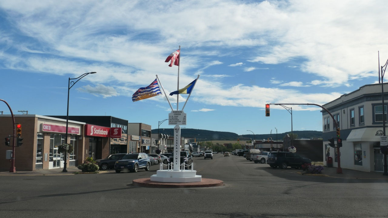
On the way through the town we drove
through the intersection where the Mile 0 post is standing in the middle – as
we were lucky and had a red light front row: we had plenty of time to look at
it and decided not to stop and walk to it – but we are still one of the
throusands of people to take a picture of it
We decide to stay at Walmart:

After picking up the Medication and a
quick stop in Save-on-food it is already 5 pm, now the question is should we go
to the PP and then maybe don’t even like it but we have to pay because we are
tired and don’t want to continue on, or should we stay at Walmart – and Walmart
won!!!! When coming here we saw the signs saying no overnight parking cars and
trucks – so we got a bit confused can we overnight park??? We ask one of the
guys here and he said yes, as long as you are on the outside and don’t take up
parking lots as you are not an 18-wheeler. Good, next step inside to get Data
and that required a phone call, but then Walmart has everything even a bench to
sit down.
And let’s not forget a beautiful
sunset!!! – there you see the best ones are in Walmart Parking lot!!
In the morning we meet some fellow
travellers who are now on the way east and as we think we saw everything in
Dawson Creek we were heading out – yes we always go south!!!

2025-05-22