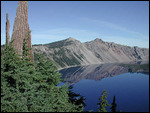
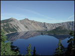
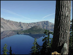
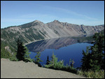
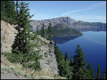
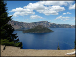
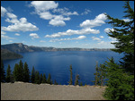
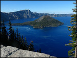
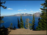
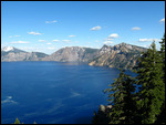
This is a stop worth your time. Crater Lake. On a calm, clear day, the reflections are spectacular. The lake is too wide to take one photograph as it's 33 miles around.
We also got some photos when the wind was a bit more breezy but still magnificent. You just sit there and look at the lake it's so beautiful.
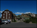
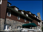
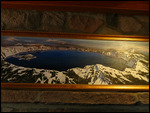
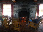
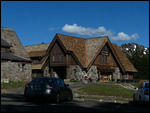
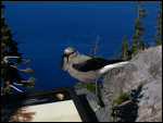
Then, there were other things to notice....
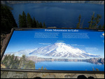
....and some interesting data about how the lake was formed and named....
Crater Lake is a caldera lake in the western United States, located in south-central Oregon. It
is the main feature of Crater Lake National Park and is famous for its deep blue color and water clarity. The lake partly fills a nearly 2,148-foot (655 m)-deep caldera that was formed around 7,700 (± 150) years ago by the collapse of the volcano Mount Mazama. There are no rivers flowing into or out of the lake; the evaporation is compensated for by rain and snowfall at a rate such that the total amount of water is replaced every 250 years. At 1,943 feet (592m), the lake is the deepest in the United States, and the seventh or ninth deepest in the world, depending on whether average or maximum depth is measured.
In June 1853, John Wesley Hillman became the first non-native American explorer to report sighting the lake he named the "Deep Blue Lake." The lake was renamed at least three times, as Blue Lake, Lake Majesty, and finally Crater Lake.
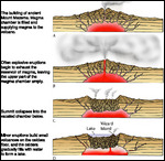
Mount Mazama, part of the Cascade Range volcanic arc, was built up mostly of andesite, dacite, and rhyodacite over a period of at least 400,000 years. The caldera was created in
a massive volcanic eruption between 6,000 and 8,000 years ago that led to the subsidence of Mount Mazama. About 50 cubic kilometres (12 cu mi) of rhyodacite was erupted in this event. Since that time, all eruptions on Mazama have been confined to the caldera.
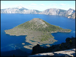
Lava eruptions later created a central platform, Wizard Island, Merriam Cone, and other, smaller volcanic features, including a rhyodacite dome that was eventually created atop the central platform. Sediments and landslide debris also covered the caldera floor.
Eventually, the caldera cooled, allowing rain and snow to accumulate and eventually form a
lake. Landslides from the caldera rim thereafter formed debris fans and turbidite sediments on the lake bed. Fumaroles and hot springs remained common and active during this period. Also after some time, the slopes of the lake's caldera rim more or less stabilized, streams restored a radial drainage pattern on the mountain, and dense forests began to revegetate the barren landscape. It is estimated that about 720 years was required to fill the lake to its present depth of 594 m (1,949 ft). Much of this occurred during a period when the prevailing climate was less moist than at present.
http://en.wikipedia.org/wiki/Crater_Lake
Not only is the lake gorgeous to view, but the history of how it was formed is fascinating. Plus, there are numerous spots around the lake for viewing. During the summer, there is a boat that takes you around the lake. We did that years ago and it's worth taking. It was not offered when we were there this time.
Go see this place.
Steve and Kim
Blue Blue Crater Lake
Friday, June 05, 2015
 Crater Lake National Park, Oregon, United States
Other Entries
-
14Stunning vistas and monuments
Apr 1650 days prior Monument Valley, United Statesphoto_camera25videocam 0comment 0
 -
15WOW !!!
Apr 1749 days prior Goosenecks of the San Juan River State Park, United Statesphoto_camera18videocam 0comment 4
 -
16Spectacular Rock Formations
Apr 1947 days prior Arches National Park, United Statesphoto_camera28videocam 0comment 2
 -
17Sights and views around Moab
Apr 2541 days prior Moab, United Statesphoto_camera37videocam 0comment 2
 -
18A Wall full of Petroglyphs
Apr 2739 days prior Newspaper Rock State Historical Monument, United Statesphoto_camera25videocam 0comment 0
 -
19HUGE Rock Bridges created by rivers
Apr 2838 days prior Natural Bridges National Monument, United Statesphoto_camera23videocam 0comment 0
 -
20Capitol Reef NP - The Folding of the Earth
Apr 3036 days prior Capitol Reef National Park, United Statesphoto_camera28videocam 0comment 0
 -
21Bryce Canyon - Still the best views
May 0333 days prior Bryce Canyon National Park, United Statesphoto_camera21videocam 0comment 3
 -
22So you wanna full-time RV huh?
May 0630 days prior Cedar City, United Statesphoto_camera24videocam 0comment 3
 -
23Rooms fit for a King and Queen
May 0729 days prior Las Vegas, United Statesphoto_camera51videocam 0comment 3
 -
24Death Valley - Better than expected
May 1521 days prior Death Valley National Park, United Statesphoto_camera39videocam 0comment 7
 -
25Japanese Internment Camp at Manzanar
May 1620 days prior Lone Pine, United Statesphoto_camera24videocam 0comment 0
 -
26Mountains to the Pacific Ocean in one day
May 1818 days prior Pismo Beach, United Statesphoto_camera14videocam 0comment 3
 -
27Yosemite - Always Breathtaking
May 2511 days prior Yosemite National Park, United Statesphoto_camera31videocam 0comment 3
 -
28Yosemite Flowers, Streams, Birds
May 2610 days prior Yosemite National Park, United Statesphoto_camera37videocam 0comment 1
 -
29A Short, Peaceful Overnighter
May 306 days prior Willits, United Statesphoto_camera17videocam 0comment 3
 -
30Avenue of the Giants Redwoods
Jun 014 days prior Redcrest, United Statesphoto_camera33videocam 0comment 1
 -
31Blue Blue Crater Lake
Jun 05 Crater Lake National Park, United Statesphoto_camera27videocam 0comment 1
 -
32Rogue River Waterfalls and Lava Tube
Jun 061 day later Prospect, United Statesphoto_camera23videocam 1comment 2
 -
33Up the Columbia River Gorge
Jun 083 days later Columbia River, United Statesphoto_camera17videocam 0comment 1
 -
34Gorgeous countryside and wonderful RV Park
Jun 094 days later Kennewick, United Statesphoto_camera25videocam 0comment 1
 -
35The Grand Coulee Dam
Jun 1611 days later Grand Coulee, United Statesphoto_camera26videocam 2comment 0
 -
36FLOWERS, FLOWERS, FLOWERS for the flower lovers
Jun 1813 days later Spokane, United Statesphoto_camera41videocam 0comment 1
 -
37So many things to see and do in Libby, Montana
Jun 2015 days later Libby, United Statesphoto_camera55videocam 1comment 1
 -
38Magnificent Glacier National Park
Jun 2520 days later Glacier National Park, United Statesphoto_camera37videocam 0comment 2
 -
39Small Town with Lots to do
Jul 0126 days later Havre, United Statesphoto_camera35videocam 1comment 0
 -
40Nice relaxing couple of days and another dam !
Jul 0530 days later Fort Peck, United Statesphoto_camera34videocam 0comment 0
 -
41Theodore Roosevelt National Park North Dakota
Jul 0934 days later Dickinson, United Statesphoto_camera42videocam 0comment 0
 -
42Lewis and Clark at Fort Mandan
Jul 1136 days later Washburn, United Statesphoto_camera33videocam 0comment 0
 -
43Albino Bison and some Minnesota
Jul 1237 days later Jamestown, United Statesphoto_camera26videocam 0comment 0
 -
44One night only in Minnesota
Jul 1338 days later Barnesville, United Statesphoto_camera2videocam 0comment 0
 -
45Some northern Wisconsin for you
Jul 1439 days later Superior, United Statesphoto_camera27videocam 0comment 0
 -
46Lovely Wisconsin
Jul 1742 days later Chippewa Falls, United Statesphoto_camera17videocam 0comment 0
 -
47Upper Peninsula of Michigan STOP 1
Jul 2045 days later Gladstone, United Statesphoto_camera38videocam 0comment 0
 -
48Yoopers! Upper Penninsula STOP 2
Jul 2348 days later Ishpeming, United Statesphoto_camera26videocam 0comment 0
 -
49Soo Locks
Jul 2954 days later Sault Sainte Marie, United Statesphoto_camera24videocam 0comment 0
Comments
2025-05-22
Comment code: Ask author if the code is blank

 Crater Lake National Park, Oregon, United States



lyman
2015-08-11
so much beauyy....are you on your way homr? very best