Beautiful and Exciting Day
Friday, June 06, 2014
 Bluff, Utah, United States
 Bluff, Utah, United States
Friday June 6, 2014
Non-Travel Day
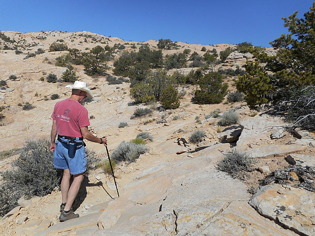
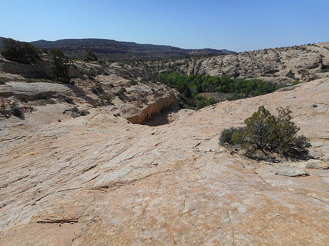
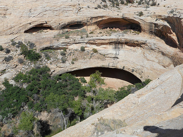
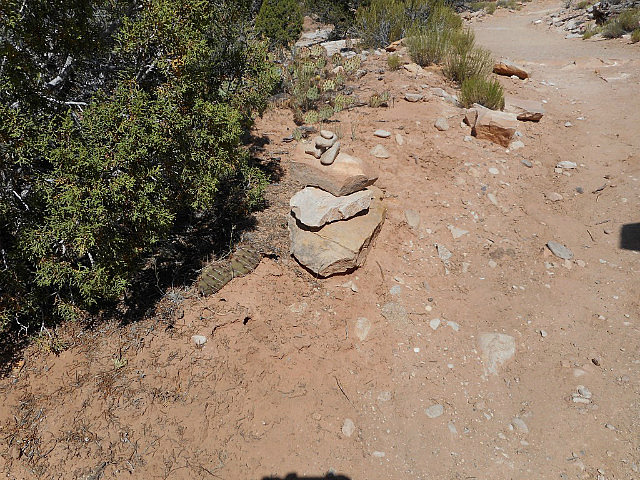
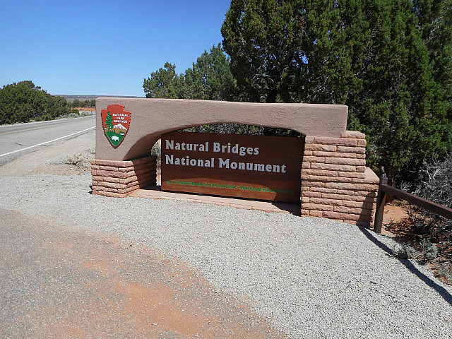
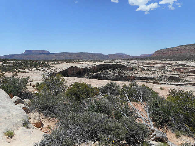
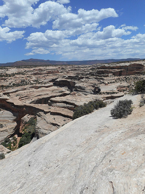
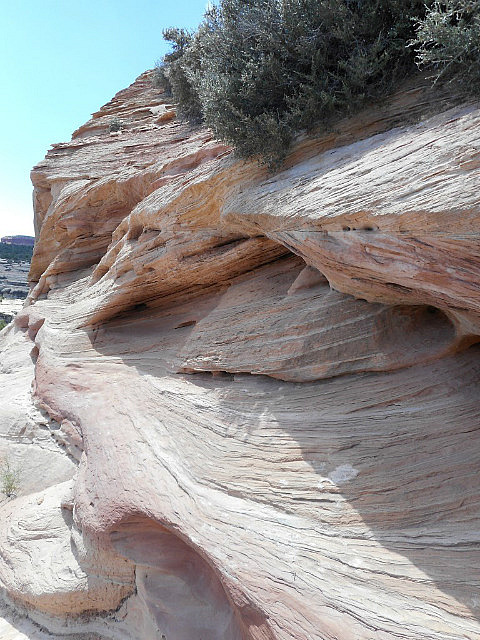
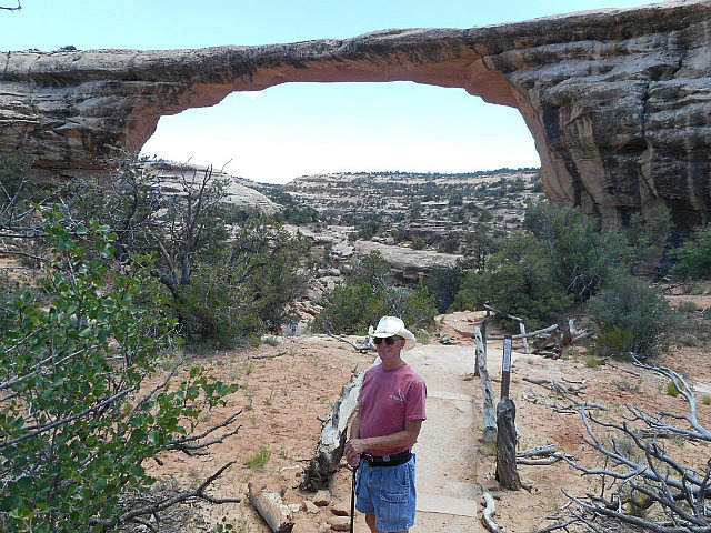
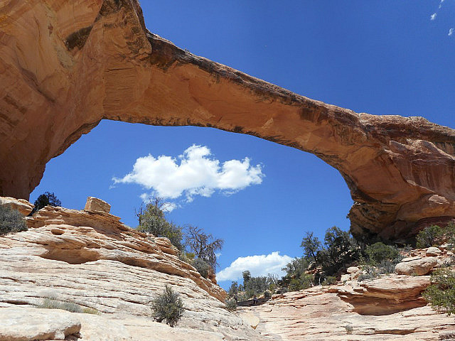
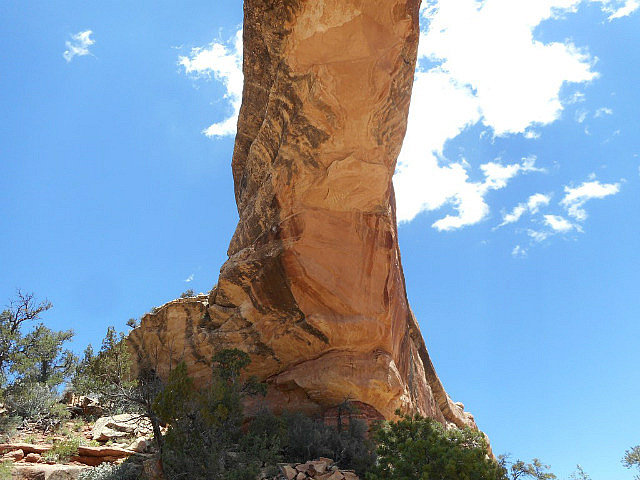
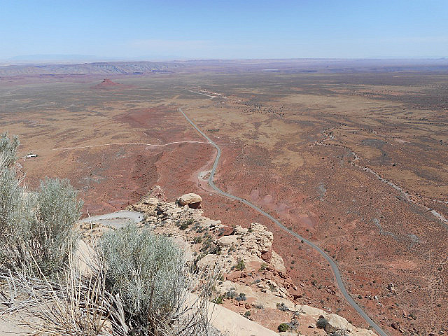
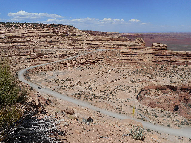
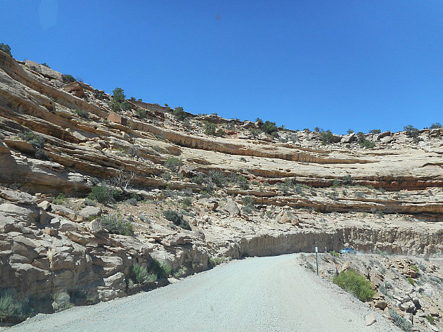
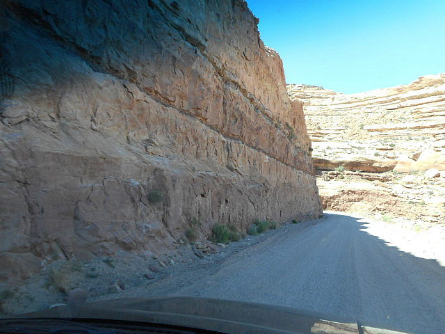
This morning was another sunny but chilly day, 45 degrees, but by 9:00 it was up to 70 degrees and in the afternoon it got into the upper 80’s . We decided to stay relatively close to our campground today and not do a lot of driving. We started off by going north on US Hwy 191, part of the “Trail of the Ancients National Byway”; and then west on Utah Hwy 95, part of “Utah’s Bicentennial Scenic Highway”. Our first stop was at “Butler Wash, Mule Canyon & Cave Towers Ruins”; from the parking lot it was a one mile hike over a gravel, dirt and rock trail where sometimes the only way to find the trail was to look for the trail markers in the form of small piles of rocks. The hike was worth the effort, to look out over the canyon and see the cliff dwellings of the ancient civilizations, from 300 AD to 1300 AD; you can only imagine the hard life these people had. Continuing west on UT 95 we came to the “Natural Bridges National Monument”, within the park are 3 of the world’s largest natural stone bridges, each of which can be viewed from overlooks along an 8 mile loop drive through the park. These bridges are the result of water action eroding away the softer underlying rock in such a way as to leave the top layer of rock to form the bridge . The overlooks were ¼ to ½ mile from the road; the third bridge along the drive is viewable from beneath after a downhill hike of ½ mile, of course that means a ½ mile hike uphill to return. The views and the feeling we got by being so close to this wonder of nature was worth the effort and exhaustion after the return hike up the hill. This is the oldest of the 3 natural bridges at 106 ft. high, spanning 180 ft. and 27 ft. wide, but is only 9 feet thick. More strenuous hikes were available to the other two natural bridges, but they were way beyond what we could do. Next we headed south on UT Hwy 261 through extremely desolate terrain, most of which was on top of the mesa. Upon reaching the edge of the mesa we encountered 3 miles of severe grades and switchbacks down the mountain side; the 2 lane blacktop road turned into one wide gravel lane descending the mountain with steep walls on the uphill side but without guardrails on the outside, where passing oncoming vehicles became a challenge. This was a thrill ride down the mountainside
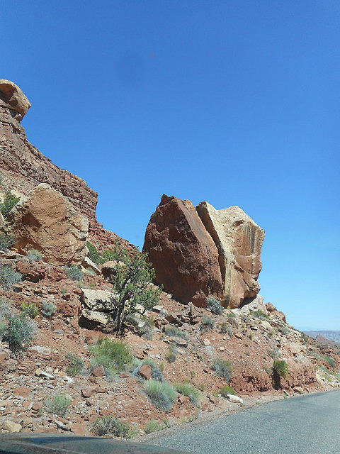
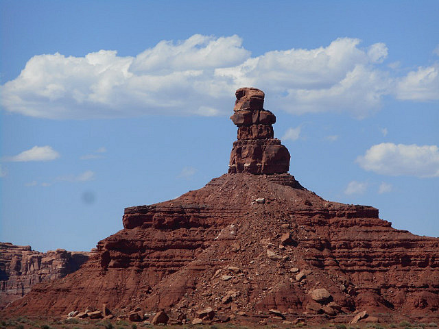
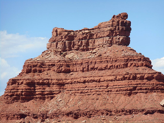
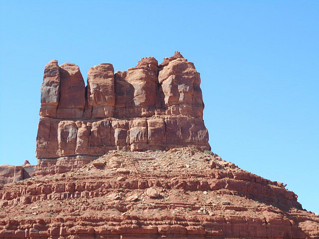
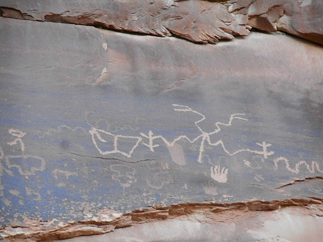
but with fantastic views of the valley below . “Valley of the Gods” was our next destination, which is an area managed by the BLM, so the area was primitive. The literature describes the road through the area as “native surface road suitable for high clearance vehicles”, it was a one lane rough road sometimes requiring us to go around boulders, and on many occasions lose sight of the road as we crested a steep rise and the road immediately dropped away. The valley is full of towering sandstone formations that defy description. We next enjoyed a delicious prime rib dinner at one of the local restaurants. After dinner we drove down to the San Juan River and the “Sand Island Petroglyphs”, a large rock face with numerous petroglyphs that were carved by travelers passing through this area thousands of years ago.
Other Entries
-
Jun 042 days prior Grand Junction, United States
 -
Jun 051 day prior
Bluff, United States -
Jun 06
Bluff, United States -
Jun 071 day later
Bluff, United States -
Jun 082 days later
Bluff, United States -
Jun 093 days later
Moab, United States -
Jun 104 days later
Moab, United States -
Jun 115 days later
Moab, United States -
Jun 126 days later
Moab, United States -
Jun 137 days later
Moab, United States -
Jun 148 days later
Moab, United States -
Jun 159 days later
Panguitch, United States -
Jun 1610 days later
Panguitch, United States -
Jun 1711 days later
Panguitch, United States -
Jun 1812 days later
Panguitch, United States -
Jun 1913 days later
Kanab, United States -
Jun 2014 days later
Kanab, United States -
Jun 2115 days later
Kanab, United States -
Jun 2216 days later
Las Vegas, United States -
Jun 2317 days later
Las Vegas, United States -
Jun 2418 days later
Las Vegas, United States


Comments
2025-05-23
Comment code: Ask author if the code is blank
Judi
2014-06-23
Beautiful photos!