Lava Beds National Monument
Friday, July 04, 2014
 McCloud, California, United States
Friday July 4, 2014
Non-Travel Day
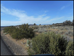
Our destination today was the “Lava Beds National Monument” located to the north east of the campground . We headed east on CA Rt. 89 to forest service roads 46, 97 and 10 which took us through some beautiful back country, through high desert and lush pine forests, over narrow mountain roads where oncoming traffic had to pull over to let us by, and luckily we did not meet much oncoming traffic. At times we questioned our decision to come this way, but it did prove worthwhile and the scenery was beautiful. Lava Beds National Monument lies on the flanks of the massive Medicine Lake Volcano, which during the last half-million years has erupted many times spewing lava, cinders and rocks over a wide area. Here in the park you can explore surface lava flows, walk among the large volcanic rocks and boulders, and descend into numerous lava tubes. After viewing the film in the Visitor’s Center we descended into the “Mushpot Cave”, a lava tube, which has a paved walkway that is lit and with interpretive signs. After that we took a ranger led tour of the “Sentinel Cave” which lasted about 1 and ½ hours, this was a great experience to have a knowledgeable ranger explain the process that created the various types of rocks and the lava tube through which we were
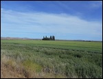
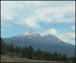
walking. Jack explored a third lava tube, the “Golden Dome Cave”, while Valerie relaxed back at the truck. Leaving the park we wanted to take a different route home, so we headed north on CA Rt. 139, west on CR Rt. 161 then south on US 97, I-5 and east on CA Rt. 89 to the campground. This route took us through some beautiful farmland and then the Ponderosa Pine forests that cover much of the higher mountain sides. For almost the entire trip back we had the snow caped 14,000 foot “Mount Shasta” as a beacon toward which we were heading.
Other Entries
-
44Driving on Scenic Byway 12
Jun 1717 days prior Panguitch, United Statesphoto_camera11videocam 0comment 2
 -
45Scenic Ride
Jun 1816 days prior Panguitch, United Statesphoto_camera12videocam 0comment 0
 -
46Traveling to Knab, UT
Jun 1915 days prior Kanab, United Statesphoto_camera8videocam 0comment 0
 -
47Zion National Park
Jun 2014 days prior Kanab, United Statesphoto_camera11videocam 0comment 3
 -
48North Rim of Grand Canyon.
Jun 2113 days prior Kanab, United Statesphoto_camera8videocam 0comment 3
 -
49Heading to Las Vegas, NV
Jun 2212 days prior Las Vegas, United Statesphoto_camera5videocam 0comment 1
 -
50Hoover Dam and Freemont Experience.
Jun 2311 days prior Las Vegas, United Statesphoto_camera11videocam 0comment 1
 -
51Work and Fun
Jun 2410 days prior Las Vegas, United Statesphoto_camera0videocam 0comment 0
 -
52Driving on the Byways
Jun 259 days prior Las Vegas, United Statesphoto_camera7videocam 0comment 1
 -
53Driving along the desert
Jun 268 days prior Las Vegas, United Statesphoto_camera0videocam 0comment 1
 -
54Grimes Point Archaeological Site
Jun 277 days prior Carson City, United Statesphoto_camera4videocam 0comment 1
 -
55Checking out the capital of Nevada and Reno
Jun 286 days prior Carson City, United Statesphoto_camera9videocam 0comment 0
 -
56Lake Tahoe
Jun 295 days prior Carson City, United Statesphoto_camera11videocam 0comment 0
 -
57Virginia City
Jun 304 days prior Carson City, United Statesphoto_camera15videocam 0comment 0
 -
58Going to California
Jul 013 days prior Susanville, United Statesphoto_camera0videocam 0comment 1
 -
59Lessen Volcanic National Park
Jul 022 days prior Susanville, United Statesphoto_camera15videocam 0comment 0
 -
60Seeing Beautiful Falls.
Jul 031 day prior McCloud, United Statesphoto_camera6videocam 1comment 1
 -
61Lava Beds National Monument
Jul 04 McCloud, United Statesphoto_camera6videocam 0comment 0
 -
62R & R
Jul 051 day later McCloud, United Statesphoto_camera0videocam 0comment 0
 -
63On our way to the California coast.
Jul 062 days later Klamath, United Statesphoto_camera12videocam 0comment 1
 -
64Checking out the giant trees called Redwoods
Jul 073 days later Klamath, United Statesphoto_camera13videocam 1comment 1
 -
65Redwoods and Lighthouse
Jul 084 days later Klamath, United Statesphoto_camera12videocam 1comment 0
 -
66Imperial Manor RV Park
Jul 095 days later Citrus Heights, United Statesphoto_camera6videocam 0comment 2
 -
67Old Sacramento
Jul 106 days later Citrus Heights, United Statesphoto_camera7videocam 0comment 1
 -
68Coloma and Nevada City, CA
Jul 117 days later Citrus Heights, United Statesphoto_camera8videocam 0comment 0
 -
69R & R is Good
Jul 128 days later Citrus Heights, United Statesphoto_camera0videocam 0comment 0
 -
70R & R is excellent
Jul 139 days later Citrus Heights, United Statesphoto_camera0videocam 0comment 0
 -
71Driving from California to Nevada
Jul 1410 days later Battle Mountain, United Statesphoto_camera10videocam 0comment 1
 -
72Casino Time Again
Jul 1511 days later West Wendover, United Statesphoto_camera11videocam 0comment 0
 -
73Utah and Salt Lake City
Jul 1612 days later North Salt Lake, United Statesphoto_camera7videocam 0comment 2
 -
74Temple Square, Salt Lake City
Jul 1713 days later North Salt Lake, United Statesphoto_camera15videocam 0comment 2
 -
75Golden Spike National Historic Site
Jul 1814 days later North Salt Lake, United Statesphoto_camera12videocam 0comment 1
 -
76Rodeo
Jul 1915 days later North Salt Lake, United Statesphoto_camera17videocam 0comment 1
 -
77Exploring south of Salt Lake Ci
Jul 2016 days later North Salt Lake, United Statesphoto_camera14videocam 0comment 0
 -
78Bike Ride and Salt Lake
Jul 2117 days later North Salt Lake, United Statesphoto_camera9videocam 0comment 0
 -
79Domestic Activities Again
Jul 2218 days later North Salt Lake, United Statesphoto_camera0videocam 0comment 0

 McCloud, California, United States


2025-05-23