http://www.madagascar-environnement.com/
http://www.madagascar-environnement.com/ecotourisme/ecotourisme-madagascar.html
Arrivée à Tamatave à 2 heures du mat, je décide à nouveau de prendre un train pas comme les autres , le Dia Soa, il part à 8 h 20 de la gare en reconstruction de Tamatave.
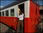
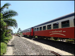
En arrivant près de la gare, et vue l'état de délabrement du batiment, j ai presque rebroussé chemin . Mais au loin, j'aperçois la silhouette longiligne d'un wagon blanc et rouge , deux des trois couleurs présentent sur le drapeau malgache...
J'arrive sur le quai, il est 6 h 30, je rencontre un homme qui me témoignent bien que le train partira et partira même à l'heure !! bravo.
Cet homme en fait, Jouvence , est un des policiers du train . 2 semaines par mois , il fait les trajets traversant mangroves , canaux, ponts métalliques, jungles, villages poussièreux ; le reste du mois , il occupe les bureaux de la police nationale de Moramanga. La station de police de Moramanga se situe juste en face d' une gare ferroviaire !! .
Il a deux enfants : Jouvenceau , son fils de 5 ans et Jouvencelle 2 ans , j aurais l'occasion de dormir chez lui par la suite . La seule famille malgache qui m'a invité chez eux...
Près du premier wagon , une pancarte : "Nous mettons à votre disposition, trois voitures voyageurs de 72 places chacun, accompagnées de deux wagons fourgons pour vos bagages. Le train «Dia Soa » a spécialement été mis en place pour desservir les zones enclavées entre Moramanga et Tamatave. Le « Dia Soa » fonctionne 6/7jours, et son parcours comprend 26 points d’arrêts qui lui permet de prendre des voyageurs en chemin.Partez à la découverte des paysages les plus reculés et les plus magnifiques de Madagascar. Partez pour un voyage pas comme les autres, à la lisière de nombreuses forêts et en longeant de nombreux ruisseaux. Plongez au cœur de paysages riches en couleurs et en diversités.
Découvrez Madagascar comme vous ne l’avez jamais vu !!"
J'accompagne Jouvence dans le marché central, il doit ramener, "un chapeau de pluie " pour sa femme. Je le suit mais avec appréhension car Tamatave est réputé malsain pour les vazahas, mais il me montre son flingue collé à la ceinture de son pantalon : rassuré !! J'en profite alors pour faire quelques provisions car je ne sais pas combien de temps je resterais sur les "Panganales" ?
Rouge, blanc et or. Embarquement dans la lumière du matin en gare
de Tamatave à bord du Dia Soa. Destination : Moramanga. Attention !
Le rater, c’est devoir attendre une semaine. Hihihihihi!


Pour la petite histoire, les premiers rails furent posés à Anivorano ( région de Brickaville ) le 1er Avril 1901. La ligne reliant Antananarivo-Brickaville a été ouverte officiellement le 1er Avril 1909.
L’inauguration du prolongement du chemin de fer de Brickaville à Tamatave, fut célébrée le 06 Mars 1913. De ce fait, on assiste à la naissance de la ligne TCE (Tananarive-Côte Est). Le 31 Mai 1915, la ville de Moramanga fut reliée à la région du Lac Alaotra. C’est la naissance de la MLA (Moramanga-Lac Alaotra).
La région du Lac Alaotra fut reliée à la ville d’Ambatondrazaka le 25
Juin 1922. Le premier train siffla à la Gare d’Antsirabe le 15 Octobre
1923. On assiste alors à la naissance de la ligne T.A (Tananarive-Antsirabe)
Comme le train FIANA-Manakara, le train se faufile entre les maisons aux toits de tôles, impossible de sortir la tête du wagon , tellement les habitations sont proches..
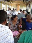
Pas de 1ère classe mais le train est plein mais pas bondé comme à Fianarantsoa, heureusement car l'air est bien plus chaud et humide que sur les Hautes Terres.
Ma destination : Andranokoditra, un petit village de pêcheurs situé sur un petit bout
de terre entre le Canal des Panganales et l’Océan Indien. L’isolement de
ce village lui permet d’être préservé du tourisme de masse. Sa richesse
naturelle et culturelle est ainsi protégée et les visiteurs peuvent
profiter d’un calme reposant et de plages désertes.
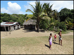
Tout le village est là avec des paniers et de l'artisanat local.
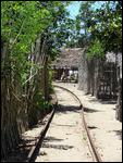
L'arrivée du train ne laisse pas les villageois de marbre et tout le village court à l'assaut du train, qui semble couper le village en deux !!
Je sors rapidement du wagon pour filmer le train au départ ..continuant "son rail" sur la bande terrestre entre eau de mer et eau douce .
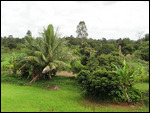
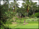
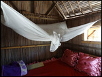
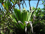
Je fais connaissance avec les villageois, on m'installe dans un bungalow au doux nom de Olivette (le nom de sa propriétaire) . On dirait que le temps c'est arrêté , un coin paradisiaque, où il fait bon vivre. La population est accueillante sans être derrière vous. Les alentours sont plantés de nombreux ravenales , les arbres du voyageur.. Dans l air , un Parfum de niaouli, dont on extrait une huile essentielle contre la toux et la fièvre.
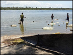
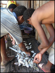
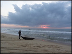
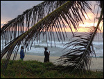
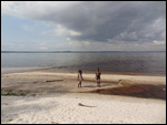
Et.., enfin l'Océan.... il faut juste traversé le village et les rails pour arriver de l'autre coté de cette bande de terre qui sépare le canal des Panganales de l'Océan Indien , elle est très agitée et ne donne pas envie de baignade! Le lendemain , j'assiste aux duels des pêcheurs face à l’Océan ! ...le pot de terre contre le pot de fer.
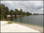
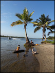
Mais avant cela , je demande au village si il y a encore des crocodiles ? non ! idyllique : je me baigne dans cette masse calme et limpide . On voit très bien le fond sablonneux et les poissons : une piscine grandeur nature !!
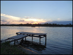
Le canal, par endroit , se transforme en un lac . Le lac Ampitabé n'est pas très loin, c'est la que se trouvent les 3 ou quatres lodges et la réserve faunique du Pallarium.
Le soir venu, dîner aux chandelles .. du poisson biensur !!

Bref historique du canal des Pangalanes :
Palissandre, vanille et poivre, ébène,cannelle et autres épices ont transité par ici, dès le XIXème siècle, selon les aléas de la situation économique. Pour en faciliter le
transport, l'administration coloniale française aurait imaginé au début
du siècle dernier, en plus d'une ligne de chemin de fer Tana – Tamatave
dans le sens Ouest/ Est, un canal utilisant un réseau de rivières, de lagunes et de lacs.
Dès 1949, dans un axe Sud/ Nord, parallèle à la redoutable « côte des cyclones », le canal des Pangalanes relie les plantations et les forêts du Sud-Est malgache à la côte. Le
projet initial prévoyait 665 km de voies navigables ininterrompues de Foulpointe à Farafanga. Le canal devait permettre une circulation intérieure commode et sûre. Un moyen efficace pour distribuer les produits importés à l'intérieur du pays et transporter les matières
premières sur Tamatave.
Qu'en reste-t-il ?
On est loin des ambitions d'hier. Le canal manque d'entretien et n'a plus été dragué depuis 20 ans. Si bien qu'il est désormais navigable que dans sa partie
nord, de Tamatave à Mananjary. Alors les gros bateaux ne passent plus.
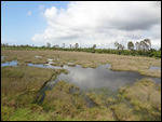
Des ports sans escaliers ni engins élévateurs, des entrepôts vides, seuls quelques chalands de graphite font régulièrement la navette, plus rarement des chargements de canne à sucre, de café ou autres épices. Il en résulte un endroit entre Terre et mer où l'eau règne en maître.
Une succession de lacs immenses, de boulevards liquides et de canaux étroits vivant au rythme des pirogues. C'est bon pour faire du « Tsanga-Tsanga » se promener en s'enfonçant
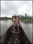
dans la veine sombre du canal.Les gens du canal utilisent deux types d'embarcation : la pirogue, simple tronc d'arbre sommairement évidé et propulsé à la pagaie, et le radeau de bambou poussé au moyen de la perche. Ils vivent du transport de marchandises, paniers tressés de jonc, produits maraîchers, poutrelles et madriers de bois pour la
construction des cases, ou bien de la pêche, lançant leurs lignes en déployant leur filet.
ENGLISH VERSION :
Arrived at Tamatave in 2 hours morning, I decided again to take one train like
no other, the Dia Soa, he left at 8:20, the railway station is re-build.
Arriving near the station, and views the State of disrepair of the building, i have almost turned back. But in the distance, I see the slender silhouette of a white and red wagon,
two of the three colors present on the Malagasy flag...
I arrive on the dock, it is 6: 30 pm, I met a man who well testify me that the train will leave and leave even at the hour! Bravo.
This man actually, tides, is one of the officers of the train. 2 weeks per month, he made trips through mangrove swamps, channels, metal bridges, jungles and dusty villages. the rest of the month, he occupied the offices of the national police of Moramanga. The Moramanga police station is located directly in front of a railway station! .
He has two children: Jouvence (youth), his 5-year-old son and Jouvencelle(youngster) 2 years, I would have the opportunity to sleep at home later. The only Malagasy family who invited me home...
Near the first car, a sign: "we put at your disposal three passenger cars of
72 seats each, accompanied by two cars vans for luggage." "Dia Soa" train has specially set up to serve the areas enclosed between Moramanga and Tamatave. "Dia Soa" Works 6/7 days, and his background includes 26 points of cases which allows him to take travellers on the way.Discover the remotest landscapes and the most magnificent of Madagascar. Go on one journey like no other, at the edge of many forests and along many streams. Dive into the heart of landscapes rich in colors and diversity.Discover Madagascar like you've never seen it!"
I accompany makeover in the central market, he must bring back , "a rain hat" for his wife. I
follow but with apprehension because Tamatave is deemed unhealthy for
the vazaha , the foreigners, but he shows me his gun stuck in the belt of his pants:
reassured! then I want to do some shopping because I don't know how long I would stay on the "Pangalanes "?
Red, white and gold. Boarding in the morning light stationToamasina aboard Dia Soa. Destination: Moramanga. Attention!if The Miss : it is having to wait a week. Hihihihihi!
For the record, the first rails were laid Anivorano (Brickaville region) April 1, 1901. The line connecting Antananarivo-Brickaville was officially opened on April 1, 1909.The inauguration of the extension of railway of Brickaville in Toamasina, was celebrated March 06, 1913. Thus, we are witnessing the birth of the line TCE (Tananarive-Côte Est). On May 31, 1915, the town of Moramanga was related to the region of lake Alaotra. It is the birth of the MLA (Moramanga-Lac Alaotra).
The region of lake Alaotra was connected to the town of Ambatondrazaka 25June 1922. The first train whizzed past the station of Antsirabe October 151923. We then witnessing the birth of the ADT (Tananarive-Antsirabe) line.
As the Fianarantsoa-Manakara, train sneaks between houses, cannot pull out head of the car, the homes are close...
Not first class but the train is full but not crowded like in Fianarantsoa, fortunately because the air is much more hot and humid on the Highlands.
My destination :
Andranokoditra, a small fishing village located on a small piece of land between the Pangalanes Canal and the Indian Ocean. Isolation of this village allows it to be preserved from mass tourism. Its wealth natural and cultural is thus protected and visitors can enjoy a relaxing quiet and deserted beaches.
The entire village is there with baskets and handicrafts.The arrival of the train does not leave villagers in marble and the entire village runs to the onslaught of the train, which seems to cut the village in two ! I get quickly out of the car to film the train initially...continuing "its rail" on the band of land between sea water and fresh water.
I am acquainted with the villagers, they settle down in a bungalow in the sweet name of Olivette (the name of its owner). It looks like the time it is stopped, a corner of paradise, where life is live.
The population is welcoming without being behind you. The surroundings are planted with many ravenales, tree of the traveller... In the air, a perfume of niaouli, which is extracted an essential oil against cough and fever.
And..,
finally the Ocean... it takes just crossed the village and the rails to
arrive on the other side of this strip of land that separates the
Indian Ocean and Pangalanes canal, it is very choppy and does not want to
swim! The next day, I attend to the fishermen by the Ocean duels! .. .the pot of Earth against the iron pot.
But before that, I ask the village if there are crocodiles? No! idyllic: I bathe in this mass calm and clear. one can see the sandy bottom and fish: a full-size pool !
The canal, by some locations, turns into a lake. Lake Ampitabe is not very far, there is 3 or four lodges and the Pallarium wildlife reserve.The evening dinner by candlelight... a fish course !
Brief history of the Pangalanes canal :
Rosewood, vanilla and pepper, ebony, cinnamon and other spices passed through
here, from the 19th century, according to the vagaries of the economic
situation. To facilitate thetransport, the French colonial administration would have imagined at the beginningof the last century, in addition to a line of railway Tana - TamataveWest / is, a channel using a network of rivers, lagoons and lakes.
As
early as 1949, South / North, parallel to the dreaded "cyclones coast"
the Pangalanes canal connects plantations and forests in southeastern
Madagascar coast. Theinitial proposal: 665 km of uninterrupted waterways of Foulpointe to Farafanga. The canal was to allow a domestic movement convenient and safe. An effective way to distribute products imported within the country and transporting materialsfirst on Tamatave.
What is?It is far from the ambitions of yesterday. Channel lack of maintenance and has more been dredged for 20 years. So it is now navigable in its partNorth of Tamatave in Mananjary. So the big boats spend more.Ports
without stairs or lift gear, empty warehouses, only a few barges
graphite regularly commute, more rarely loads of sugarcane, coffee or
other spices. The result is a place between land and sea where water reigns supreme.
A succession of huge Lakes, liquid boulevards and narrow channels living in the rhythm of the canoes. It is good for making of the «Tsanga Tsanga» walk in sinkingvein dark channel.Channel
people use two types of boat: the canoe, simple tree trunk summarily
hollowed and powered the paddle, and the bamboo raft pushed through the
boom. They live for the carriage of goods, baskets of cane, horticultural products, beams and planks of wood for theconstruction of the boxes, or fishing, throwing their lines by deploying their net.

 Tamatave, Atsinanana, Madagascar

2025-05-22