The longest Day
Saturday, August 16, 2014
 Whitehorse, Yukon, Canada
As we had the additional day in Dawson today was going to be a huge ride. Before leaving we stopped for a coffee at the RiverWest Bistro great muffins. As we were leaving Mike appeared he told us about his quest four corners of the US. He traveled from Miami to Alaska now heading for Bahia on a 50cc scooter.
Up early to get the ferry across the Klondike / Yukon river. We head up to the Top of the world road going toTok Alaska.
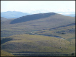
The Top of the World Highway is a 127-kilometre (79 mi) long highway, beginning the ferry in West Dawson and ending at a junction with the Taylor Highway near Jack Wade, Alaska. It is only open during the summer months.
As of July 2014, the US portion of the highway is paved, and most of the Canadian portion is unpaved. The highway got is name because, along much of its length, it skirts the crest of the hills, so as you ride along you look down on the valleys below. It is one of the most northerly highways in the world.
The border is the highest US road border, known as Little Gold Creek in Canada and Boundary (or Poker Creek) in the U.S., features one of the few jointly-built single building customs ports of entry along the Canada-U.S. border.
We stop for a coffee Chicken Alaska a Gold camp and popular for bikers stop.
Once we met the Alaskan highway we turned south on to the Alaskan highway. It is now very windy and cold weather closing in over the mountains of the Kluane National park.
However it is still sights all the way.
We stop for soup and to warm up at Destruction Bay.
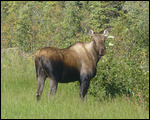
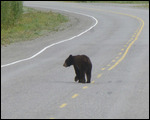
The run in to Whitehorse as it was getting dark was the most amazing animal spotting we have had. The Grizzy mum with 3 cubs just watching the road was incredible we had to push on so lucky you no photos.
Finally arrive BW Whitehorse 10pm order a very welcome Pizza
Other Entries
-
40Yeehaw giddy up
Jul 3017 days prior Cody, United Statesphoto_camera9videocam 0comment 0
 -
41A ranch too far
Jul 3116 days prior Yellowstone National Park, United Statesphoto_camera32videocam 0comment 0
 -
42Old Faithful
Aug 0115 days prior Yellowstone National Park, United Statesphoto_camera11videocam 0comment 0
 -
43Lamar Valley
Aug 0214 days prior Sheridan, United Statesphoto_camera26videocam 0comment 0
 -
44Clusters last Stand
Aug 0313 days prior Helena, United Statesphoto_camera9videocam 0comment 0
 -
45Montana
Aug 0412 days prior Whitefish, United Statesphoto_camera5videocam 0comment 0
 -
46Mountain Goats
Aug 0511 days prior Banff, Canadaphoto_camera19videocam 0comment 0
 -
47The Bundies
Aug 0610 days prior Banff, Canadaphoto_camera4videocam 0comment 0
 -
48One of the best roads in the world
Aug 079 days prior Jasper, Canadaphoto_camera38videocam 0comment 0
 -
49A great days cycle
Aug 088 days prior Jasper, Canadaphoto_camera11videocam 0comment 0
 -
50The long drive
Aug 097 days prior Houston, Canadaphoto_camera5videocam 0comment 0
 -
51First bear spot
Aug 106 days prior Stewart, Canadaphoto_camera29videocam 0comment 0
 -
52Bear spotting and a picnic
Aug 115 days prior Stewart, Canadaphoto_camera24videocam 0comment 0
 -
53Cassiar Highway
Aug 124 days prior Watson Lake, Canadaphoto_camera7videocam 0comment 0
 -
54A road too far!!!!
Aug 133 days prior Carmacks, Canadaphoto_camera11videocam 0comment 0
 -
55The day we meet Dawson Dick!
Aug 142 days prior Dawson City, Canadaphoto_camera19videocam 0comment 0
 -
56Gold Fever
Aug 151 day prior Dawson City, Canadaphoto_camera11videocam 0comment 0
 -
57The longest Day
Aug 16 Whitehorse, Canadaphoto_camera21videocam 0comment 0
 -
58Alaskan Highway
Aug 171 day later Watson Lake, Canadaphoto_camera7videocam 0comment 0
 -
59Just another transit town
Aug 182 days later Fort Nelson, Canadaphoto_camera13videocam 0comment 0
 -
60Search for tyres continues
Aug 193 days later Prince George, Canadaphoto_camera3videocam 0comment 0
 -
61Detour into Whistler
Aug 204 days later Whistler, Canadaphoto_camera28videocam 0comment 0
 -
62Goodbyes and Reunions
Aug 215 days later Vancouver, Canadaphoto_camera6videocam 0comment 0
 -
63Victoria (best almond croissant I have ever had)
Aug 226 days later Victoria, Canadaphoto_camera7videocam 0comment 0
 -
64Bike Service in Victora
Aug 237 days later Victoria, Canadaphoto_camera4videocam 0comment 0
 -
65Rest eat rest eat
Aug 248 days later Pender Island, Canadaphoto_camera15videocam 0comment 0
 -
66The journey South continues
Aug 2610 days later Port Angeles, United Statesphoto_camera5videocam 0comment 0
 -
67Lightning the load
Aug 2711 days later Quinault, United Statesphoto_camera30videocam 0comment 0
 -
68Tom takes him self back to his boy scout days
Aug 2812 days later Alder Lake, United Statesphoto_camera12videocam 0comment 0
 -
69Mountains and National Parks
Aug 2913 days later Battle Ground, United Statesphoto_camera9videocam 0comment 0
 -
70Another wet day
Aug 3014 days later Bend, United Statesphoto_camera4videocam 0comment 0
 -
71356's (i'll have one of those when i get home)
Aug 3115 days later Mount Shasta, United Statesphoto_camera28videocam 0comment 0
 -
72All the leaves are brown
Sep 0116 days later San Francisco, United Statesphoto_camera11videocam 0comment 0
 -
73The crazies are taking over San Francisco
Sep 0318 days later San Francisco, United Statesphoto_camera35videocam 0comment 0
 -
74The Big Fire
Sep 0419 days later Groveland, United Statesphoto_camera8videocam 0comment 0
 -
75So many views - what a place
Sep 0520 days later Groveland, United Statesphoto_camera27videocam 0comment 0

 Whitehorse, Yukon, Canada


2025-05-22